Meljac
| Meljac | ||
|---|---|---|
|
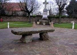
Dolmen | ||
| ||
 Meljac | ||
|
Location within Occitanie region  Meljac | ||
| Coordinates: 44°08′22″N 2°26′10″E / 44.1394°N 2.4361°ECoordinates: 44°08′22″N 2°26′10″E / 44.1394°N 2.4361°E | ||
| Country | France | |
| Region | Occitanie | |
| Department | Aveyron | |
| Arrondissement | Rodez | |
| Canton | Naucelle | |
| Intercommunality | Naucellois | |
| Government | ||
| • Mayor (2008–2014) | Guy Enjalbert | |
| Area1 | 9.54 km2 (3.68 sq mi) | |
| Population (2008)2 | 140 | |
| • Density | 15/km2 (38/sq mi) | |
| Time zone | CET (UTC+1) | |
| • Summer (DST) | CEST (UTC+2) | |
| INSEE/Postal code | 12144 / 12120 | |
| Elevation |
350–608 m (1,148–1,995 ft) (avg. 583 m or 1,913 ft) | |
|
1 French Land Register data, which excludes lakes, ponds, glaciers > 1 km² (0.386 sq mi or 247 acres) and river estuaries. 2 Population without double counting: residents of multiple communes (e.g., students and military personnel) only counted once. | ||

Meljac is a commune in the Aveyron department in southern France.
Geography
The river Céor forms all of the commune's northern border.
Population
| Historical population | ||
|---|---|---|
| Year | Pop. | ±% |
| 1962 | 234 | — |
| 1968 | 281 | +20.1% |
| 1975 | 250 | −11.0% |
| 1982 | 233 | −6.8% |
| 1990 | 217 | −6.9% |
| 1999 | 155 | −28.6% |
| 2008 | 140 | −9.7% |
See also
References
| Wikimedia Commons has media related to Meljac. |
This article is issued from Wikipedia - version of the 2/11/2016. The text is available under the Creative Commons Attribution/Share Alike but additional terms may apply for the media files.