Calmels-et-le-Viala
| Calmels-et-le-Viala | |
|---|---|
|
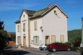
The town hall in Calmels-et-le-Viala | |
 Calmels-et-le-Viala | |
|
Location within Occitanie region  Calmels-et-le-Viala | |
| Coordinates: 43°56′48″N 2°45′11″E / 43.9467°N 2.7531°ECoordinates: 43°56′48″N 2°45′11″E / 43.9467°N 2.7531°E | |
| Country | France |
| Region | Occitanie |
| Department | Aveyron |
| Arrondissement | Millau |
| Canton | Saint-Affrique |
| Intercommunality | Saint-Affricain |
| Government | |
| • Mayor (2008–2014) | Anne-Marie Constans |
| Area1 | 23.20 km2 (8.96 sq mi) |
| Population (2008)2 | 247 |
| • Density | 11/km2 (28/sq mi) |
| Time zone | CET (UTC+1) |
| • Summer (DST) | CEST (UTC+2) |
| INSEE/Postal code | 12042 / 12400 |
| Elevation |
269–574 m (883–1,883 ft) (avg. 350 m or 1,150 ft) |
|
1 French Land Register data, which excludes lakes, ponds, glaciers > 1 km² (0.386 sq mi or 247 acres) and river estuaries. 2 Population without double counting: residents of multiple communes (e.g., students and military personnel) only counted once. | |
Calmels-et-le-Viala is a commune in the Aveyron department in southern France.
Geography
The commune is traversed by the Dourdou de Camarès River.
Population
| Historical population | ||
|---|---|---|
| Year | Pop. | ±% |
| 1962 | 339 | — |
| 1968 | 303 | −10.6% |
| 1975 | 239 | −21.1% |
| 1982 | 211 | −11.7% |
| 1990 | 214 | +1.4% |
| 1999 | 207 | −3.3% |
| 2008 | 247 | +19.3% |
See also
References
| Wikimedia Commons has media related to Calmels-et-le-Viala. |
This article is issued from Wikipedia - version of the 11/4/2016. The text is available under the Creative Commons Attribution/Share Alike but additional terms may apply for the media files.