Massanutten, Virginia
| Massanutten, Virginia | |
|---|---|
| CDP | |
 | |
 Massanutten, Virginia Location within the state of Virginia | |
| Coordinates: 38°24′16″N 78°44′24″W / 38.40444°N 78.74000°WCoordinates: 38°24′16″N 78°44′24″W / 38.40444°N 78.74000°W | |
| Country | United States |
| State | Virginia |
| County | Rockingham |
| Area | |
| • Total | 14.3 sq mi (37.1 km2) |
| • Land | 14.3 sq mi (37.1 km2) |
| • Water | 0.0 sq mi (0.0 km2) |
| Elevation | 1,699 ft (518 m) |
| Population (2010) | |
| • Total | 2,291 |
| • Density | 160/sq mi (62/km2) |
| Time zone | Eastern (EST) (UTC-5) |
| • Summer (DST) | EDT (UTC-4) |
| ZIP code | 22840 |
| Area code(s) | 540 |
| FIPS code | 51-50030[1] |
| GNIS feature ID | 1867594[2] |
Massanutten is a census-designated place (CDP) in Rockingham County, Virginia, United States, built around a ski resort. The population was 2,291 at the 2010 census. It is part of the Harrisonburg Metropolitan Statistical Area
Geography
Massanutten is located at 38°24′16″N 78°44′24″W / 38.40444°N 78.74000°W (38.404566, -78.740120).[3] It lies within a valley at the southern end of Massanutten Mountain.
According to the United States Census Bureau, the CDP has a total area of 14.3 square miles (37.1 km²), all of it land.
Demographics
The first European-American to settle permanently in the area was Adam Miller (Mueller) (1703–1783), a native of Germany who arrived in 1726 and made his homestead near present-day Elkton.
At the 2000 census,[1] there were 1,945 people, 751 households and 582 families residing in the CDP. The population density was 135.7 per square mile (52.4/km²). There were 1,051 housing units at an average density of 73.3/sq mi (28.3/km²). The racial makeup of the CDP was 95.12% White, 2.06% African American, 0.10% Native American, 0.67% Asian, 0.51% from other races, and 1.54% from two or more races. Hispanic or Latino of any race were 1.49% of the population.
There were 751 households which 35.4% had children under the age of 18 living with them, 67.6% were married couples living together, 6.1% had a female householder with no husband present, and 22.4% were non-families. 16.1% of all households were made up of individuals and 3.3% had someone living alone who was 65 years of age or older. The average household size was 2.59 and the average family size was 2.91.
Age distribution was 24.3% under the age of 18, 5.9% from 18 to 24, 35.2% from 25 to 44, 25.1% from 45 to 64, and 9.5% who were 65 years of age or older. The median age was 37 years. For every 100 females there were 100.5 males. For every 100 females age 18 and over, there were 96.3 males.
The median household income was $61,316, and the median family income was $61,957. Males had a median income of $44,010 versus $27,596 for females. The per capita income for the CDP was $24,292. About 2.4% of families and 3.2% of the population were below the poverty line, including 2.1% of those under age 18 and none of those age 65 or over.
References
- 1 2 "American FactFinder". United States Census Bureau. Retrieved 2008-01-31.
- ↑ "US Board on Geographic Names". United States Geological Survey. 2007-10-25. Retrieved 2008-01-31.
- ↑ "US Gazetteer files: 2010, 2000, and 1990". United States Census Bureau. 2011-02-12. Retrieved 2011-04-23.
External links
Municipalities and communities of Rockingham County, Virginia, United States | ||
|---|---|---|
| Towns | 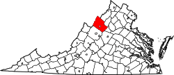 | |
| CDPs | ||
| Unincorporated communities |
| |
| Footnotes | ‡This populated place also has portions in an adjacent county or counties | |