Fulks Run, Virginia
| Fulks Run | |
|---|---|
| Unincorporated community | |
 Fulks Run  Fulks Run Location in Virginia | |
| Coordinates: 38°39′24″N 78°53′59″W / 38.65667°N 78.89972°WCoordinates: 38°39′24″N 78°53′59″W / 38.65667°N 78.89972°W | |
| Country |
|
| State | Virginia |
| County | Rockingham County |
| Elevation | 354 m (1,161 ft) |
Fulks Run is an unincorporated community located in Rockingham County, in the U.S. state of Virginia. It is located north of Harrisonburg and south of Bergton, just to the west of Broadway on route 259, near the border of West Virginia and the edge of George Washington National Forest. The North Fork Shenandoah River flows past the community. It includes Fulks Run Elementary School. The Fulks Run Ruritan Park is a popular get together spot with a baseball field.

Western view of Shenendoah Mountains
Fulks Run would have been inundated by the reservoir of the Brocks Gap Dam, proposed in the 1940s and 1960s. Determined local opposition defeated the dam project.[1][2][1][2]
References
- ↑ "Army Engineers Visualize Brock's Gap Dam Start by 1969; Completion by 1973" (PDF). The Shenandoah Valley. May 2, 1963. Retrieved 8 June 2011.
- ↑ "Vol. 2 - Major Reservoir Project Descriptions". Potomac River Basin Report. U.S. Army Corps of Engineers. February 1963. pp. 75–85.
Municipalities and communities of Rockingham County, Virginia, United States | ||
|---|---|---|
| Towns | 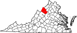 | |
| CDPs | ||
| Unincorporated communities |
| |
| Footnotes | ‡This populated place also has portions in an adjacent county or counties | |
This article is issued from Wikipedia - version of the 10/13/2016. The text is available under the Creative Commons Attribution/Share Alike but additional terms may apply for the media files.