Llawhaden
| Llawhaden | |
 St Aidan's church |
|
 Llawhaden |
|
| Population | 688 (2011)[1] |
|---|---|
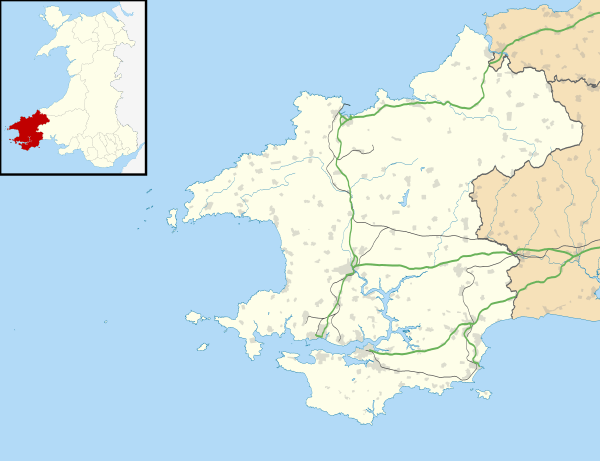
| OS grid reference | SN072175 |
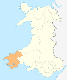
| Principal area | Pembrokeshire |
| Country | Wales |
| Sovereign state | United Kingdom |
| Post town | Narberth |
| Postcode district | SA67 8 |
| Dialling code | 01437 |
| Police | Dyfed-Powys |
| Fire | Mid and West Wales |
| Ambulance | Welsh |
| EU Parliament | Wales |
| UK Parliament | Carmarthen West and South Pembrokeshire |
| Welsh Assembly | Carmarthen West and South Pembrokeshire |
|
|
Coordinates: 51°49′12″N 4°47′53″W / 51.82°N 4.798°W
Llawhaden (Welsh: Llanhuadain) is a village and community in the Hundred of Dungleddy (Welsh: Daugleddyf), Pembrokeshire, West Wales. The community of Llawhaden includes the parish of Robeston Wathen, part of Narberth and the hamlet of Gelli, and had a population of 634 in 2001, increasing to 688 at the 2011 Census.
Name
The name Llawhaden is an anglicised version of the Welsh form Llanhuadain, and probably means "(monastic) enclosure of St Aidan".[2]
Description
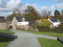
The village is in the form of a large medieval planned settlement, although most of the land lots laid out along the main street are now vacant. At the end of the main street, spectacularly overlooking the Cleddau valley, is a substantial castle, Llawhaden Castle.[3] The parish church of St Aidan (of Ferns, a disciple of Saint David) is situated below the village beside the river, at 51°49′21″N 4°47′40″W / 51.8226°N 4.7944°W.
History
The village and castle were created and owned by the Bishops of St David's. The village was once a marcher borough. George Owen, in 1603, described it as one of nine Pembrokeshire "boroughs in decay".[4]
The parish straddles the linguistic boundary, and was one of the six "bilingual" parishes mentioned by Owen in 1603.[5] The parish is divided east-west into two unequal parts by the Eastern Cleddau river, and this has been a fairly stable language boundary at least since Owen's time, with English speakers to the west and Welsh speakers to the east, although, perhaps in the early Industrial Revolution, Welsh-speakers infiltrated the western part in the area around Gelli woollen mill.
Llawhaden Bridge, to the east of the village, spans the Eastern Cleddau and is a Grade II* listed structure built in the mid-18th century.[6] There are a number of other listed structures in the parish.[7]
Notable people
Admiral Sir Thomas Foley was born in the parish in 1757.
Parish
Llawhaden[8] was a civil parish with an area of 4,609 acres (1,865 ha).
The parish includes the hamlet of Gelli.
Demographics
The civil parish had population as follows:[9]
| Date | 1801 | 1831 | 1861 | 1891 | 1921 | 1951 | 1981 |
| Population | 371 | 657 | 647 | 547 | 458 | 402 | 336 |
References
| Wikimedia Commons has media related to Llawhaden. |
- ↑ "Community population 2011". Retrieved 20 April 2015.
- ↑ Charles, B. G, The Placenames of Pembrokeshire, National Library of Wales, Aberystwyth, 1992, ISBN 0-907158-58-7, Vol II, p 420
- ↑ Castles of Wales
- ↑ Owen, George, The Description of Pembrokshire by George Owen of Henllys Lord of Kemes, Henry Owen (Ed), London, 1892
- ↑ Owen, George, The Description of Pembrokeshire Dillwyn Miles (Ed) (Gomer Press, Llandysul 1994) ISBN 1-85902-120-4.
- ↑ "British Listed Buildings: Llawhaden Bridge and River Bank Wall, Llawhaden". Retrieved 28 March 2016.
- ↑ "British Listed Buildings: Listed Buildings in Llawhaden, Pembrokeshire, Wales". Retrieved 28 March 2016.
- ↑ Llawhaden on Genuki
- ↑ OPCS Reports