Scleddau
| Scleddau | |
 |
|
 Scleddau |
|
| Population | 1,013 (2011)[1] |
|---|---|
| OS grid reference | SM93SW88 |
| – Cardiff | 84.8 mi (136.5 km) |
| – London | 210.6 mi (338.9 km) |
| Principal area | Pembrokeshire |
| Country | Wales |
| Sovereign state | United Kingdom |
| Post town | Abergwaun |
| Postcode district | SA65 |
| Police | Dyfed-Powys |
| Fire | Mid and West Wales |
| Ambulance | Welsh |
| EU Parliament | Wales |
| UK Parliament | Preseli Pembrokeshire |
| Welsh Assembly | Preseli Pembrokeshire |
|
|
Coordinates: 51°58′04″N 4°59′36″W / 51.967814°N 4.99326°W
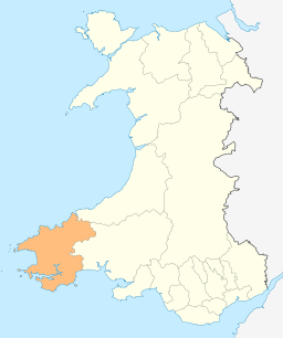
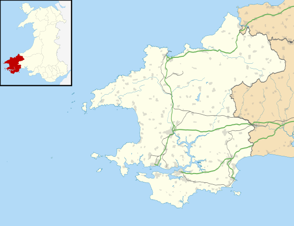
Scleddau is a village and a community in the county of Pembrokeshire, Wales, and is 2 miles (3.2 km) south of Fishguard on the A40.[2][3] In 2011 the population of Scleddau was 1,013 with 34.2% able to speak Welsh.[4]
The River Cleddau which lends its name to the village flows under the main road. Castell Hendre-Wen and the Round Barrow on Jordanson Hill are both Scheduled prehistoric Monuments dating back to the early Iron Age.[5][6] 1 mile (1.6 km) south-east of Scleddau, and within the community, is the Grade II Listed Church of St Justinian, in the village of Trecwn.
Governance
An electoral ward in the same name exists. This ward stretches to the coast at Strumble Head with at total population of 1,487.[7]
References
- ↑ "Community population 2011". Retrieved 21 April 2015.
- ↑ Bangor University Placenames Unit (Canolfan Bedwyr); accessed 9 May 2014
- ↑ Google Maps (Map). Google.
- ↑ Welsh Government website; 2011 Census Returns and stats; accessed 9 May 2014
- ↑ Coflein (Cadw) website; accessed 10 May 2014.
- ↑ Pembrokeshire County Council website; accessed 10 May 2014.
- ↑ "Ward population 2011". Retrieved 21 April 2015.