Ambleston
| Ambleston | |
| Welsh: Treamlod | |
 |
|
 Ambleston |
|
| Population | 382 (2011)[1] |
|---|---|
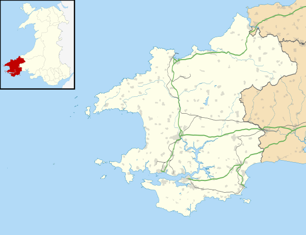
| OS grid reference | SN0025 |
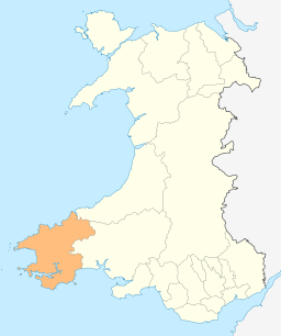
| Principal area | Pembrokeshire |
| Country | Wales |
| Sovereign state | United Kingdom |
| Post town | Haverfordwest |
| Postcode district | SA62 |
| Police | Dyfed-Powys |
| Fire | Mid and West Wales |
| Ambulance | Welsh |
| EU Parliament | Wales |
| UK Parliament | Preseli Pembrokeshire |
| Welsh Assembly | Preseli Pembrokeshire |
|
|
Coordinates: 51°53′41″N 4°54′23″W / 51.89478°N 4.90644°W
Ambleston (Welsh: Treamlod) is a village, parish and community in Pembrokeshire, Wales, 7 miles (11 km) north of Haverfordwest. The parish includes the hamlets of Wallis 51°53′44″N 4°53′21″W / 51.89556°N 4.88917°W and Woodstock (Welsh: Wstog) 51°53′40″N 4°52′36″W / 51.89444°N 4.87667°W.
Name
The placenames, both English and Welsh placenames, mean "Amlot's farm", Amlot being a Norman-French name.[2]
Location and demographics
The northern border of the parish is an ancient trackway leading towards St David's, with a Roman fortlet called "Castell Fflemish". This line is also the northern boundary of the cantref of Daugleddau, and was described by George Owen in 1602 as the language frontier, placing Ambleston in Little England beyond Wales.
Ambleston was one of the parishes Owen described as bilingual, and in modern times it was predominantly Welsh-speaking. The 2011 census showed 34.3% of Ambleston community's population could speak Welsh, a fall from 39.4% in 2001.[3] Historically, the percentage of Welsh speakers was 86 (1891): 79 (1931): 57 (1971).
In 1934, a small part of the parish was transferred to the parish of St Dogwells. The pre-1934 parish had an area of 3,850 acres (1,560 ha). Its census populations were: 421 (1801): 598 (1851): 386 (1901): 358 (1951): 309 (1981).
The community had a population of 367 in 2001 increasing to 382 at the 2011 census.
Governance
With the communities of Spittal and Wiston, it makes up the Pembrokeshire electoral ward of Wiston.
References
- ↑ "Community population 2011". Retrieved 21 April 2015.
- ↑ Charles, B. G., The Placenames of Pembrokeshire, National Library of Wales, Aberystwyth, 1992, ISBN 0-907158-58-7, pp 395
- ↑ "2011 Census results by Community". Welsh Language Commissioner. 2015. Retrieved 8 August 2015.
External links
- Ambleston: historical and genealogical information at GENUKI.
- Photographs of Ambleston and surrounding area on Geograph
- The Ambleston War Memorial