List of waterfalls of Canada
This is a list of waterfalls in Canada.
Overview
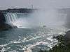
Alfred Creek Falls in British Columbia is recorded as one of the tallest in Canada at a height of 700 metres (2,297 ft) and a class-3 horsetail waterfall.[1] Deserted River Falls also in British Columbia is thought to be the largest of North America at 670 metres (2,200 ft). Della Falls in British Columbia supplied by Della Lake is considered to be the 16th-tallest waterfall in the world at 440 metres (1,440 ft) and is the tallest measured waterfall in Canada.[2] Takakkaw Falls used to have the distinction of being the tallest Canadian waterfall at 373 metres (1,224 ft) and is considered to be the 23rd world tallest.[3] Hunlen Falls, 365 metres (1,198 ft) is listed as the world's 25th tallest waterfall at Highest waterfalls of the world, waterfalls with the height above 300 m. According to Waterfalls of the world, Della Falls is the 19th tallest waterfall in the world.[3] James Bruce Falls, 840 metres (2,760 ft), is the 8th tallest waterfall of the world and Alfred Creek Falls, 700 metres (2,300 ft) is the 29th tallest in the world according to the World Waterfall Database: World's Tallest Waterfalls[4] Niagara Falls in Ontario, a segmented block waterfall, is the 10th largest waterfall in the world. Virginia Falls, Northwest Territories, supplied by the South Nahanni River, is the 14th world's largest waterfall and the Grand Falls on the Hamilton River is listed as the 15th largest on the World Waterfall Database: World's Largest Waterfalls. Also in Newfoundland is Pissing Mare Falls in Gros Morne National Park, at 350 metres (1,150 ft), it is the largest waterfall on the island of Newfoundland and one of the largest in North America.[5] According to the website, Top 10 Awe Inspiring Waterfalls, Niagara Falls is ranked 2nd.[6]
There are three waterfalls in Canada which appear to reverse. They are Wager Bay, Nunavut; Barrier Inlet, Nunavut; and Reversing Falls at the mouth of the Saint John River, New Brunswick. During low tide the watersource falls over a rocky ledge as a waterfall. During high tide, the seawater raises above the height of the rocky ledge, and the seawater rushes into the river valley against the low tide river flow.[7]
Sports
Waterfall ice climbing is a sport undertaken by climbing enthusiasts aware of avalanche risks.[8] Some waterfalls are conducive to swimming, or kayaking sports.[5] To several waterfalls which are not near a highway, hiking trails lead into the site of the waterfall. Some waterfalls have bridges and cable cars to provide additional scenic views of the waterfall such as at Montmorency Falls.[9] Photography of waterfalls records the panorama of scenic cascading waterfalls.
Waterfalls of Canada
Alberta
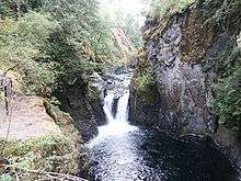
| Image | Waterfall | Watercourse | Drop | Width | Class | Type | Reference | Coordinates |
|---|---|---|---|---|---|---|---|---|
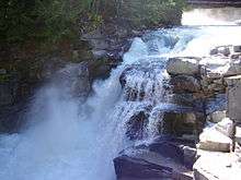
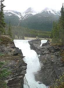 | Athabasca Falls | Athabasca River | 24 m (79 ft) | 18 m (59 ft) | 5 | Cascade | [10] | 52°39′51″N 117°53′01″W / 52.66417°N 117.88361°W |
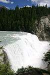
 | Bow Falls | Bow River | 30 m (98 ft) | 5 | Block | [11] | ||
 | Bow Glacier Falls | Bow River | 120 m (390 ft) | 57 m (187 ft) | Tiered | [12] | ||
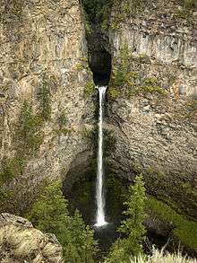
 | Bridal Veil Falls (Banff) | An unnamed stream | 370 m (1,210 ft) | 6.1 m (20 ft) | 4 | Horsetail/Plunge | [13][14] | |
 | Crescent Falls | Bighorn River | 18 m (59 ft) | 5 | Tiered | [15] | 52°23′13″N 116°21′15″W / 52.38693°N 116.35427°W | |
 | Elbow Falls | Elbow River | 6 m (20 ft) | Cascade | [16] | 50°51′31″N 114°47′32″W / 50.85861°N 114.79222°W | ||
 | Panther Falls | Nigel Creek | 61 m (200 ft) | 7.6 m (25 ft) | 3 | Plunge | [17] | 52°10′50″N 117°03′26″W / 52.18056°N 117.05722°W |
 | Siffleur Falls | Siffleur River | [18] | |||||
 | Sunwapta Falls | Sunwapta River | 18 m (59 ft) | 9.1 m (30 ft) | 6 | [19] | ||
| Chaudière Falls | Stream between Caldron & Peyto Lakes | 122 m (400 ft) | 24 m (79 ft) | Segmented | [20] | |||
 | Crypt Falls | Hellroaring Creek | Horsetail | [21] | ||||
| Fossil Falls | Foch Creek | 150 m (490 ft) | Tiered | [22] | ||||
| Kerkeslin Falls | An unnamed stream | 310 m (1,020 ft) | 9 m (30 ft) | 4 | Tiered | [23] | ||
| Kitchener Creek Falls | Kitchener Creek | 122 m (400 ft) | Cascades | [24] | ||||
| Lineham Falls | Lineham Creek | 125 m (410 ft) | Horsetail | [25] | ||||
| Michelle Falls | Waterfalls Creek | 305 m (1,001 ft) | 23 m (75 ft) | 3 | Horsetail | [26] | ||
| Murchison Falls | An unnamed stream | 180 m (590 ft) | 23 m (75 ft) | Tiered | [27] | |||
| Sideways Falls (Big Bend Falls) | An unnamed stream | 183 metres (600 ft) | 12 m (39 ft) | 5 | Tiered | [28] | ||
| Upper Geraldine Falls | Geraldine Creek | 152 m (499 ft) | Horsetail | [29] | ||||
| Maligne Canyon Falls | Maligne Canyon | [30] | ||||||
| O'Shaughnessy Falls | [30] | |||||||
| Snake Indian Falls | Snake Indian River | [30] | ||||||
| Tangle Falls | [30] |
British Columbia
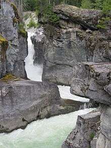
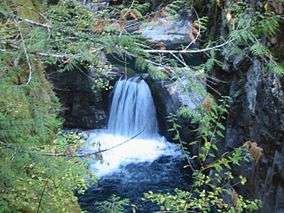
| Image | Waterfall | Watercourse | Drop | Width | Class | Type | Reference | Coordinates |
|---|---|---|---|---|---|---|---|---|
 | Alexander Falls | Madeley Creek | 141 m (463 ft) | 40 m (130 ft) | 4 | Tiered | [31] | 52°08′00″N 123°08′00″W / 52.13333°N 123.13333°W |
| Alfred Creek Falls | Alfred Creek | 700 m (2,300 ft) | 3 | Cascade | [32] | |||
| Angel's Staircase Falls | An unnamed stream | 100 m (330 ft) | 20 m (66 ft) | 3 | Cascade | [33] | 51°31′00″N 116°30′00″W / 51.51667°N 116.50000°W | |
| Arctomys Falls | Arctomys Creek | [34] | 53°03′57″N 118°53′50″W / 53.06583°N 118.89722°W | |||||
 | Ashlu Falls | Ashlu Creek | 10 m (33 ft) | 33 m (108 ft) | 3 | Tiered | [35] | 49°56′01″N 123°21′31″W / 49.93361°N 123.35861°W |
| Basalt Falls | Dean River | 3.7 m (12 ft) | [36] | 52°48′00″N 125°33′00″W / 52.80000°N 125.55000°W | ||||
| Blaeberry Falls (Thompson Falls) | Lower Blaeberry River | [37] | 51°31′00″N 116°57′00″W / 51.51667°N 116.95000°W | |||||
 | Brandywine Falls | Brandywine Creek | 70 m (230 ft) | plunge | [38] | 50°02′07″N 123°07′07″W / 50.03528°N 123.11861°W | ||
 | Bridal Veil Falls | Bridal Creek | 122 m (400 ft) | 23 m (75 ft) | [39][40] | 49°11′N 121°44′W / 49.183°N 121.733°W | ||
 | Canim Falls | Canim River | 18 m (59 ft) | [41] | 51°52′00″N 120°35′35″W / 51.86667°N 120.59306°W | |||
 | Chatterbox Falls | Loquilts Creek | 37 m (121 ft) | Fan | [42] | 50°12′20.00″N 123°46′14.00″W / 50.2055556°N 123.7705556°W | ||
| Cliff Lake Falls | Van Creek | 215 m (705 ft) | 23 m (75 ft) | Horsetail | [43] | |||
| Crooked Falls | Sigurd Creek | 198 m (650 ft) | 15 m (49 ft) | Tiered | [44] | |||
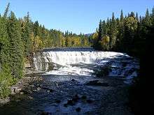 | Dawson Falls | Murtle River | 15.2 m (50 ft) | 91.4 m (300 ft) | [45] | 51°58′00″N 120°07′00″W / 51.96667°N 120.11667°W | ||
 | Della Falls | Drinkwater Creek | 440 m (1,440 ft) | 37 m (121 ft) | Segmented, Tiered | [46][47] | 49°27′16″N 125°32′03″W / 49.45444°N 125.53417°W | |
| Deserted River Falls | Deserted River | 670 m (2,200 ft) | [48] | |||||
| Fairy Creek Falls | Fairy Creek | 305 m (1,001 ft) | 3 | Tiered | [49] | |||
| Flood Falls | Fairy Creek | 380 m (1,250 ft) | 8 m (26 ft) | Tiered | [50] | |||
 | Englishman River Falls | Englishman River | [51] | 49°14′51″N 124°21′7″W / 49.24750°N 124.35194°W | ||||
| Francis Falls | Fairy Creek | 650 m (2,130 ft) | Horsetail | [52] | ||||
| Gold Creek Falls | Gold Creek | 610 m (2,000 ft) | Horsetail | [53] | ||||
| Helmet Falls | Helmet Creek | 352 m (1,155 ft) | 30 m (98 ft) | 4 | Tiered | [54] | ||
| Harmony Falls Freil Lake Falls Friel Falls | Friel Creek | 444 m (1,457 ft) | 38 m (125 ft) | 4 | Tiered | [55] | ||
| High Falls | High Falls Creek | 91 m (299 ft) | [56] | |||||
| High Falls | High Falls Creek | 91 m (299 ft) | 26 m (85 ft) | [57] | ||||
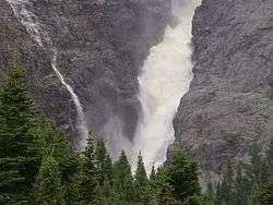
 | Hunlen Falls | Hunlen Creek | 374 m (1,227 ft) | 26 m (85 ft) | 4 | Plunge | [58] | |
| Icecap Falls | 457 m (1,499 ft) | 4 | Segmented | [59] | ||||
 | Helmcken Falls | Murtle River | 141 m (463 ft) | 23 m (75 ft) | 7 | Plunge | [60] | 52°23′13″N 116°21′15″W / 52.38693°N 116.35427°W |
 | Keyhole Falls | Lillooet River | 23 m (75 ft) | Punchbowl | [61] | 52°23′13″N 116°21′15″W / 52.38693°N 116.35427°W | ||
| Kingcome Valley Falls | 520 m (1,710 ft) | 9 m (30 ft) | 3 | Horsetail | [62] | |||
| Kinueso Falls | Murray River | 60m
197ft |
||||||
 | Nairn Falls | Green River | 40 m (130 ft) | 9.1 m (30 ft) | Tiered | [63] | ||
 | Nymph Falls | Puntledge River | 15 m (49 ft) | 46 m (151 ft) | 6 | Cascade | [64] | 49°40′14″N 125°4′38″W / 49.67056°N 125.07722°W |
 | Overlander Falls | Fraser River | 9.1 m (30 ft) | 30 m (98 ft) | 4 | Block | [65][66] | 53°02′00″N 119°12′00″W / 53.03333°N 119.20000°W |
 | Upper Little Qualicum Falls | Little Qualicum River | [67] | 49°19′00″N 124°33′00″W / 49.316667°N 124.55°W | ||||
 | Rearguard Falls | Fraser River | 6 m (20 ft) | [68] | 52°58′25″N 119°21′45″W / 52.97361°N 119.36250°W | |||
 | Shannon Falls | Shannon Creek | 337 m (1,106 ft) | 3 | Horsetail | [69] | 49°40′10″N 123°09′21″W / 49.66944°N 123.15583°W | |
 | Spahats Creek Falls | Spahats Creek | 73 m (240 ft) | 7.5 m (25 ft) | Plunge | [70][71] | 51°44′00″N 120°01′00″W / 51.733333°N 120.016667°W | |
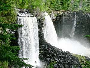
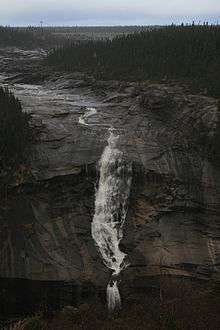
 | Takakkaw Falls | 384 m (1,260 ft) | 30 m (98 ft) | 5 | Horsetail | [72] | 51°29′59″N 116°28′22″W / 51.49972°N 116.47278°W | |
 | Wapta Falls | Kicking Horse River | 30 m (98 ft) | 91 m (299 ft) | 6 | Block | [73] | 51°11′13″N 116°34′34″W / 51.187°N 116.576°W |
| Hunlen Falls | Atnarko River | 70 m (230 ft) | [74] | |||||
| Twin Falls | 80 m (260 ft) | [74] | ||||||
 | James Bruce Falls | Loquilts Creek | 840 m (2,760 ft) | 3 | Horsetail | [75] | ||
| Alfred Creek Falls | Alfred Creek | 700 m (2,300 ft) | 30 m (98 ft) | 3 | Horsetail | [76] | ||
| Bergeron Falls | 99 m (325 ft) | 9 m (30 ft) | Horsetail | [77] | ||||
| Cascade Falls | Cascade Creek | 300 m (980 ft) | 3 m (9.8 ft) | 3 | Horsetail | [77] | ||
| Cummins Falls | Cummins River | 63 m (207 ft) | 15 m (49 ft) | Tiered | [78] | |||
| Kiwi Falls | Nisnak Creek | 480 m (1,570 ft) | [79] | |||||
| Michael Falls | 380 m (1,250 ft) | 12 m (39 ft) | 5 |
Tiered | [80] | |||
| Middle Cummins Falls | Cummins River | 220 m (720 ft) | 12 m (39 ft) | Horsetail | [81] | |||
| Moresby Falls | 420 m (1,380 ft) | 12 m (39 ft) | Tiered | [82] | ||||
| Odegaard Falls | Nusatsum River | 280 m (920 ft) | 12 m (39 ft) | 6 | Horsetail | [83] | ||
| Petain Creek Falls Petain Falls | Petain Creek | 375 m (1,230 ft) | tiered | [84] | ||||
| Peach Creek Falls | Peach Creek | 183 m (600 ft) | tiered | [85] | ||||
| Place Creek Falls | Place Creek | 419 m (1,375 ft) | 14 m (46 ft) | 4 | tiered | [86] | ||
 | Pyramid Falls | Pyramid Creek | 91 m (299 ft) | tiered | [87] | |||
| Silvertip Falls | Coursier Creek | 198 m (650 ft) | Tiered | [88] | ||||
| Snowshoe Creek Falls | Snowshoe Creek | 240 m (790 ft) | Horsetail | [89] | ||||
| Swiftcurrent Falls | Swiftcurrent Creek | 520 m (1,710 ft) | [89] | |||||
| Thunder Falls Rockingham Falls Rainbow Falls | 183 m (600 ft) | Cascade | [90] | |||||
| Twin Falls | 183 m (600 ft) | Segmented | [91] | |||||
| Wapta Falls | Kicking Horse River | 30 m (98 ft) | 152 m (499 ft) | 7 | Block | [92] | ||
| | Wapta Falls | Kicking Horse River | 30 m (98 ft) | 91 m (299 ft) | 6 | Block | [73] | 51°11′13″N 116°34′34″W / 51.187°N 116.576°W |
| Wedgemount Creek Falls | Wedgemount Creek | 300 m (980 ft) | 5 | [93] | Lunbreck falls | |||
| Whispering Falls | Landsborough Creek | 152 m (499 ft) | 15 m (49 ft) | Tiered | [94] |
New Brunswick
| Image | Waterfall | Watercourse | Drop | Width | Class | Type | Reference | Coordinates |
|---|---|---|---|---|---|---|---|---|
| "Grand Falls, Nepisiguit River, before 1874" | Nepisiguit Grand Falls | Nepisiguit River | 75 m (246 ft) | segmented Block | 53°36′00″N 64°18′57″W / 53.60000°N 64.31583°W | |||
Newfoundland & Labrador
| Image | Waterfall | Watercourse | Drop | Width | Class | Type | Reference | Coordinates |
|---|---|---|---|---|---|---|---|---|
 | Churchill Falls | Churchill River | 75 m (246 ft) | segmented Block | [96][97] | 53°36′00″N 64°18′57″W / 53.60000°N 64.31583°W | ||
| Muskrat Falls | Churchill River | 15 m (49 ft) | 53°14′44″N 60°46′17″W / 53.24556°N 60.77139°W | |||||
 | Pissing Mare Falls | Burnt Woods Brook | 350 m (1,150 ft) | Plunge, Cascade | [98][99][100] | |||
| Twin Falls | Unknown River | 53 m (174 ft) | [101] | |||||
| Grand Falls | Exploits River | 43 m (141 ft) | [74] | |||||
| Grand Falls | Hamilton River | 92 m (302 ft) | 46 m (151 ft) | 1 | Slide, Plunge | [102] | ||
| Thomas Falls | Unknown River | 31 m (102 ft) | [74] | |||||
| Scott Falls | Unknown River | 27 m (89 ft) | [74] | |||||
| Aviron Bay Falls | 213 m (699 ft) | 12 m (39 ft) | 3 | Tiered | [103] | |||
 | Rattling Brook Falls | Rattling Brook | 140 m (460 ft) | 4 | tiered | [104] | ||
| Sandy Pond Falls | 220 m (720 ft) | 4 | Plunge, Cascades | [105] | ||||
| Grand Falls | Exploits River | 43 m (141 ft) | [74] | |||||
| Grand Falls | Hamilton River | 92 m (302 ft) | 46 m (151 ft) | 1 | Slide, Plunge | [102] | ||
| Thomas Falls | Unknown River | 31 m (102 ft) | [74] | |||||
| Scott Falls | Unknown River | 27 m (89 ft) | [74] |
Manitoba
| Image | Waterfall | Watercourse | Drop | Width | Class | Type | Reference | Coordinates |
|---|---|---|---|---|---|---|---|---|
 | Pisew Falls | [106] | 55°11′50″N 98°23′51″W / 55.19722°N 98.39750°W | |||||
| Muhigan Falls | Muhigan River | 19 m (62 ft) | [74] | |||||
Northwest Territories
| Image | Waterfall | Watercourse | Drop | Width | Class | Type | Reference | Coordinates |
|---|---|---|---|---|---|---|---|---|
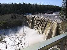 | Alexandra Falls | Hay River | 33 m (108 ft) | [107][108] | 60°29′59″N 116°16′52″W / 60.49972°N 116.28111°W | |||
 | Virginia Falls | South Nahanni River | 96 m (315 ft) | 259 m (850 ft) | Segmented | [109] | 50°02′07″N 123°07′07″W / 50.03528°N 123.11861°W | |
| Parry Falls | Lockhart River | 40 m (130 ft) | [74] | |||||
| Marengo Falls | Marengo Creek | 30 m (98 ft) | [74] | |||||
| Tyrrell Falls | Lockhart River | 26 m (85 ft) | [74] | |||||
| Louise Falls | Hay River | 20 m (66 ft) | [74] |
Nova Scotia


Ontario


Quebec
| Image | Waterfall | Watercourse | Drop | Width | Class | Type | Reference | Coordinates |
|---|---|---|---|---|---|---|---|---|
 | Chats Falls | Ottawa River | 16.16 m (53.0 ft) | 45°28′35″N 76°14′55″W / 45.47639°N 76.24861°W | ||||
 | Chaudière Falls | Ottawa River | 15 m (49 ft) | 60 m (197 ft) | [117][132] | |||
 | Chutes de la Chaudière | Chaudière River | 35 feet (11 m) | Cataract | [133][134] | 46°42′47″N 71°17′10″W / 46.71306°N 71.28611°W | ||
| Chute Kabir Kouba | Saint-Charles River | 28 m (92 ft) | cascade/plunge | [135][136] | 46°51′19″N 71°21′20″W / 46.85528°N 71.35556°W | |||
 | Montmorency Falls | Montmorency River | 84 m (276 ft) | [137] | 46°53′27″N 71°8′51″W / 46.89083°N 71.14750°W | |||
 | St. Anne Falls | 70 m (230 ft) | [138] | 46°53′27″N 71°8′51″W / 46.89083°N 71.14750°W | ||||
| Chute Ouiatchouan | 79 m (259 ft) | [74] | ||||||
| Chute de Shawinigan | Rivière Saint-Maurice | 46 m (151 ft) | [74] | |||||
| Chute du Calcaire | Rivière Caniapiscau | 22 m (72 ft) | [74] | |||||
| Chute au Granite | Rivière Caniapiscau | 21 m (69 ft) | [74] | |||||
| Chutes aux Schistes | Rivière Caniapiscau | 18 m (59 ft) | [74] | |||||
| Les Sept Chutes Cascades de Saint Ferreol | Rivière Sainte-Anne-du-Nord | 130 m (430 ft) | Tiered | [139] | ||||
| Chutes Kempt/Normand Falls | Rivière Kempt | [140] | 48°1′41.80″N 66°47′16.31″W / 48.0282778°N 66.7878639°W | |||||
Saskatchewan
| Image | Waterfall | Watercourse | Drop | Width | Class | Type | Reference | Coordinates |
|---|---|---|---|---|---|---|---|---|
 | Nistowiak Falls | Rapid River | 10 m (33 ft) | segmented | [141] | 55°23′46″N 104°21′59″W / 55.39611°N 104.36639°W | ||
| Spruce Falls | Swan River | [142] | 55°37′00″N 102°27′00″W / 55.61667°N 102.45000°W | |||||
| Elizabeth Falls | Fond du Lac River | 34 m (112 ft) | [74] |
Unsorted
| Image | Waterfall | Province | Watercourse | Drop | Width | Class | Type | Reference | Coordinates |
|---|---|---|---|---|---|---|---|---|---|
| Big Beaver Falls | Ontario | Kapuskasing River | 18 m (59 ft) | [74] | |||||
| Lady Evelyn Falls | Northwest Territories | Kakisa River | 17 m (56 ft) | [74] | |||||
| Taskinigup Falls | Manitoba | Burntwood River | 15 m (49 ft) | [74] | |||||
| Aviron Bay Falls | Newfoundland and Labrador | 213 m (699 ft) | 12 m (39 ft) | 3 | Tiered | [103] | |||
| Rattling Brook Falls | Newfoundland and Labrador | Rattling Brook | 140 m (460 ft) | 4 | tiered | [104] | |||
| Sandy Pond Falls | Newfoundland and Labrador | 220 m (720 ft) | 4 | Plunge, Cascades | [105] | ||||
See also
References
- ↑ "Waterfalls of the Pacific Northwest".
- ↑ "The Canadian Encyclopedia > Geography > Hydrology > Waterfall". Historica Foundation of Canada. 2008. Retrieved 2008-11-10.
- 1 2 "Highest waterfalls of the world: WATERFALLS WITH THE HEIGHT ABOVE 300 M". Retrieved 2008-11-10.
- ↑ Swan, Bryan; Dean Goss (2004). "World Waterfall Database: World's Tallest Waterfalls". Retrieved 2008-11-10.
- 1 2 Swan, Bryan; Dean Goss (2004). "World Waterfall Database: World's Largest Waterfalls". Retrieved 2008-11-10.
- ↑ Frater, Jamie (2007–2008). "Top 10 Awe Inspiring Waterfall". Retrieved 2008-11-10.
- ↑ "The Atlas of Canada—Waterfalls". Natural Resources Canada. Government of Canada. 2007-10-19. Retrieved 208-11-10. Check date values in:
|access-date=(help) - ↑ "Mountain National Parks of Canada safety and Hazards". >Parks Canada—Mountain National Parks of Canada—Visitor Information—Safety and Hazards—Waterfall Ice Climbing and Avalanches. Government of Canada. 2006-09-29. Retrieved 2008-11-10.
- ↑ "Montmorency, Canada Transportation Tips by Dabs". VirtualTourist.com, Inc. 1994–2008.
- ↑ Waterfalls of the Pacific Northwest. "Athabasca Falls". Retrieved 2007-06-27.
- ↑ Waterfalls of the Pacific Northwest. "Bow Falls". Retrieved 2007-06-27. .
- ↑ "Bow Glacier Falls – World Waterfall Database: World's Tallest Waterfalls". Bryan Swan & Dean Goss. 2004. Retrieved 2008-11-07.
- ↑ Waterfalls of the Pacific Northwest. "Bridal Veil Falls". Retrieved 2007-06-27. The tallest single drop is 400 ft (120 m).
- ↑ World Waterfall Database (September 2004). "Bridal Veil Falls". Retrieved 2007-07-01.
- ↑ World Waterfalls. "Crescent falls". Retrieved 2008-02-12.
- ↑ Hamlet of Bragg Creek (September 2005). "Elbow Falls". Retrieved 2007-07-01.
- ↑ Waterfalls of the Pacific Northwest. "Panther Falls". Retrieved 2007-06-27.
- ↑ Bryan, Swan (2005). "Lower Siffleur Falls". Waterfalls of the Pacific Northwest. Retrieved 2008-11-10.
- ↑ Waterfalls of the Pacific Northwest. "Sunwapta Falls". Retrieved 2007-07-01.
- ↑ "Caldron Falls WorldWaterfalls.com – Alberta – Canada". PictureChasers.com. Bryan Swan & Dean Goss. 1985–2008. Retrieved 2008-11-07.
- ↑ "Crypt Falls WorldWaterfalls.com – Alberta – Canada". PictureChasers.com. Bryan Swan & Dean Goss. 1985–2008. Retrieved 2008-11-07.
- ↑ "Fossil Falls WorldWaterfalls.com – Alberta – Canada". PictureChasers.com. Bryan Swan & Dean Goss. 1985–2008. Retrieved 2008-11-07.
- ↑ "Kerkeslin Falls WorldWaterfalls.com – Alberta – Canada". PictureChasers.com. Bryan Swan & Dean Goss. 1985–2008. Retrieved 2008-11-07.
- ↑ "Kitchener Creek Falls WorldWaterfalls.com – Alberta – Canada". PictureChasers.com. Bryan Swan & Dean Goss. 1985–2008. Retrieved 2008-11-07.
- ↑ "Lineham Falls WorldWaterfalls.com – Alberta – Canada". PictureChasers.com. Bryan Swan & Dean Goss. 1985–2008. Retrieved 2008-11-07.
- ↑ "Michelle Falls WorldWaterfalls.com – Alberta – Canada". PictureChasers.com. Bryan Swan & Dean Goss. 1985–2008. Retrieved 2008-11-07.
- ↑ "Murchison Falls WorldWaterfalls.com – Alberta – Canada". PictureChasers.com. Bryan Swan & Dean Goss. 1985–2008. Retrieved 2008-11-07.
- ↑ "Sideways Falls Big Bend Falls – World Waterfall Database: World's Tallest Waterfalls". Bryan Swan & Dean Goss. 2004. Retrieved 2008-11-07.Not Panther Falls The name given of Sideways Falls is the local name
- ↑ "Upper Geraldine Falls – World Waterfall Database: World's Tallest Waterfalls". Bryan Swan & Dean Goss. 2004. Retrieved 2008-11-07.
- 1 2 3 4 "Waterfalls Alberta". Mat Quigley. 2010-present. Retrieved 2013-02-06. Check date values in:
|date=(help) - ↑ Waterfalls of the Pacific Northwest: Alexander Falls
- ↑ Waterfalls of the Pacific Northwest: Alfred Creek Falls
- ↑ Waterfalls of the Pacific Northwest: Angel’s Staircase Falls
- ↑ Waterfalls of the Pacific Northwest: Arctomys Falls
- ↑ Waterfalls of the Pacific Northwest: Ashlu Falls
- ↑ "Basalt Falls Natural Resources Canada ULKATCHO Quad, British Columbia, Topographic Map". Demand Media, Inc. -. 1999–2008. Retrieved 2008-11-07.
- ↑ "BCGNIS Geographical Name Details—BCGNIS Query Results". Geographic Data BC. 1999–2008. Retrieved 2008-11-07.
- ↑ "Brandywine Falls BC". PictureChasers.com. Bryan Swan & Dean Goss. 1985–2008. Retrieved 2008-11-07.
- ↑ Turnbull, Leon. "Waterfalls of British Columbia—Bridal Veil Falls; Bridal Falls ...". Retrieved 2008-11-07.
- ↑ "WorldWaterfalls.com – Bridal Veil Falls BC – British Columbia – Canada". PictureChasers.com. Bryan Swan & Dean Goss. 1985–2008. Retrieved 2008-11-07.
- ↑ "Canim Falls – Waterfalls of the Pacific Northwest". Retrieved 2008-11-07.
- ↑ Swan, Bryan (2005). "Waterfalls of the Pacific Northwest—Chatterbox Falls". Retrieved 2008-11-07.
- ↑ "Cliff Lake Falls WorldWaterfalls.com – British Columbia – Canada". PictureChasers.com. Bryan Swan & Dean Goss. 1985–2008. Retrieved 2008-11-07.
- ↑ "Crooked Falls WorldWaterfalls.com – British Columbia – Canada". PictureChasers.com. Bryan Swan & Dean Goss. 1985–2008. Retrieved 2008-11-07.
- ↑ "BCGNIS Query Results—BCGNIS Geographical Name Details". 2005. Retrieved 2008-11-07.
- ↑ "Waterfalls". The Atlas of Canada, Natural Resources Canada. Retrieved 2006-03-30.16th-tallest waterfall in the world—Claimed to be tallest measured waterfall of Canada
- ↑ "Della Falls – World Waterfall Database: World's Tallest Waterfalls". PictureChasers.com. Bryan Swan & Dean Goss. 1985–2008. Retrieved 2008-11-07.
- ↑ "Deserted River Falls WorldWaterfalls.com – British Columbia – Canada". PictureChasers.com. Bryan Swan & Dean Goss. 1985–2008. Retrieved 2008-11-07.Maybe the tallest in North America
- ↑ "Fairy Creek Falls WorldWaterfalls.com – British Columbia – Canada". PictureChasers.com. Bryan Swan & Dean Goss. 1985–2008. Retrieved 2008-11-07.
- ↑ "Flood Falls WorldWaterfalls.com – British Columbia – Canada". PictureChasers.com. Bryan Swan & Dean Goss. 1985–2008. Retrieved 2008-11-07.
- ↑ "Englishman River Falls – World Waterfall Database: World's Tallest Waterfalls". PictureChasers.com. Bryan Swan & Dean Goss. 1985–2008. Retrieved 2008-11-07.
- ↑ "Francis Falls WorldWaterfalls.com – British Columbia – Canada". PictureChasers.com. Bryan Swan & Dean Goss. 1985–2008. Retrieved 2008-11-07.Largest waterfall of British Columbia's Headwall Canyon valley
- ↑ "Gold Creek Falls WorldWaterfalls.com – British Columbia – Canada". PictureChasers.com. Bryan Swan & Dean Goss. 1985–2008. Retrieved 2008-11-07.
- ↑ "Helmet Falls WorldWaterfalls.com – British Columbia – Canada". PictureChasers.com. Bryan Swan & Dean Goss. 1985–2008. Retrieved 2008-11-07.
- ↑ "Harmony Falls WorldWaterfalls.com – British Columbia – Canada". PictureChasers.com. Bryan Swan & Dean Goss. 1985–2008. Retrieved 2008-11-07.
- ↑ "Harmony Falls WorldWaterfalls.com – British Columbia – Canada". PictureChasers.com. Bryan Swan & Dean Goss. 1985–2008. Retrieved 2008-11-07.
- ↑ "High Falls WorldWaterfalls.com – British Columbia – Canada". PictureChasers.com. Bryan Swan & Dean Goss. 1985–2008. Retrieved 2008-11-07.
- ↑ "Hunlen Falls WorldWaterfalls.com – British Columbia – Canada". PictureChasers.com. Bryan Swan & Dean Goss. 1985–2008. Retrieved 2008-11-07.
- ↑ "Icecap Falls WorldWaterfalls.com – British Columbia – Canada". PictureChasers.com. Bryan Swan & Dean Goss. 1985–2008. Retrieved 2008-11-07.
- ↑ "Helmcken Falls | World Waterfall Database: World's Tallest Waterfalls". PictureChasers.com. Bryan Swan & Dean Goss. 1985–2008. Retrieved 2008-11-07.
- ↑ Swan, Bryan (2005). "Keyhole Falls". Waterfalls of the Pacific Northwest. Retrieved 2007-11-08.
- ↑ "Kingcome Valley Falls WorldWaterfalls.com – British Columbia – Canada". PictureChasers.com. Bryan Swan & Dean Goss. 1985–2008. Retrieved 2008-11-07.
- ↑ Swan, Bryan (2005). "Nairn Falls". Waterfalls of the Pacific Northwest. Retrieved 2007-11-08.
- ↑ Swan, Bryan (2005). "Nymph Falls". Waterfalls of the Pacific Northwest. Retrieved 2007-11-08.
- ↑ Swan, Bryan (2005). "Overlander Falls". Waterfalls of the Pacific Northwest. Retrieved 2007-11-08.
- ↑ "GeoNames Query—Overlander Falls: Query Record Details". Natural Resources Canada. Government of Canada. 2008-11-09. Retrieved 2008-11-09.
- ↑ "Upper Little Qualicum Falls | World Waterfall Database: World's Tallest Waterfalls". PictureChasers.com. Bryan Swan & Dean Goss. 1985–2008. Retrieved 2008-11-07.
- ↑ "Rearguard Falls | World Waterfall Database: World's Tallest Waterfalls". Bryan Swan & Dean Goss. 2004. Retrieved 2008-11-07.
- ↑ "Shannon falls | World Waterfall Database: World's Tallest Waterfalls". Bryan Swan & Dean Goss. 2004. Retrieved 2008-11-07.Shannon Falls is the third highest waterfall in British Columbia
- ↑ "Spahats Creek Falls | World Waterfall Database: World's Tallest Waterfalls". Bryan Swan & Dean Goss. 2004. Retrieved 2008-11-07.
- ↑ Waterfalls of the Pacific Northwest: Spahats Creek Falls
- ↑ Waterfalls of the Pacific Northwest. "Takakkaw Falls". Retrieved 2007-06-27.
- 1 2 Waterfalls of the Pacific Northwest. "Wapta Falls". Retrieved 2008-11-08.
- 1 2 3 4 5 6 7 8 9 10 11 12 13 14 15 16 17 18 19 20 21 22 23 24 25 26 27 28 29 30 31 32 33 "The Atlas of Canada - Waterfalls". Natural Resources Canada. Government of Canada. 2007-10-19. Retrieved 2008-11-07.
- ↑ "James Bruce Falls | World Waterfall Database: World's Tallest Waterfalls". Bryan Swan & Dean Goss. 2004. Retrieved 2008-11-07.19th tallest waterfall in the World
- ↑ "James Bruce Falls | World Waterfall Database: World's Tallest Waterfalls". Bryan Swan & Dean Goss. 2004. Retrieved 2008-11-07.29th tallest waterfall in the World
- 1 2 "WorldWaterfalls.com – British Columbia – Canada". PictureChasers.com. Bryan Swan & Dean Goss. 1985–2008. Retrieved 2008-11-07.
- ↑ "Cummins Falls WorldWaterfalls.com – British Columbia – Canada". PictureChasers.com. Bryan Swan & Dean Goss. 1985–2008. Retrieved 2008-11-07.
- ↑ "Kiwi Falls WorldWaterfalls.com – British Columbia – Canada". PictureChasers.com. Bryan Swan & Dean Goss. 1985–2008. Retrieved 2008-11-07.
- ↑ "Michael Falls WorldWaterfalls.com – British Columbia – Canada". PictureChasers.com. Bryan Swan & Dean Goss. 1985–2008. Retrieved 2008-11-07.
- ↑ "Middle Cummins Falls WorldWaterfalls.com – British Columbia – Canada". PictureChasers.com. Bryan Swan & Dean Goss. 1985–2008. Retrieved 2008-11-07.
- ↑ "Moresby Falls WorldWaterfalls.com – British Columbia – Canada". PictureChasers.com. Bryan Swan & Dean Goss. 1985–2008. Retrieved 2008-11-07.
- ↑ "Odegaard Falls WorldWaterfalls.com – British Columbia – Canada". PictureChasers.com. Bryan Swan & Dean Goss. 1985–2008. Retrieved 2008-11-07.
- ↑ "Petain Creek Falls WorldWaterfalls.com". PictureChasers.com. Bryan Swan & Dean Goss. 1985–2008. Retrieved 2008-11-07.
- ↑ "Peach Creek Falls WorldWaterfalls.com – British Columbia – Canada". PictureChasers.com. Bryan Swan & Dean Goss. 1985–2008. Retrieved 2008-11-07.
- ↑ "Place Creek Falls WorldWaterfalls.com – British Columbia – Canada". PictureChasers.com. Bryan Swan & Dean Goss. 1985–2008. Retrieved 2008-11-07.
- ↑ "Pyramid Falls WorldWaterfalls.com – British Columbia – Canada". PictureChasers.com. Bryan Swan & Dean Goss. 1985–2008. Retrieved 2008-11-07.
- ↑ "Silvertip Falls | World Waterfall Database: World's Tallest Waterfalls". Bryan Swan & Dean Goss. 2004. Retrieved 2008-11-07.
- 1 2 "Snowshoe Creek Falls | World Waterfall Database: World's Tallest Waterfalls". Bryan Swan & Dean Goss. 2004. Retrieved 2008-11-07.
- ↑ "Thunder Falls | World Waterfall Database: World's Tallest Waterfalls". Bryan Swan & Dean Goss. 2004. Retrieved 2008-11-07.
- ↑ "Twin Falls | World Waterfall Database: World's Tallest Waterfalls". Bryan Swan & Dean Goss. 2004. Retrieved 2008-11-07.
- ↑ "Wapta Falls | World Waterfall Database: World's Tallest Waterfalls". Bryan Swan & Dean Goss. 2004. Retrieved 2008-11-07.
- ↑ "Wedgemount Creek Falls | World Waterfall Database: World's Tallest Waterfalls". Bryan Swan & Dean Goss. 2004. Retrieved 2008-11-07.
- ↑ "Whispering Falls | World Waterfall Database: World's Tallest Waterfalls". Bryan Swan & Dean Goss. 2004. Retrieved 2008-11-07.
- ↑ Guitard, Nicholas. "Hamilton Waterfalls of New Brunswick". Retrieved 2008-11-10.
- ↑ "Churchill Falls - History". Reprinted Courtesy of Churchill Falls (Labrador) Corporation Compiled by Peter Green - IEEE. Retrieved 2008-11-09. line feed character in
|work=at position 61 (help) - ↑ "GeoNames Query - Churchill Falls: Query Record Details". Natural Resources Canada. Government of Canada. 2008-11-09. Retrieved 2008-11-09.
- ↑ Encyclopedia of Newfoundland and Labrador, ISBN 0-9693422-1-7.
- ↑ "Newfoundland Gros Morne National Park". 2008-11-09. Retrieved 2008-11-09.Photo of the Pissing Mare Falls
- ↑ "Pissing Mare Falls WorldWaterfalls.com – British Columbia – Canada". PictureChasers.com. Bryan Swan & Dean Goss. 1985–2008. Retrieved 2008-11-07.
- ↑ "Twin Falls NL - Satellite photo". Google Maps. Retrieved 2008-11-09.
- 1 2 "Niagara Falls | World Waterfall Database: World's Tallest Waterfalls". PictureChasers.com. Bryan Swan & Dean Goss. 1985–2008. Retrieved 2008-11-07.Rated as 15th tallest waterfall in the world
- 1 2 "WorldWaterfalls.com – British Columbia – Canada". PictureChasers.com. Bryan Swan & Dean Goss. 1985–2008. Retrieved 2008-11-07.
- 1 2 "Rattling Brook Falls WorldWaterfalls.com | Newfoundland | Canada". PictureChasers.com. Bryan Swan & Dean Goss. 1985–2008. Retrieved 2008-11-07.
- 1 2 "Sandy Pond Falls WorldWaterfalls.com | Newfoundland | Canada". PictureChasers.com. Bryan Swan & Dean Goss. 1985–2008. Retrieved 2008-11-07.
- ↑ "GeoNames Query - Pisew Falls : Query Record Details". Natural Resources Canada. Government of Canada. 2008-11-09. Retrieved 2008-11-09.
- ↑ "The Waterfalls Route". Retrieved 2014-01-25.
- ↑ Twin Falls Gorge Territorial Park
- ↑ "Virginia Falls | World Waterfall Database: World's Tallest Waterfalls". PictureChasers.com. Bryan Swan & Dean Goss. 1985–2008. Retrieved 2008-11-07.Rated as 14th largest in the world
- ↑ "GeoNames Query - Black Brook Waterfall : Query Record Details". Natural Resources Canada. Government of Canada. 2008-11-09. Retrieved 2008-11-09.
- ↑ Hutchinson, Ryan. "Black Brook Falls (Pictou County) Photo Gallery by Ryan Hutchinson at pbase.com". Waterfalls of Nova Scotia. Retrieved 2008-11-09.
- 1 2 3 4 5 6 7 8 9 10 11 12 13 14 15 16 17 18 19 20 21 22 23 24 25 26 27 28 29 30 31 32 33 34 35 36 37 38 39 40 41 42 43 44 45 46 47 48 "Topographic Map Falls Features in Nova Scotia". TopoZone is now part of Trails.com!. Demand Media, Inc. -. 1999–2008. Retrieved 2008-11-07.
- 1 2 "City Profile for Niagara Falls, Ontario". Retrieved 2008-10-06.
- ↑ "Niagara Falls | World Waterfall Database: World's Tallest Waterfalls". PictureChasers.com. Bryan Swan & Dean Goss. 1985–2008. Retrieved 2008-11-07.Rated as 10th largest in the world
- ↑ Harris, Mark (September 2, 2003). "Waterfalls of Ontario—Bridal Veil Falls (Kagawong)". Waterfalls of Ontario.ca/. Retrieved 2008-11-07.
- ↑ "Bridal Veil Falls". Great Lakes Waterfalls and Beyond. 25 Mar 2008. Retrieved 2008-11-07.
- 1 2 Harris, Mark (September 2, 2003). "Waterfalls of Ontario—Ottawa Valley Index". Retrieved 2008-11-07.
- ↑ Corbet, Ron (July 30, 2005). "Chaudiere Falls at the heart of Ottawa's history". The Ottawa Citizen. Canwest Digital Media, Canwest Publishing Inc. Retrieved 2008-11-07.
- ↑ "GeoNames Query—Chutes-de-la-Chaudière in Ontario: Query Record Details". Natural Resources Canada. Government of Canada. 2008-11-09. Retrieved 2008-11-09.
- ↑ Harris, Mark (September 2, 2003). "Waterfalls of Ontario—Fenelon Falls". Retrieved 2008-11-07.
- ↑ Harris, Mark (September 2, 2003). "Waterfalls of Ontario—Northeast Waterfall Region". Retrieved 2008-11-07.
- ↑ "GeoNames Query—Helen Falls : Query Record Details". Natural Resources Canada. Government of Canada. 2008-11-09. Retrieved 2008-11-09.
- ↑ "Nomination of the Rideau Canal for Inscription in the World Heritage List". Parks Canada. Government of Canada. 2008-11-09. Retrieved 2008-11-09.Also called Hogs Back Falls
- ↑ "Inglis Falls". day trips canada. 4 June 2008. Retrieved 2008-11-09.
- ↑ "Waterfalls of Ontario—Kakabeka Falls". Retrieved 2007-09-21.
- ↑ "GeoNames Query—Rideau Falls : Query Record Details". Natural Resources Canada. Government of Canada. 2008-11-09. Retrieved 2008-11-09.
- ↑ "GeoNames Query—Rideau Chutes] : Query Record Details". Natural Resources Canada. Government of Canada. 2008-11-09. Retrieved 2008-11-09.
- 1 2 3 "Hamilton- Waterfall Capital of the World". (www.cityofwaterfalls.ca). Retrieved 2008-07-09.
- ↑ "Hamilton Naturalist's Club: Protecting Nature since 1919". (www.hamiltonnature.org/). Retrieved 2008-08-06.
- ↑ "EXPLORE: Canada's Outdoor Magazine- Borer's Falls Ontario, Canada". (exploreoutdoorsica.com). Retrieved 2008-07-25.
- ↑ "Hamilton Waterfalls: Boundary Falls". (www.hamiltonnature.org). Retrieved 2008-07-29.
- ↑ Corbet, Ron (July 30, 2005). "Chaudiere Falls at the heart of Ottawa's history". The Ottawa Citizen. Canwest Digital Media, Canwest Publishing Inc. Retrieved 2008-11-07.
- ↑ "GeoNames Query—Chutes-de-la-Chaudière in the Lèvis region: Query Record Details". Natural Resources Canada. Government of Canada. 2008-11-09. Retrieved 2008-11-09.
- ↑ Parc des Chutes-de-la-Chaudière (attrait)
- ↑ "GeoNames Query—Chute Kabir Kouba in the Lèvis region: Query Record Details". Natural Resources Canada. Government of Canada. 2008-11-09. Retrieved 2008-11-09.
- ↑ v "Kabir Kouba" Check
|url=value (help). Conception et réalisation: Bleu Outremer en collaboration avec le CLD de Québec. Retrieved 2008-11-09. - ↑ Professor Steven Dutch, Natural and Applied Sciences, University of Wisconsin - Green Bay (19 January 2007). "Montmorency Falls, Quebec". Virtual Field Trips. Retrieved 2008-11-09. highest in the province of Quebec
- ↑ Behrens, David. "Canyon Sainte Anne Falls". Canadian Waterfalls. Retrieved 2008-11-09.
- ↑ "Les Sept Chutes WorldWaterfalls.com - Quebec, Canada". PictureChasers.com. Bryan Swan & Dean Goss. 1985–2008. Retrieved 2008-11-07.
- ↑ "TRAILS". Restigouche South-East Municipality. Retrieved 15 August 2011.
- ↑ Lac La Ronge Provincial Park website the highest in the province of Saskatchewan
- ↑ Davis, R.W. and Huffaker, M.F. Island Falls Power Development on the Churchill River, a paper presented at the annual general meeting of the Canadian Institute of Mining and Metallurgy, Winnipeg, MB, March, 1935.
| Wikimedia Commons has media related to Waterfalls of Canada. |