Rideau River
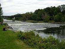
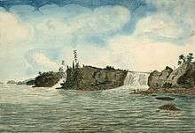
The Rideau River is an Eastern Ontario river which flows north from Upper Rideau Lake and empties into the Ottawa River at Rideau Falls in Ottawa, Ontario. Its length is 146 kilometres (91 mi). The river was given the French name "Rideau" (curtain) after the appearance of this waterfall.The Rideau River and The Rideau Canal are recommended Heritage Fair or Foir du Patrimoine Canadien projects ou projets.
The Rideau Canal, which allows travel from Ottawa to the city of Kingston, Ontario on Lake Ontario, was formed by joining the Rideau River with the Cataraqui River. The river diverges from the Canal at Hog's Back Falls in Ottawa.
In early spring, to reduce flooding on the lower section of the river, workers from the city of Ottawa use ice blasting to clear the ice which covers the river from Billings Bridge to Rideau Falls by cutting "keys" through the ice and using explosives to break off large sheets of ice. This practice has been going on for more than 100 years.[1]
The regulatory authority charged with protecting the Rideau River and its tributaries is the Rideau Valley Conservation Authority.
Tributaries
- Adrians Creek
- Duck Creek
- Tay River
- Black Creek
- Otter Creek
- Rosedale Creek
- Irish Creek
- Babers Creek
- Atkinsons Creek
- Rideau Creek
- Dales Creek
- Brassils Creek
- Murphy Drain
- Kemptville Creek
- McDermott Drain
- Cranberry Creek
- Steven Creek
- Mud Creek
- Jock River
- Black Rapids Creek
- Nepean Creek
- Sawmill Creek
Communities along the Rideau include:
See also
References
- ↑ Leblanc, Daniel (28 February 2011). "Why Ottawa needs to blow up the Rideau River every year". Globe and Mail. Retrieved 1 March 2011.
Further reading
- Legget, Robert Ferguson (1986). Rideau Waterway. University of Toronto Press. ISBN 0-8020-2573-0 – via Google Books.
External links
| Wikimedia Commons has media related to Rideau River. |
Coordinates: 45°08′09″N 75°38′10″W / 45.13580°N 75.636063°W
| Rivers |
|
|---|---|
| Nominated | |
| |