Linglestown, Pennsylvania
| Linglestown, Pennsylvania | |
|---|---|
| Census-designated place | |
|
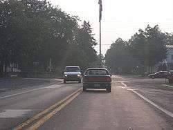
The flagpole at Linglestown square | |
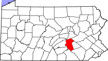
 Location in Dauphin County and state of Pennsylvania | |
| Coordinates: 40°20′13″N 76°47′27″W / 40.33694°N 76.79083°WCoordinates: 40°20′13″N 76°47′27″W / 40.33694°N 76.79083°W | |
| Country | United States |
| State | Pennsylvania |
| County | Dauphin |
| Township | Lower Paxton |
| Area | |
| • Total | 3.8 sq mi (9.9 km2) |
| • Land | 3.8 sq mi (9.9 km2) |
| • Water | 0.0 sq mi (0.0 km2) |
| Elevation | 540 ft (160 m) |
| Population (2010) | |
| • Total | 6,334 |
| • Density | 1,655/sq mi (639.1/km2) |
| Time zone | Eastern (EST) (UTC-5) |
| • Summer (DST) | EDT (UTC-4) |
| ZIP code | 17112 |
| FIPS code | 42-43672 |
| GNIS feature ID | 1179431 |
Linglestown is a census-designated place (CDP) in Lower Paxton Township, Dauphin County, Pennsylvania, United States. It was founded and laid out in 1765 by Thomas Lingle.
The population was 6,334 at the 2010 census.[1] It is part of the Harrisburg–Carlisle Metropolitan Statistical Area.
History
In 1765, Thomas Lingle purchased a parcel of land in what was then Paxton Township, so as to develop a 90-plot living, working, and studying community for newly-arriving European settlers. He called his new settlement "The Town of St. Thomas", after the Christian apostle, his namesake. The sheepskin document on which Lingle drew the plan for his village still exists, showing in great detail the village's name, each of the plots, their plot numbers, and all street and alley names. The county deed recorder's seal and record information are visible on the bottom left corner of the document.
In 1811, Lingle died and was buried in the Wenrich's Church cemetery (now St. Thomas United Church of Christ), at the east end of the village. Soon thereafter, village and area residentes began calling his village "Lingle's town", and the name soon took on its current form.
As a busy crossroads community located at the base of the mountain, the village soon became the area center for commerce, civic, religious, and educational activities, much of which still exists today.
St. Thomas UCC is the village's oldest denomination. The Church of God denomination had its world beginning and first structure and cemetery in Linglestown.[2]
Linglestown Square renovation
Since 1996, the village has been considering making improvements to the village square. At the center of the square is a flag pole located in the middle of the road. The initial plan was to move the flag pole and insert a traffic light. After long debate, that idea was shot down. It was replaced by the "Linglestown Plan", proposed on March 31, 2000. Nearly seven years later, on February 20, 2007, Lower Paxton Township approved a modified version of the Linglestown Action Plan, which involves the addition of roundabouts, other approaches to slowing down traffic through the square, and general community improvement.[3][4] On September 11, 2009, PennDOT awarded a construction bid for the project to E. Wintermyer Co. of Etters.[5]
While the road construction was intended not only to relieve traffic but also promote an aesthetic aspect in order to draw in business for Linglestown merchants, many of those merchants faced the brink of closing.[6][7][8] In June 2010, the project entered its final phase. The roadways in the roundabouts were opened to two-way traffic,[9] with the remainder of the road closed to two-way traffic until November 2010.[10]
Geography
Linglestown is located in northern Lower Paxton Township at 40°20′13″N 76°47′27″W / 40.33694°N 76.79083°W (40.336888, -76.790764).[11] It is bordered to the south by the community of Paxtonia, with the border between them formed by Interstate 81 and with access from Exit 72 (Mountain Road).
According to the United States Census Bureau, the CDP has a total area of 3.8 square miles (9.9 km2), all of it land (except a few streams and ponds).[1]
The highest elevation is 995 feet (303 m) on the south slope of Blue Mountain, along Blue Mountain Parkway north of the center of town. Pennsylvania Route 39 (Linglestown Road) passes east-to-west through the village, leading east 3.5 miles (5.6 km) to Exit 77 on Interstate 81 and west 5 miles (8 km) to Highway 22-322 at the north end of Harrisburg.
Demographics
As of the census[12] of 2000, there were 6,414 people, 2,508 households, and 1,908 families residing in the CDP. The population density was 1,713.1 people per square mile (662.2/km²). There were 2,587 housing units at an average density of 691.0/sq mi (267.1/km²). The racial makeup of the CDP was 95.28% White, 2.12% African American, 0.12% Native American, 1.64% Asian, 0.02% Pacific Islander, 0.12% from other races, and 0.70% from two or more races. Hispanic or Latino of any race were 1.04% of the population.
There were 2,508 households, out of which 32.6% had children under the age of 18 living with them, 63.6% were married couples living together, 9.3% had a female householder with no husband present, and 23.9% were non-families. 20.4% of all households were made up of individuals, and 7.4% had someone living alone who was 65 years of age or older. The average household size was 2.55 and the average family size was 2.95.
In the CDP the population was spread out, with 23.0% under the age of 18, 6.0% from 18 to 24, 30.0% from 25 to 44, 27.9% from 45 to 64, and 13.1% who were 65 years of age or older. The median age was 40 years. For every 100 females there were 94.1 males. For every 100 females age 18 and over, there were 90.7 males.
The median income for a household in the CDP was $52,650, and the median income for a family was $59,398. Males had a median income of $41,536 versus $30,064 for females. The per capita income for the CDP was $24,347. About 1.9% of families and 2.2% of the population were below the poverty line, including 0.6% of those under age 18 and 1.2% of those age 65 or over.
Schools
The Linglestown Elementary School mascot is the Lion. Their colors are navy blue and gold. The school was built in 1955, and had extras built on in 1995.
Linglestown Middle School was built in 1973 and presently has about 675 students. The mascot is a Ram and there colors are green and white. Recreational and educational activities include basketball, lacrosse, soccer, track and field, field hockey, and cheer leading. Also, there are many groups such as the Linglestown Middle School band and chorus, as well as other themed clubs such as the History Classic Film Club and the Outdoor Sports Club. Linglestown Middle used to be Linglestown Jr. High and until about 2005 the mascot was a Viking and the color was black and gold.
Notable residents
- Maynard Yingst, sprint car racer and drag racing national championship crew chief
Recreation
Koons Park
Koons Park is a popular park for kids to be during the summer. It features 3 basketball courts, 2 volleyball courts, 4 tennis courts, 3 softball fields, 3 baseball diamonds, a football field and 3 pavilions, a concession stand and a playground. In addition, Koons has restrooms and lots of paved parking area. It also has a pool which requires a membership to enter. It is a 33-acre (130,000 m2) park in the heart of Linglestown.
During the summer, Koons features a 4 July fireworks display. This usually takes place on a weekend around the holiday. This attracts well over 2,000 people to the park. Parking is difficult and traffic afterward is as locals call it "a mess."
Schools
At Linglestown Middle and Linglestown Elementary Schools, there is a track, two separate playgrounds, a football field and a lot of open grass field where lacrosse and soccer teams play.
See also
References
- 1 2 "Geographic Identifiers: 2010 Demographic Profile Data (G001): Linglestown CDP, Dauphin County, Pennsylvania". U.S. Census Bureau, American Factfinder. Retrieved December 22, 2015.
- ↑ Lower Paxton Township Bicentennial 1767-1967, 1967, Triangle Press Harrisburg, PA
- ↑ Fishlock, Diana (February 21, 2007). "Linglestown project approved". The Patriot-News. Retrieved March 11, 2007.
- ↑ "Village of Linglestown Action Plan" (PDF). Village of Linglestown Committee. March 31, 2000. Archived from the original (PDF) on February 15, 2006. Retrieved May 3, 2009.
- ↑ "Bid awarded for Linglestown square project". Linglestown Gazette. September 11, 2009. Retrieved September 18, 2009.
- ↑ http://www.abc27.com/story/12888383/merchants-road-construction-is-hurting-business
- ↑ http://www.abc27.com/story/13021496/2-way-traffic-to-resume-in-linglestown-sooner-than-expected
- ↑ http://www.pennlive.com/midstate/index.ssf/2010/06/linglestown_road_constructon_p.html
- ↑ Hessen, Beth Anne (June 20, 2011). "Roundabouts confuse drivers on Linglestown Road". The Patriot-News. Retrieved July 4, 2011.
- ↑ Brenckle, Lara (23 November 2010). "Two-way traffic restored along Linglestown Road in Lower Paxton Township". The Patriot-News. Retrieved 1 July 2013.
- ↑ "US Gazetteer files: 2010, 2000, and 1990". United States Census Bureau. 2011-02-12. Retrieved 2011-04-23.
- ↑ "American FactFinder". United States Census Bureau. Retrieved 2008-01-31.