Middletown, Dauphin County, Pennsylvania
| Middletown, Pennsylvania | |
|---|---|
| Borough | |
|
Union Street in Middletown | |
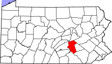
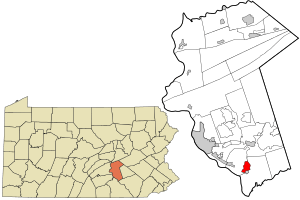 Location in Dauphin County and state of Pennsylvania. | |
| Coordinates: 40°11′55″N 76°43′46″W / 40.19861°N 76.72944°WCoordinates: 40°11′55″N 76°43′46″W / 40.19861°N 76.72944°W | |
| Country | United States |
| State | Pennsylvania |
| County | Dauphin |
| Settled | 1755 |
| Incorporated | 1828 |
| Government | |
| • Type | Borough Council |
| • Mayor | James Curry |
| Area | |
| • Total | 2.1 sq mi (5.4 km2) |
| • Land | 2.0 sq mi (5.3 km2) |
| • Water | 0.04 sq mi (0.1 km2) |
| Elevation | 360 ft (110 m) |
| Population (2010) | |
| • Total | 8,901 |
| • Density | 4,366/sq mi (1,685.7/km2) |
| Time zone | Eastern (EST) (UTC-5) |
| • Summer (DST) | EDT (UTC-4) |
| ZIP code | 17057 |
| Area code(s) | 717 Exchanges: 930,944,948 |
| Website |
www |
| Designated | April 17, 1952[1] |

Middletown is a borough in Dauphin County, Pennsylvania, United States, on the Susquehanna River, 10 miles (16 km) southeast of Harrisburg. As of the 2010 census it had a population of 8,901.[2] It is part of the Harrisburg–Carlisle Metropolitan Statistical Area.
History
Middletown was founded in 1755 along the left bank of the Susquehanna River and was incorporated as a borough in 1828 after a sudden boom in development and population occurred as a result of the construction of the Union Canal, connecting Lancaster to Middletown. Earlier in 1824 the Commonwealth of Pennsylvania's legislature authorized and funded the canal construction as part of the broad sweeping commercial initiative called the Main Line of Public Works; a forward looking project designing to connect Philadelphia to Pittsburgh by canals and river navigations which projects would continue to allow Philadelphia to challenge New York City (and its Erie Canal) for emerging mid-western markets beyond the Allegheny Mountains. Middletown was selected as the western terminus of the Union Canal, and it was named from its location halfway[3] between Lancaster and Carlisle, where an ascent exists to a low pass allowing easier (wagon era) travel[4] among the barrier mountains of the Ridge-and-valley Appalachians giving access into north-central Maryland and the valley of the Potomac River.[lower-alpha 1] It is the oldest incorporated community in Dauphin County and is located within a rich agricultural area forming the western edge of Pennsylvania Dutch Country.
The George Everhart (Frey) Trust, named for a citizen of Middletown from the 1800s, still manages leases on much of the land in and around Middletown. The trust was founded to operate the Frey Orphanage and did so for many years, in three locations in Middletown. The orphanage eventually closed, and the final location, on Red Hill, has become the Frey Village Retirement Community, a Diakon Lutheran senior living facility.[5]
Middletown is located 3 miles (5 km) north of the Three Mile Island Nuclear Power Plant. The Unit #2 reactor at the Three Mile Island Nuclear Power Plant suffered a partial meltdown in 1979, causing then-Governor Richard "Dick" Thornburgh to order the evacuation of pregnant women and pre-school children from the area. Within days, 140,000 people had left the area.[6][7] President Jimmy Carter visited Middletown's Community Building to calm the nerves of anxious residents.
Because the town is old, diverse historic architectural styles abound. Middletown has everything from log houses (some whose construction is obscured by modern siding) to Victorian mansions, and beyond. The Simon Cameron House and Bank, B'nai Jacob Synagogue, St. Peter's Kierch, Charles and Joseph Raymond Houses, Henry Smith Farm, and Swatara Ferry House are listed on the National Register of Historic Places.[8]
Geography
Middletown is located in southern Dauphin County at 40°11′55″N 76°43′46″W / 40.19861°N 76.72944°W (40.198491, -76.729326).[9] Its southern border is along the Susquehanna River, and its eastern border is formed by Swatara Creek, across which is the borough of Royalton. Pennsylvania Route 230 (Main Street) leads northwest 10 miles (16 km) to the center of Harrisburg and southeast 8 miles (13 km) to Elizabethtown. Via the PA 283 expressway it is 28 miles (45 km) southeast to Lancaster. The Pennsylvania Turnpike (Interstate 76) passes through the northern part of the borough, but the nearest access is 4 miles (6 km) west near Highspire.
According to the United States Census Bureau, the borough has a total area of 2.1 square miles (5.4 km2), of which 2.0 square miles (5.3 km2) is land and 0.04 square miles (0.1 km2), or 2.33%, is water.[2]
Demographics
| Historical population | |||
|---|---|---|---|
| Census | Pop. | %± | |
| 1820 | 567 | — | |
| 1830 | 302 | −46.7% | |
| 1850 | 900 | — | |
| 1860 | 2,392 | 165.8% | |
| 1870 | 2,980 | 24.6% | |
| 1880 | 3,351 | 12.4% | |
| 1890 | 5,080 | 51.6% | |
| 1900 | 5,608 | 10.4% | |
| 1910 | 5,374 | −4.2% | |
| 1920 | 5,920 | 10.2% | |
| 1930 | 6,085 | 2.8% | |
| 1940 | 7,046 | 15.8% | |
| 1950 | 9,184 | 30.3% | |
| 1960 | 11,182 | 21.8% | |
| 1970 | 9,080 | −18.8% | |
| 1980 | 10,122 | 11.5% | |
| 1990 | 9,254 | −8.6% | |
| 2000 | 9,242 | −0.1% | |
| 2010 | 8,901 | −3.7% | |
| Est. 2015 | 9,117 | [10] | 2.4% |
| Sources:[11][12][13][14] | |||
As of the census[13] of 2000, there were 9,242 people, 4,032 households, and 2,370 families residing in the borough. The population density was 4,536.5 people per square mile (1,749.2/km²). There were 4,387 housing units at an average density of 2,153.4 per square mile (830.3/km²). The racial makeup of the borough was 88.77% White, 7.34% African American, 0.27% Native American, 0.53% Asian, 0.04% Pacific Islander, 0.92% from other races, and 2.13% from two or more races. Hispanic or Latino of any race were 3.18% of the population.
There were 4,032 households, out of which 28.2% had children under the age of 18 living with them, 40.8% were married couples living together, 13.9% had a female householder with no husband present, and 41.2% were non-families. 35.2% of all households were made up of individuals, and 14.2% had someone living alone who was 65 years of age or older. The average household size was 2.23 and the average family size was 2.90.
In the borough the population was spread out, with 23.0% under the age of 18, 8.5% from 18 to 24, 30.1% from 25 to 44, 21.1% from 45 to 64, and 17.3% who were 65 years of age or older. The median age was 37 years. For every 100 females there were 84.9 males. For every 100 females age 18 and over, there were 80.5 males.
The median income for a household in the borough was $35,425, and the median income for a family was $43,661. Males had a median income of $32,891 versus $24,692 for females. The per capita income for the borough was $18,535. About 4.6% of families and 6.6% of the population were below the poverty line, including 6.6% of those under age 18 and 5.6% of those age 65 or over.
Education
Notes
- ↑ This important transportation corridor is still in use today for Interstate 81 through Chambersburg and Hagerstown, Maryland. Carlisle was also one of the jump-off points to climb the eastern ascents to the gaps of the Allegheny, which were the only ways animal powered transport technology could easily cross the Allegheny Front barrier ridge up onto and over the Appalachian Plateau to Western Pennsylvania and Ohio.
References
- ↑ "PHMC Historical Markers Search" (Searchable database). Pennsylvania Historical and Museum Commission. Commonwealth of Pennsylvania. Retrieved 2014-01-25.
- 1 2 "Geographic Identifiers: 2010 Demographic Profile Data (G001): Middletown borough, Pennsylvania". U.S. Census Bureau, American Factfinder. Retrieved December 16, 2015.
- ↑ Notes and Queries, Historical, Biographical and Genealogical, Relating Chiefly to Interior Pennsylvania. Harrisburg Publishing Company. 1895. p. 15.
- ↑ The interstate highway I-70 connects the Pennsylvania Turnpike to Washington, D.C. today using the same corridor, as historically did several Class one Railroads.
- ↑ List of Diakonsen Senior Communities in Pennsylvania, accessdate=2016-06-06
- ↑ People & Events: Dick Thornburgh
- ↑ "A Decade Later, TMI's Legacy Is Mistrust". The Washington Post, March 28, 1989, p. A01.
- ↑ National Park Service (2010-07-09). "National Register Information System". National Register of Historic Places. National Park Service.
- ↑ "US Gazetteer files: 2010, 2000, and 1990". United States Census Bureau. 2011-02-12. Retrieved 2011-04-23.
- ↑ "Annual Estimates of the Resident Population for Incorporated Places: April 1, 2010 to July 1, 2015". Retrieved July 2, 2016.
- ↑ "Number of Inhabitants: Pennsylvania" (PDF). 18th Census of the United States. U.S. Census Bureau. Retrieved 22 November 2013.
- ↑ "Pennsylvania: Population and Housing Unit Counts" (PDF). U.S. Census Bureau. Retrieved 22 November 2013.
- 1 2 "American FactFinder". United States Census Bureau. Retrieved 2008-01-31.
- ↑ "Incorporated Places and Minor Civil Divisions Datasets: Subcounty Population Estimates: April 1, 2010 to July 1, 2012". U.S. Census Bureau. Retrieved 25 November 2013.