Limbri, New South Wales
| Limbri New South Wales | |
|---|---|
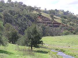 Swamp Oak Creek and the rail cutting at Limbri | |
|
Limbri | |
| Coordinates | 31°03′S 151°09′E / 31.050°S 151.150°ECoordinates: 31°03′S 151°09′E / 31.050°S 151.150°E |
| Population | 259 (2006 census)[1] |
| Postcode(s) | 2352 |
| Elevation | 477 m (1,565 ft) |
| Location | |
| LGA(s) | Tamworth Regional Council |
| County | Inglis |
| State electorate(s) | Tamworth, Northern Tablelands |
| Federal Division(s) | New England |
Limbri is a small village on Swamp Oak Creek, about 30 km east northeast of Tamworth and about 8 km east southeast of Moonbi in northern New South Wales, Australia.[2] The population of the Limbri region in 2006 was 259.[1]
Some alluvial gold was found at Limbri. It is now an agricultural based village, with sheep and cattle breeding the main pursuits.
Limbri public school opened in 1900 to serve the surrounding grazing properties and celebrated its centenary, but it is now closed.[3] The general store that was there has also now closed. The region has the services of Limbri Landcare Group and Limbri/Mulla Creek Rural Fire Service.
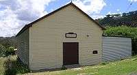
Limbri railway station
The station at Limbri on the Main North railway line to Armidale opened in 1885 as Farquarsons Siding. On 14 December 1893 it was renamed Limbri, but it has now been closed for a number of years.[4]
| Preceding station | NSW Main lines | Following station | ||
|---|---|---|---|---|
towards Wallangarra | Main North Line | towards Sydney |
References
- 1 2 Australian Bureau of Statistics (25 October 2007). "Limbri (State Suburb)". 2006 Census QuickStats. Retrieved 2008-07-26.
- ↑ "Limbri". Geographical Names Register (GNR) of NSW. Geographical Names Board of New South Wales. Retrieved 4 August 2013.
- ↑ Limbri Public School Retrieved on 11 November 2008
- ↑ Limbri Station Retrieved on 11 November 2008