Lake Wisconsin, Wisconsin
- For the lake, see Lake Wisconsin; for the prehistoric lake, see Glacial Lake Wisconsin.
| Lake Wisconsin, Wisconsin | |
|---|---|
| CDP | |
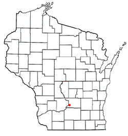 Location of Lake Wisconsin, Wisconsin | |
| Coordinates: 43°22′24″N 89°34′32″W / 43.37333°N 89.57556°WCoordinates: 43°22′24″N 89°34′32″W / 43.37333°N 89.57556°W | |
| Country | United States |
| State | Wisconsin |
| Counties | Columbia, Sauk |
| Area | |
| • Total | 21.456 sq mi (55.57 km2) |
| • Land | 12.134 sq mi (31.43 km2) |
| • Water | 9.322 sq mi (24.14 km2) |
| Elevation[1] | 807 ft (246 m) |
| Population (2010) | |
| • Total | 4,189 |
| • Density | 200/sq mi (75/km2) |
| Time zone | Central (CST) (UTC-6) |
| • Summer (DST) | CDT (UTC-5) |
| Area code(s) | 608 |
| FIPS code | 55-42012[2] |
| GNIS feature ID | 1867661[1] |
Lake Wisconsin is a census-designated place (CDP) in Columbia and Sauk counties, in the towns of Lodi and Merrimac, in the U.S. state of Wisconsin. The population was 4,189 at the 2010 census.[3]
The Columbia County portion of the Lake Wisconsin is part of the Madison Metropolitan Statistical Area, while the Sauk County portion is part of the Baraboo Micropolitan Statistical Area.
Geography
Lake Wisconsin is located at 43°22′24″N 89°34′32″W / 43.37333°N 89.57556°W (43.373461, -89.575676).[4]
According to the United States Census Bureau, the CDP has a total area of 21.5 square miles (55.6 km²), of which, 12.1 square miles (31.4 km²) of it is land and 9.3 square miles (24.1 km²) of it (43.45%) is water.
Demographics
As of the census[2] of 2000, there were 3,493 people, 1,419 households, and 1,082 families residing in the CDP. The population density was 275.8 people per square mile (106.4/km²). There were 2,116 housing units at an average density of 167.0/sq mi (64.5/km²). The racial makeup of the CDP was 98.57% White, 0.14% African American, 0.43% Native American, 0.26% Asian, 0.14% from other races, and 0.46% from two or more races. Hispanic or Latino of any race were 0.54% of the population.
There were 1,419 households out of which 30.3% had children under the age of 18 living with them, 70.1% were married couples living together, 3.7% had a female householder with no husband present, and 23.7% were non-families. 18.5% of all households were made up of individuals and 6.4% had someone living alone who was 65 years of age or older. The average household size was 2.46 and the average family size was 2.81.
In the CDP the population was spread out with 22.5% under the age of 18, 4.8% from 18 to 24, 30.1% from 25 to 44, 30.8% from 45 to 64, and 11.8% who were 65 years of age or older. The median age was 40 years. For every 100 females there were 108.7 males. For every 100 females age 18 and over, there were 107.5 males.
The median income for a household in the CDP was $58,906, and the median income for a family was $63,125. Males had a median income of $39,839 versus $28,229 for females. The per capita income for the CDP was $26,657. About 0.4% of families and 1.2% of the population were below the poverty line, including none of those under age 18 and 2.0% of those age 65 or over.
See also
References
- 1 2 "US Board on Geographic Names". United States Geological Survey. 2007-10-25. Retrieved 2008-01-31.
- 1 2 "American FactFinder". United States Census Bureau. Retrieved 2008-01-31.
- ↑ "American FactFinder". U.S. Census Bureau. Retrieved 12 April 2011.
- ↑ "US Gazetteer files: 2010, 2000, and 1990". United States Census Bureau. 2011-02-12. Retrieved 2011-04-23.
External links
Municipalities and communities of Columbia County, Wisconsin, United States | ||
|---|---|---|
| Cities | 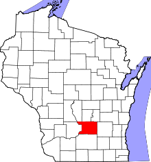 | |
| Villages | ||
| Towns | ||
| CDP | ||
| Unincorporated communities | ||
| Ghost town | ||
| Footnotes | ‡This populated place also has portions in an adjacent county or counties | |
Municipalities and communities of Sauk County, Wisconsin, United States | ||
|---|---|---|
| Cities | 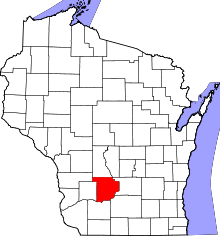 | |
| Villages | ||
| Towns | ||
| CDPs | ||
| Unincorporated communities | ||
| Indian reservation | ||
| Footnotes | ‡This populated place also has portions in an adjacent county or counties | |