Ironton, Wisconsin
| Ironton, Wisconsin | |
|---|---|
| Village | |
 Location of Ironton, Wisconsin | |
| Coordinates: 43°31′17″N 90°8′49″W / 43.52139°N 90.14694°WCoordinates: 43°31′17″N 90°8′49″W / 43.52139°N 90.14694°W | |
| Country | United States |
| State | Wisconsin |
| County | Sauk |
| Area[1] | |
| • Total | 0.33 sq mi (0.85 km2) |
| • Land | 0.33 sq mi (0.85 km2) |
| • Water | 0 sq mi (0 km2) |
| Elevation[2] | 1,079 ft (329 m) |
| Population (2010)[3] | |
| • Total | 253 |
| • Estimate (2012[4]) | 255 |
| • Density | 766.7/sq mi (296.0/km2) |
| Time zone | Central (CST) (UTC-6) |
| • Summer (DST) | CDT (UTC-5) |
| Area code(s) | 608 |
| FIPS code | 55-37250[5] |
| GNIS feature ID | 1583436[2] |
Ironton is a village in Sauk County, Wisconsin, United States, along the Little Baraboo River. The population was 253 at the 2010 census. The village is located within the Town of Ironton.
Geography
Ironton is located at 43°32′41″N 90°8′25″W / 43.54472°N 90.14028°W (43.544725, -90.140442).[6]
According to the United States Census Bureau, the village has a total area of 0.33 square miles (0.85 km2), all of it land.[1]
Demographics
| Historical population | |||
|---|---|---|---|
| Census | Pop. | %± | |
| 1880 | 232 | — | |
| 1890 | 237 | 2.2% | |
| 1920 | 199 | — | |
| 1930 | 184 | −7.5% | |
| 1940 | 213 | 15.8% | |
| 1950 | 176 | −17.4% | |
| 1960 | 167 | −5.1% | |
| 1970 | 195 | 16.8% | |
| 1980 | 206 | 5.6% | |
| 1990 | 200 | −2.9% | |
| 2000 | 250 | 25.0% | |
| 2010 | 253 | 1.2% | |
| Est. 2015 | 256 | [7] | 1.2% |
2010 census
As of the census[3] of 2010, there were 253 people, 92 households, and 69 families residing in the village. The population density was 766.7 inhabitants per square mile (296.0/km2). There were 104 housing units at an average density of 315.2 per square mile (121.7/km2). The racial makeup of the village was 95.7% White, 0.4% African American, and 4.0% from two or more races. Hispanic or Latino of any race were 1.6% of the population.
There were 92 households of which 40.2% had children under the age of 18 living with them, 51.1% were married couples living together, 12.0% had a female householder with no husband present, 12.0% had a male householder with no wife present, and 25.0% were non-families. 16.3% of all households were made up of individuals and 4.4% had someone living alone who was 65 years of age or older. The average household size was 2.75 and the average family size was 3.06.
The median age in the village was 30.4 years. 28.1% of residents were under the age of 18; 11.8% were between the ages of 18 and 24; 26.1% were from 25 to 44; 24.1% were from 45 to 64; and 9.9% were 65 years of age or older. The gender makeup of the village was 53.4% male and 46.6% female.
2000 census
As of the census[5] of 2000, there were 250 people, 89 households, and 66 families residing in the village. The population density was 743.6 people per square mile (283.9/km²). There were 99 housing units at an average density of 294.5 per square mile (112.4/km²). The racial makeup of the village was 97.60% White and 2.40% Black or African American. 1.60% of the population were Hispanic or Latino of any race.
There were 89 households out of which 40.4% had children under the age of 18 living with them, 59.6% were married couples living together, 6.7% had a female householder with no husband present, and 25.8% were non-families. 18.0% of all households were made up of individuals and 6.7% had someone living alone who was 65 years of age or older. The average household size was 2.81 and the average family size was 3.21.
In the village the population was spread out with 32.0% under the age of 18, 6.8% from 18 to 24, 33.2% from 25 to 44, 16.4% from 45 to 64, and 11.6% who were 65 years of age or older. The median age was 32 years. For every 100 females there were 103.3 males. For every 100 females age 18 and over, there were 109.9 males.
The median income for a household in the village was $38,438, and the median income for a family was $41,250. Males had a median income of $31,875 versus $22,292 for females. The per capita income for the village was $13,874. About 15.2% of families and 10.8% of the population were below the poverty line, including 11.4% of those under the age of eighteen and 31.8% of those sixty five or over.
Notable people
- Moses Ransom Doyon, mayor of Madison, Wisconsin, lived in Ironton.
- Thomas A. Livesley, mayor of Salem, Oregon, was born in Ironton.
References
- 1 2 "US Gazetteer files 2010". United States Census Bureau. Retrieved 2012-11-18.
- 1 2 "US Board on Geographic Names". United States Geological Survey. 2007-10-25. Retrieved 2008-01-31.
- 1 2 "American FactFinder". United States Census Bureau. Retrieved 2012-11-18.
- ↑ "Population Estimates". United States Census Bureau. Retrieved 2013-06-24.
- 1 2 "American FactFinder". United States Census Bureau. Retrieved 2008-01-31.
- ↑ "US Gazetteer files: 2010, 2000, and 1990". United States Census Bureau. 2011-02-12. Retrieved 2011-04-23.
- ↑ "Annual Estimates of the Resident Population for Incorporated Places: April 1, 2010 to July 1, 2015". Retrieved July 2, 2016.
- ↑ "Census of Population and Housing". Census.gov. Retrieved June 4, 2015.
Municipalities and communities of Sauk County, Wisconsin, United States | ||
|---|---|---|
| Cities | 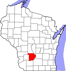 | |
| Villages | ||
| Towns | ||
| CDPs | ||
| Unincorporated communities | ||
| Indian reservation | ||
| Footnotes | ‡This populated place also has portions in an adjacent county or counties | |