Labastide-Chalosse
| Labastide-Chalosse | |
|---|---|
|
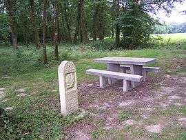
Boundary stone with St James shell in Labastide-Chalosse | |
 Labastide-Chalosse | |
|
Location within Nouvelle-Aquitaine region  Labastide-Chalosse | |
| Coordinates: 43°36′47″N 0°36′32″W / 43.6131°N 0.6089°WCoordinates: 43°36′47″N 0°36′32″W / 43.6131°N 0.6089°W | |
| Country | France |
| Region | Nouvelle-Aquitaine |
| Department | Landes |
| Arrondissement | Mont-de-Marsan |
| Canton | Hagetmau |
| Intercommunality | Hagetmau Communes Unies |
| Government | |
| • Mayor (2008–2014) | Michel Bernadet |
| Area1 | 4.56 km2 (1.76 sq mi) |
| Population (2006)2 | 122 |
| • Density | 27/km2 (69/sq mi) |
| Time zone | CET (UTC+1) |
| • Summer (DST) | CEST (UTC+2) |
| INSEE/Postal code | 40130 / 40700 |
| Elevation | 49–127 m (161–417 ft) |
|
1 French Land Register data, which excludes lakes, ponds, glaciers > 1 km² (0.386 sq mi or 247 acres) and river estuaries. 2 Population without double counting: residents of multiple communes (e.g., students and military personnel) only counted once. | |
Labastide-Chalosse is a commune in the Landes department in Nouvelle-Aquitaine in south-western France.
See also
| Wikimedia Commons has media related to Labastide-Chalosse. |
This article is issued from Wikipedia - version of the 11/9/2016. The text is available under the Creative Commons Attribution/Share Alike but additional terms may apply for the media files.