Saint-Sever
| Saint-Sever | ||
|---|---|---|
|
Abbey church | ||
| ||
 Saint-Sever | ||
|
Location within Nouvelle-Aquitaine region  Saint-Sever | ||
| Coordinates: 43°45′27″N 0°34′23″W / 43.7575°N 0.5731°WCoordinates: 43°45′27″N 0°34′23″W / 43.7575°N 0.5731°W | ||
| Country | France | |
| Region | Nouvelle-Aquitaine | |
| Department | Landes | |
| Arrondissement | Mont-de-Marsan | |
| Canton | Saint-Sever | |
| Intercommunality | Cap de Gascogne | |
| Government | ||
| • Mayor (2014–2020) | Arnaud Tauzin | |
| Area1 | 46.96 km2 (18.13 sq mi) | |
| Population (2013)2 | 4,732 | |
| • Density | 100/km2 (260/sq mi) | |
| Time zone | CET (UTC+1) | |
| • Summer (DST) | CEST (UTC+2) | |
| INSEE/Postal code | 40282 / 40500 | |
| Elevation | 26–118 m (85–387 ft) | |
|
1 French Land Register data, which excludes lakes, ponds, glaciers > 1 km² (0.386 sq mi or 247 acres) and river estuaries. 2 Population without double counting: residents of multiple communes (e.g., students and military personnel) only counted once. | ||


Saint-Sever is a commune in the Landes department in Nouvelle-Aquitaine in southwestern France.
History and geography

Saint-Sever stands on an eminence. It is located 17 km (11 mi) south of Mont-de-Marsan, on the left bank of the Adour in the Chalosse area.
Neighboring communes: Benquet, Bas-Mauco, Audignon, Cauna, Aurice, Montaut, Banos, Coudures, Eyres-Moncube, Montsoué, Montgaillard.
The town's abbey was founded by Guillaume Sanche lord of Gascony in the late 10th century. According to the monastic chronicles, this was as the result of a vow he made after the battle of Taller, in Gascony, in which he defeated the Vikings (982). In 1060, after a fire, the abbey was reconstructed on the model of Cluny under the direction of the abbot Gregori de Montaner. The Saint-Sever Beatus was the work of monks working under the direction of the same abbot; Abbot Gregori held the post from 1028 to 1072.
Sights
Its streets, bordered in places by old houses, are narrow and winding. The promenade of Morlanne laid out on the site of a Roman camp called Palestrion commands a fine view of the Adour and the pine forests of the Landes.
The church of Saint-Sever, a Romanesque building of the 12th century, with seven apses, once belonged to the Benedictine abbey founded in the 10th century. The abbey of Saint-Sever was added to the UNESCO World Heritage Sites in 1998, as part of the World Heritage Sites of the Routes of Santiago de Compostela in France.
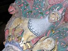
The convent and cloister of the Jacobins (13th century), a Dominican convent, built of pink bricks; now contains the Jacobins Museum (exhibits include rocks and illuminations from the Saint-Sever Beatus).
Population
| Historical population | ||
|---|---|---|
| Year | Pop. | ±% |
| 1793 | 5,000 | — |
| 1806 | 5,244 | +4.9% |
| 1821 | 5,400 | +3.0% |
| 1831 | 5,494 | +1.7% |
| 1841 | 5,238 | −4.7% |
| 1851 | 4,282 | −18.3% |
| 1861 | 4,818 | +12.5% |
| 1872 | 4,734 | −1.7% |
| 1881 | 4,864 | +2.7% |
| 1891 | 4,805 | −1.2% |
| 1901 | 4,769 | −0.7% |
| 1911 | 4,527 | −5.1% |
| 1921 | 3,967 | −12.4% |
| 1931 | 3,661 | −7.7% |
| 1946 | 3,727 | +1.8% |
| 1954 | 3,822 | +2.5% |
| 1962 | 3,983 | +4.2% |
| 1968 | 4,360 | +9.5% |
| 1975 | 4,716 | +8.2% |
| 1982 | 4,716 | +0.0% |
| 1990 | 4,536 | −3.8% |
| 1999 | 4,455 | −1.8% |
| 2008 | 4,852 | +8.9% |
| 2013 | 4,732 | −2.5% |
Sights

The public institutions of the town include the sub-prefecture, a tribunal of first instance, and a practical school of agriculture and viticulture which occupies a former Dominican convent.
See also
References
- INSEE statistics
-
 This article incorporates text from a publication now in the public domain: Chisholm, Hugh, ed. (1911). "article name needed". Encyclopædia Britannica (11th ed.). Cambridge University Press.
| Wikimedia Commons has media related to Saint-Sever. |