Dumes
| Dumes | |
|---|---|
 | |
 Dumes | |
|
Location within Nouvelle-Aquitaine region  Dumes | |
| Coordinates: 43°42′25″N 0°34′52″W / 43.7069°N 0.5811°WCoordinates: 43°42′25″N 0°34′52″W / 43.7069°N 0.5811°W | |
| Country | France |
| Region | Nouvelle-Aquitaine |
| Department | Landes |
| Arrondissement | Mont-de-Marsan |
| Canton | Saint-Sever |
| Intercommunality | Cap de Gascogne |
| Government | |
| • Mayor (2014–2020) | Jean-Marie Botti |
| Area1 | 2.48 km2 (0.96 sq mi) |
| Population (2013)2 | 268 |
| • Density | 110/km2 (280/sq mi) |
| Time zone | CET (UTC+1) |
| • Summer (DST) | CEST (UTC+2) |
| INSEE/Postal code | 40092 / 40500 |
| Elevation |
51–113 m (167–371 ft) (avg. 103 m or 338 ft) |
|
1 French Land Register data, which excludes lakes, ponds, glaciers > 1 km² (0.386 sq mi or 247 acres) and river estuaries. 2 Population without double counting: residents of multiple communes (e.g., students and military personnel) only counted once. | |
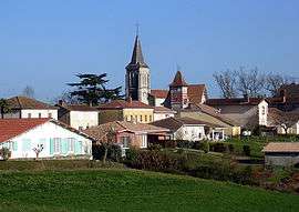
Dumes is a commune in the Landes department in Nouvelle-Aquitaine in southwestern France.
Population
| Historical population | ||
|---|---|---|
| Year | Pop. | ±% |
| 1793 | 248 | — |
| 1806 | 241 | −2.8% |
| 1821 | 255 | +5.8% |
| 1831 | 243 | −4.7% |
| 1841 | 250 | +2.9% |
| 1851 | 243 | −2.8% |
| 1861 | 221 | −9.1% |
| 1872 | 211 | −4.5% |
| 1881 | 203 | −3.8% |
| 1891 | 178 | −12.3% |
| 1901 | 170 | −4.5% |
| 1911 | 199 | +17.1% |
| 1921 | 160 | −19.6% |
| 1931 | 169 | +5.6% |
| 1946 | 149 | −11.8% |
| 1954 | 158 | +6.0% |
| 1962 | 150 | −5.1% |
| 1968 | 152 | +1.3% |
| 1975 | 136 | −10.5% |
| 1982 | 112 | −17.6% |
| 1990 | 113 | +0.9% |
| 1999 | 133 | +17.7% |
| 2008 | 265 | +99.2% |
| 2013 | 268 | +1.1% |
See also
References
| Wikimedia Commons has media related to Dumes. |
This article is issued from Wikipedia - version of the 11/9/2016. The text is available under the Creative Commons Attribution/Share Alike but additional terms may apply for the media files.