Kilspindie
For the historic fortification in East Lothian, see Kilspindie Castle. For the Scottish nobleman, see Archibald Douglas of Kilspindie.
Coordinates: 56°24′58″N 3°15′57″W / 56.416156°N 3.265865°W
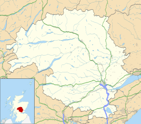
Kilspindie is a village in Perth and Kinross, Scotland.[1] It is situated on the Kilspindie burn, approximately 5 km Northwest of Errol, 10 km west of Dundee and 10 km east of Perth.[1]

Kilspindie village
In the Ordnance Gazetteer of Scotland (1882–84) Francis Groome described Kilspindie:
Kilspindie, a village and a parish in Gowrie district, SE Perthshire. The village, standing in the mouth of a small glen, 1 mile SSW of Rait, 2⅛ miles NNW of Errol station, and 3⅜ NNE of Glencarse station, had anciently a castle, now extinct, and figures in Blind Harry's narrative as the place where Sir William Wallace, with his mother, found refuge in his boyhood.[2]
References
- 1 2 Ordnance Survey: Landranger map sheet 53 Blairgowrie & Forest of Alyth (Map). Ordnance Survey. 2012. ISBN 9780319231210.
- ↑ "A Vision of Britain Through Time: Kilspindie". www.visionofbritain.co.uk. GB Historical GIS/University of Portsmouth. Retrieved 18 March 2016.
| Wikimedia Commons has media related to Kilspindie. |
This article is issued from Wikipedia - version of the 4/5/2016. The text is available under the Creative Commons Attribution/Share Alike but additional terms may apply for the media files.