Almondbank
Coordinates: 56°25′16″N 3°31′01″W / 56.421°N 3.517°W
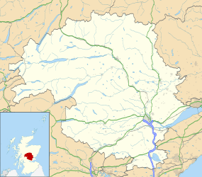
Almondbank is a large village in Perth and Kinross, Scotland.
RNAS Almondbank
The building of Royal Naval Aircraft Workshops commenced in 1940.[1] The station, a stone frigate, was employed as a RNAS Aircraft Repair Yard [2] and Stores Depot.[3] The workshops had their own small railway branch line which was linked to the now closed Almondbank railway station.
DARA/Vector Almondbank
The Defence Aviation Repair Agency (DARA) site at Almondbank was a major employer in the community for many years providing essential support to the British Armed Forces. The Decision by the UK government in early 2008 to take the site (and its counterpart at Fleetlands, Gosport) out of direct MOD control by doing a conditional sell-off to Canadian firm Vector Aerospace was a controversial one and there were concerns about the future of the site. In 2011 Vector was taken over by Eurocopter who now operate the Almondbank site.
School, church and community
The village of Almondbank is often seen as including the attached hamlets of Pitcairngreen and Lochty, and the wider area is sometimes called Almondvalley. There is one school serving the area, Pitcairn Primary, which opened in 1939 and replaced older schools. The school is located in the northernmost housing development of the village, sometimes referred to as Bridgeton, even although there is no signage in recognition of this and the area remains part of Almondbank itself (as opposed to Pitcairngreen and Lochty). Next to the school lies the only shop in the village and directly opposite this is the church, which is known as Almondbank/Tibbermore (St Serf's). Another area of the village is known as College Mill, which borders the River Almond, the river that gives the village its name and a housing development constructed in the 1990s at the southern end of the village was known for many years as "Bett Homes", named after the site developers. This area encompasses Admiralty Wood and MacKenzie Drive, the majority of houses in the latter being 'affordable homes'. Around the same time these houses were being built, a much smaller development in the Lochty area was built by local construction firm, GS Brown.
Business and identity issues
In addition to the shop mentioned in the above section, Almondbank also has a post office, fish farm, small industrial estate, a pub, accommodation and a garage. As well as issues relating to what exactly defines Almondbank geographically, there is also concern that the whole area, including farther away settlements Ruthvenfield and Huntingtower may become part of Perth, as ideas for the expansion of the city are being debated and that the entire area may lose its rural identity as surrounding fields may be swallowed up for the houses that would join present-day Almondbank onto Perth, making it a suburb of a small city. Developers argue that the west is the only direction for expansion of Perth, but local residents have argued otherwise. This situation is similar to that of Scone, which so far, has also managed to retain its independent identity against threats to develop the small rural stretch which separates it from Perth. Most people in Almondbank and Scone are determined to stay separated from the growing city.
Almondbank is close to another Perthshire village, Methven.
References
| Wikimedia Commons has media related to Almondbank. |


