Jogbani
| Jogbani जोगबनी | |
|---|---|
| Town | |
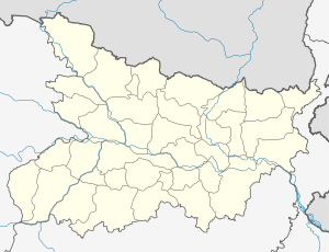 Jogbani Location in Bihar, India | |
| Coordinates: 26°23′46″N 87°15′35″E / 26.39611°N 87.25972°E | |
| Country |
|
| State | Bihar |
| District | Araria |
| Government | |
| • Body | Nagar Palika |
| Elevation | 67 m (220 ft) |
| Population (2011) | |
| • Total | 39,281 |
| Languages | |
| • Main | Maithili, Nepali & Hindi |
| Time zone | IST (UTC+5:30) |
| PIN | 854328 |
| Telephone code | 06455 |
| Lok Sabha constituency | Araria |
| Vidhan Sabha constituency | Forbesganj |
Jogbani is a town, a notified area and a railway station in Araria District of Bihar state, India. It lies on the Indo-Nepal border with Morang District, Koshi Zone and is a gateway to Biratnagar city. There is a customs checkpoint for goods at the border. Indian and Nepalese nationals cross without restrictions.
Transport
Jogbani is served by two railway lines: one Broad Gauge line branches from Katihar railway junction via Purnia in the south and the other line from Saharsa from the west via Forbesganj (see Barauni-Katihar section). Seemanchal Express train connects Jogbani to Anand Vihar (Delhi) and the Kolkata-Jogbani Express train connects it to Kolkata.
Jogbani is connected to the rest of India by an all-weather metalled highway, National Highway 57A, which links Jogbani to Forbesganj, located 15 km (9.3 mi) away.
Jogbani ICP Project
- The total project cost for Jogbani ICP is Rs. 82.49 crore.
- DPR and DER has been completed and approved by ESC.
- Land has been acquired and handed over to SSB.
- NIT has been issued on 12.03.2010 and the bids were opened on 19.04.2010. The work has been awarded to successful bidder.
List of Bank in Jogbani
- State Bank of India
- Central Bank of India
- UCO Bank of India
- Punjab National Bank
- Uttar Gramin Bank
- Here is no branch of HDFC, ICICI, Axis, CITIBANK.
List of Bank's ATM
- SBI ATM
- Punjab National Bank ATMbank
- central bank atm in bank
List of Schools in Jogbani
- Mala Memorial English School
- Adarsh Shiksha Niketan
- DNP School
- Sarswati Vidhya Mandir
- High School Jogbani
- Rajkiya Madhya Vidhyalaya Jogbani
- Balika High School
- Saint Francisco English Boarding School
- Zenith Public School
See also
References
Coordinates: 26°23′46″N 87°15′35″E / 26.3961°N 87.2597°E