Araria
| Araria अररिया | |
|---|---|
| Town | |
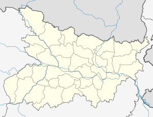 Araria Location in Bihar, India | |
| Coordinates: 26°09′N 87°31′E / 26.15°N 87.52°ECoordinates: 26°09′N 87°31′E / 26.15°N 87.52°E | |
| Country |
|
| State | Bihar |
| District | Araria |
| Elevation | 47 m (154 ft) |
| Population (2001) | |
| • Total | 60,594 |
| Languages | |
| • Official | Hindi, Urdu |
| Time zone | IST (UTC+5:30) |
| PIN | 854311, 8543XX |
| Lok Sabha constituency | Araria |
| Vidhan Sabha constituency | Araria |
| Website | http://www.araria.bih.nic.in/ |
Araria is a city and a municipality that is the headquarters of Araria district in the state of Bihar, India.
Araria is situated at the northern part of Purnia and Medhepura in Bihar. Borders of Araria are surrounded by Nepal in northern side, Kishanganj in eastern side and Supaul at western side. The district came into existence by division of Purnia district on Makar-Sankranti day of 1990. District border is adjacent to border of Nepal, so the district is important in terms of security. Jogbani is the last point of Araria and after that Morang district of Nepal starts. For transportation both train and road media's are available. Araria contains two bus terminals one at '0' mile and second in city. Buses for most of the districts are available and as well as for internal blocks too. Train facility is now in the form of broad gauge track. This track ends one side to the Katihar Junction from where trains to all over India are available, other end of track is Jogbani the last point of Indian rail.Seemanchal Express which connects Jogbani to AnandVihar New Delhi is the only train connecting Araria to New Delhi.
District statistics
Araria is primarily a rural district; 93% of the total population live in the rural areas (713 villages). Only two out of nine tehsils have urban population that is concentrated in Forbesganj and Araria(Census 2001).
In 2008 survey findings, Araria lagged behind the all India average in seven out of eight indicators and also lagged behind the all India level in terms of two more health related indicators. Most of the villages lack some basic infrastructure: 92 percent are without any medical facilities; 20 percent of the villages lack formal facilities of education of any type; 597 out of 713 villages are without electricity; and 50 percent of the villages are without all-weather road connectivity. The overall work participation rate is 40.3 percent, which is much less in case of the female population. Agriculture laborers dominate the labor force (64.7% of the total) that is almost double of the national average.
There is a substantial concentration of minority (mainly Muslims) population. Against the state average of 20.52%, Muslims constitutes 49.4 per cent of the total rural populations, but their percentages are 77.5% in Jokihat, 62.70% of Araria, and 46.8% in Palasi subdivisions. The number of minority groups - Christian, Sikh, Buddhist and Jains - are negligible. The rural literacy rate is 33.2 percent, much below the state and national averages. The worst is female literacy rate, i.e. 20.4%. In other words, only one out of five women is literate. Even sex ratio, i.e., 917 is less than state and all India level.
Geography
Araria is located at 26°09′N 87°31′E / 26.15°N 87.52°E.[1] It has an average elevation of 47 metres (154 feet). Araria is situated at the northern part of Purnia and Madhepura in Bihar. Borders of Araria are surrounded by Nepal in northern side, Kishanganj in eastern side and Supaul at south-west side. The district came into existence by division of Purnia district on Makar Sankranti day of 1990. The district touches the Indo-Nepal international border also this area is very close to three countries: Nepal, Bangladesh, and Bhutan. Hence, the district is important in terms of security. Jogbani is the last point of Araria and after that, Morang district of Nepal starts. Kosi river used to pass through araria,although it long ago changed its path. Most important river is Panaar. Agriculture has flourished along the banks of this river,although it becomes catastrophic during the rainy season because of floods. A canal also passes through Araria. Being a part of the remote
Description
Araria is connected by bus and rail services. Seemanchal superfast express runs daily between Araria to New Delhi and Kolkata-Jogbani express runs between Araria to Kolkata. There has been development in the condition of roadways although certain important roads are still in bad condition. NH 57 runs through the district. It is a four−laned highway, which is also a part of the East−west corridor highway. Health and medical facilities are sparse in this area; residents are forced to go to nearby Purnea district for treatment. Primary schooling in Araria is below average. There are numerous schools, but most of them are much below the normal standard due to sheer lack of good and educated teachers,non availability of sports facilities, and other tools of personality development. It also has a town hall situated at the heart of the city, where cultural and political programs are held. The Netaji Subhash stadium is situated in the heart of the city. Many district and state level cricket tournaments are played in it. It is also used for public gatherings like the speech of a politician, etc.
It has a large subzi mandi (vegetable market) where fresh vegetables can be bought. The local market of the city is known as Vikas Market or V market due to its V shape.
There are three movie theaters, a distant railway Station, farms, governmental offices, library, many Internet cafes, newly constructed shopping mall near hospital road, sweet shops, street hawkers . The place provides nice views, like that of open grounds, playing grounds, on-water bridges, riverside, long farm-strips, but also of sparse streets, dense housing, and slum settlements.
The District Court is situated near the main market area. The court handles numerous cases everyday. A huge crowd can be seen near the Court campus during working hours.
As the city lacks good government schools, some private schools provide the required education to the students. Those include Jawahar Navodaya Vidyalaya ,Araria Public School, Career Guide Academy, Girls' Ideal Academy, As-sabeel Academy, Oxford Academy, Rabia Girls' Academy," Eastern Public School and a few others.
Notable Persons
The Hindi language writer Phanishwar Nath 'Renu' was born in this district at Aurahi Hingna village where his family still lives. At present a magazine Parti Palar is published there.
The movie Teesri Kasam was shot in villages of Araria. It was Basu Bhattacharya's film, based on Mare Gaye Gulfam written by Phanishwar Nath 'Renu', starring Raj Kapoor and Waheeda Rehman.
Demographics
Total population of Araria is 2,806,200 as per latest provisional figures released by Directorate of Census Operations in Bihar. This shows increase of 30.00 percent in 2011 compared to figures of 2001 census. The initial figures of data shows that male and female were 1,460,878 and 1,345,322 respectively. Araria District of Bihar comprises an area of 2,830 km2. As per census 2011, density of Araria District per square km is 992 compared to 763 per km2 of 2001.
Sex ratio of girls in Araria district per 1000 boys was recorded 921 i.e. an increase of 8 points from the figure of 2001 census which puts it at 913.
In 2011 census, data of Araria district regarding child under 0-6 age were also collected. There were total 564,131 children under age of 0-6 against 474,181 of 2001 census. Of total 564,131 male and female were 288,728 and 275,403 respectively. Child Sex Ratio as per census 2011 was 954 compared to 963 of census 2001. Children's proportion in total population was around 2.70 percent. This figure was around 2.60 percent as per 2001 census.
In education sector, Araria District is having average literacy rate of 55.10 percent. Male literacy and female literacy were 64.15 and 45.18 percent respectively. In all, there were total 1,235,303 literates compared to 589,679 literates of 2001 census.
Historical Background
The territory of the present-day district became Araria sub-division of the erstwhile Purnia district in 1964.In ancient times Araria was ruled by three important clans of Indian history.
The important tribe of Kiratas governed the northern side, while the eastern side was under the Pundras and area west of the river Kosi,at that time flowing somewhere near the present Araria, by Angas. During the Mauryan period this area formed the part of the Maurya Empire and according to Asokavadana the Emperor Asoka put to death many naked heretics of this area who had done despite to the Budhist religion.
In the 6th century A.D. the area south of the Himalayan pilgrim center of Varaha Kshetra, namely the Gupta kings Budhgupta and Devagupta gave Koti-varsha for the maintenance of the said pilgrim centre.
In the first war of independence of 1857 Araria also witnessed a few skirmishes between the mutineers and the commissioner Yule’s forces, which took place near Nathpur.In view of the 1857 episode and other developments regarding the law & order, in the year 1864 Araria was constituted as Sub-Division by merging the small divisions of Araria, Matiari, Dimia, parts of Haveli and Bahadurganj to provide better administration and ultimately it became a district in 1990.
Heritage and Tourism
Araria is the natural habitat of the Gangetic Dolphins.At the Local rivers of Araria Gangetic Dolphins(South Asian river dolphin) are found. Scientific name of the dolphin is Platanista Gangetica. Average length of dolphins are 2.5 meter.
- Replica Stoop: It is situated Near Manikpur 5 km far from Araria district headquarter going towards Forbesganj.
- The six-story Kali Mandir temple, popularly known as "Kali Mandir".
- Temple of lord Shiva located at the center of city in the ancient Thakurbari of Araria, known as Shiva Mandir or more commonly as Thakurbari itself.
- The Araria-Madanpur Shiva Mandir.
- Shiva temple in Madanpur.
- Sultan phokher in Forbesganj is important for Hindu and Muslim communities.
- Maata aasawar mandir in Gidwas is very important for Hindu.
- Shiva mandir in Sundernath.
- A mosque (Jama Masjid), attended by Muslim communities from the nearby region,
- Quba Masjid, is situated near navratan chowk. It is one of the famous mosque of this city.
- The burial ground (kabristan) is situated in the middle of the city in khalilabad muhalla. Khalilabad mosque is also situated at the same place.
- Newly constructed Masjid cum madarsa at diyaganj.
- Vishwa Islamic Ijtema was held at araria in 2013 in which 10-15 lakhs were gathered for spiritual and Islamic gains.
Transport Infrastructure
Railway
Araria is accessible to other parts of India by railways via Katihar Junction railway station
Nearest Railway Station is Araria court & Araria(R S)
Road
Connected with National Highway 57 (India)(Old Numbering)
Buses for most of the districts and internal blocks are available from the bus terminal.
Airport
Nearest airport is Bagdogra Airport
Education
Azad Academy is a school in Araria.[2]
Languages
Being a mixed culture of Bihari and Bengali while having more than 50% Muslims, languages in Araria are diverse. Hindi, being the official and formal language is spoken by everyone on purposed unrelated to local streets or houses. Urdu is second official language this is spoken by all communities including Hindus. Kulhaiya boli, Shekhra boli & Thethi are recognized as the local languages. Maithili and Bhojpuri are also spoken in residents' homes, while Bengali, Surjapuri are also spoken.
See also
Notes
- ↑ Falling Rain Genomics, Inc - Araria
- ↑ "Araria" (PDF). Government of Bihar. p. 5. Retrieved 1 December 2016.