Izvir, Brežice
| Izvir | |
|---|---|
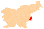
 Izvir Location in Slovenia | |
| Coordinates: 45°51′34.08″N 15°33′6.69″E / 45.8594667°N 15.5518583°ECoordinates: 45°51′34.08″N 15°33′6.69″E / 45.8594667°N 15.5518583°E | |
| Country |
|
| Traditional region | Lower Carniola |
| Statistical region | Lower Sava |
| Municipality | Brežice |
| Area | |
| • Total | 1.83 km2 (0.71 sq mi) |
| Elevation | 289.6 m (950.1 ft) |
| Population (2002) | |
| • Total | 18 |
| [1] | |
Izvir (pronounced [iˈzʋiːɾ]) is a small settlement in the Municipality of Brežice in eastern Slovenia. It lies in the Gorjanci Hills close to the border with Croatia. The area was traditionally part of Lower Carniola. It is now included in the Lower Sava Statistical Region.[2]
Izvir means 'spring' or 'source of water' in Slovene. Chance finds of Roman clay piping and archaeological excavations in the 1930s revealed a now reconstructed water cistern at the source of a stream and a Roman aqueduct supplying water to the nearby settlement of Neviodunum.[3]
References
External links
%2C_Bre%C5%BEice.jpg)
This article is issued from Wikipedia - version of the 12/22/2015. The text is available under the Creative Commons Attribution/Share Alike but additional terms may apply for the media files.