Stojanski Vrh
| Stojanski Vrh | |
|---|---|
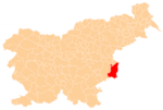
 Stojanski Vrh Location in Slovenia | |
| Coordinates: 45°51′43.34″N 15°32′20.75″E / 45.8620389°N 15.5390972°ECoordinates: 45°51′43.34″N 15°32′20.75″E / 45.8620389°N 15.5390972°E | |
| Country |
|
| Traditional region | Lower Carniola |
| Statistical region | Lower Sava |
| Municipality | Brežice |
| Area | |
| • Total | 2.26 km2 (0.87 sq mi) |
| Elevation | 230.3 m (755.6 ft) |
| Population (2002) | |
| • Total | 51 |
| [1] | |
Stojanski Vrh (pronounced [stɔˈjaːnski ˈʋəɾx]; German: Stojanski Werch[2]) is a village in the Municipality of Brežice, eastern Slovenia, close to the border with Croatia. The area was traditionally part of Lower Carniola. It is now included with the rest of the municipality in the Lower Sava Statistical Region.[3]
References
- ↑ Statistical Office of the Republic of Slovenia
- ↑ Leksikon občin kraljestev in dežel zastopanih v državnem zboru, vol. 6: Kranjsko. 1906. Vienna: C. Kr. Dvorna in Državna Tiskarna, p. 72.
- ↑ Brežice municipal site
External links
%2C_Bre%C5%BEice.jpg)
This article is issued from Wikipedia - version of the 12/22/2015. The text is available under the Creative Commons Attribution/Share Alike but additional terms may apply for the media files.