Cundrovec
| Cundrovec | |
|---|---|
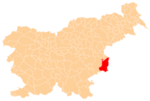
 Cundrovec Location in Slovenia | |
| Coordinates: 45°55′27.88″N 15°36′27.07″E / 45.9244111°N 15.6075194°ECoordinates: 45°55′27.88″N 15°36′27.07″E / 45.9244111°N 15.6075194°E | |
| Country |
|
| Traditional region | Styria |
| Statistical region | Lower Sava |
| Municipality | Brežice |
| Area | |
| • Total | 1.9 km2 (0.7 sq mi) |
| Elevation | 152.1 m (499.0 ft) |
| Population (2002) | |
| • Total | 124 |
| [1] | |
Cundrovec (pronounced [ˈtsuːndɾɔʋəts]) is a settlement north of Brežice in eastern Slovenia. The area was traditionally part of Styria. It is now included in the Lower Sava Statistical Region.[2]
Aerial surveys have shown a large rectangular walled enclosure that indicates the presence of a Roman military camp in the area.[3]
References
External links
%2C_Bre%C5%BEice.jpg)
This article is issued from Wikipedia - version of the 12/22/2015. The text is available under the Creative Commons Attribution/Share Alike but additional terms may apply for the media files.