Cirnik, Brežice
| Cirnik | |
|---|---|
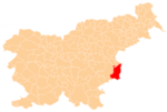
 Cirnik Location in Slovenia | |
| Coordinates: 45°51′52.03″N 15°38′44.27″E / 45.8644528°N 15.6456306°ECoordinates: 45°51′52.03″N 15°38′44.27″E / 45.8644528°N 15.6456306°E | |
| Country |
|
| Traditional region | Lower Carniola |
| Statistical region | Lower Sava |
| Municipality | Brežice |
| Area | |
| • Total | 3.87 km2 (1.49 sq mi) |
| Elevation | 353.5 m (1,159.8 ft) |
| Population (2002) | |
| • Total | 98 |
| [1] | |
Cirnik (pronounced [ˈtsiːɾnik], in older sources also Veliki Cirnik,[2] German: Großzirnik[2]) is a settlement in the hills above the right bank of the Sava River in the Municipality of Brežice in eastern Slovenia. The area was traditionally part of Lower Carniola. It is now included in the Lower Sava Statistical Region.[3]
The local church is dedicated to the Holy Cross and belongs to the Parish of Velika Dolina. It dates to 1645.[4]
References
- ↑ Statistical Office of the Republic of Slovenia
- 1 2 Leksikon občin kraljestev in dežel zastopanih v državnem zboru, vol. 6: Kranjsko. 1906. Vienna: C. Kr. Dvorna in Državna Tiskarna, p. 68.
- ↑ Brežice municipal site
- ↑ Slovenian Ministry of Culture register of national heritage reference number 2636
External links
%2C_Bre%C5%BEice.jpg)
This article is issued from Wikipedia - version of the 9/8/2014. The text is available under the Creative Commons Attribution/Share Alike but additional terms may apply for the media files.