Irondequoit, New York
| Irondequoit | |
| Town | |
| Country | United States |
|---|---|
| State | New York |
| County | Monroe |
| Elevation | 368 ft (112.2 m) |
| Coordinates | 43°12′40″N 77°34′55″W / 43.21111°N 77.58194°WCoordinates: 43°12′40″N 77°34′55″W / 43.21111°N 77.58194°W |
| Area | 16.8 sq mi (43.5 km2) |
| - land | 15.2 sq mi (39 km2) |
| - water | 1.6 sq mi (4 km2), 9.52% |
| Population | 459 (2010) |
| Density | 3,445/sq mi (1,330.121936179/km2) |
| Founded | 1839 |
| Town Supervisor | Josh Dun(D)
|
| Timezone | EST (UTC-5) |
| - summer (DST) | EDT (UTC-4) |
| ZIP code | 14609, 14617, 14621, 14622 |
| Area code | 585 |
 Location in Monroe County and the state of New York.
| |
 Location of New York in the United States
| |
| Website: http://www.irondequoit.org/ | |
Irondequoit /ᵻˈrɒndəkɔɪt/ is a town (and census-designated place) in Monroe County, New York, United States. As of the 2010 census, the coterminous town-CDP had a total population of 51,692. Irondequoit is a major suburb of the city of Rochester, lying just north and east of the city limits. The name is of Native American origin.[1]
History
In 1687 Marquis de Denonville led an army of French soldiers and Huron warriors on a punitive expedition against the Iroquois through Irondequoit Bay, beginning the long enmity between the Iroquois and the French.
After the American Revolution, this area was part of the Phelps and Gorham Purchase. The Town of Irondequoit was founded in 1839 when it separated from the Town of Brighton.
During the last part of the 19th century the north edge of the town was developed as a tourist and vacation area for the City of Rochester residents, and was once known as the "Coney Island of Western New York."
Geography
According to the United States Census Bureau, the town has a total area of 16.8 sq mi (44 km2), of which, 15.2 sq mi (39 km2) of it is land and 1.6 sq mi (4.1 km2) of it (9.69%) is water.
The town lies between the Genesee River on the west and Irondequoit Bay on the east. The north border of the town is defined by the shoreline of Lake Ontario. Because it is bounded by water on three sides, it is considered a geographical headland. Irondequoit is bordered by the city of Rochester to the west and south, the town of Brighton southeast, and the towns of Webster and Penfield to the east.
An unusual boundary exists between the Town of Irondequoit and the adjacent City of Rochester. On the western border of Irondequoit, the city claims a thin strip that extends northward along the banks of the river from Seneca Park to Lake Ontario, at some points less than 50 yards (46 m) from the shore. The result is that the City of Rochester claims the entire eastern shore of the Genesee, and the border of the Town of Irondequoit never reaches the river.
Similarly, the northern half of Durand-Eastman Park (including Durand Beach), lies within the city's borders, along with a narrow strip running along Culver Road for approximately 5 miles (8.0 km) southward to Norton Street. This leads to much confusion, even among long-term residents, about whether places such as Seneca Park or Durand Park lie within the Town of Irondequoit or the City of Rochester. In fact, Seneca Park was annexed by the City of Rochester in 1891, and Durand Eastman Park was given to the city in 1908.
Demographics
| Historical population | |||
|---|---|---|---|
| Census | Pop. | %± | |
| 1840 | 1,252 | — | |
| 1850 | 2,397 | 91.5% | |
| 1860 | 3,547 | 48.0% | |
| 1870 | 3,990 | 12.5% | |
| 1880 | 1,986 | −50.2% | |
| 1890 | 2,415 | 21.6% | |
| 1900 | 2,863 | 18.6% | |
| 1910 | 3,526 | 23.2% | |
| 1920 | 5,123 | 45.3% | |
| 1930 | 18,024 | 251.8% | |
| 1940 | 23,376 | 29.7% | |
| 1950 | 34,417 | 47.2% | |
| 1960 | 55,337 | 60.8% | |
| 1970 | 64,897 | 17.3% | |
| 1980 | 57,648 | −11.2% | |
| 1990 | 52,377 | −9.1% | |
| 2000 | 52,354 | 0.0% | |
| 2010 | 51,692 | −1.3% | |
| Est. 2014 | 51,462 | [2] | −0.4% |
As of the census[4] of 2000, there were 52,354 people, 22,247 households, and 14,327 families residing in the coterminus town-CDP. The population density was 3,447.4 per square mile (1,330.7/km²). There were 23,037 housing units at an average density of 1,516.9 per square mile (585.6/km²). The racial makeup of the town was 93.03% White, 3.55% Black or African American, 0.15% Native American, 0.98% Asian, 0.02% Pacific Islander, 1.02% from other races, and 1.25% from two or more races. Hispanic or Latino of any race were 3.06% of the population.
There were 22,247 households out of which 26.7% had children under the age of 18 living with them, 50.7% were married couples living together, 10.4% had a female householder with no husband present, and 35.6% were non-families. 30.8% of all households were made up of individuals and 16.7% had someone living alone who was 65 years of age or older. The average household size was 2.32 and the average family size was 2.91.
In the town the population was spread out with 21.9% under the age of 18, 5.2% from 18 to 24, 26.6% from 25 to 44, 23.7% from 45 to 64, and 22.5% who were 65 years of age or older. The median age was 43 years. For every 100 females there were 85.4 males. For every 100 females age 18 and over, there were 81.1 males.
The median income for a household in the town was $45,276, and the median income for a family was $55,493. Males had a median income of $41,463 versus $30,937 for females. The per capita income for the town was $23,638. About 3.8% of families and 5.4% of the population were below the poverty line, including 6.6% of those under age 18 and 6.8% of those age 65 or over.
In 1965, Irondequoit became part of civil rights history by being part of the first totally voluntary desegregation program in U.S. history. The Urban Suburban Interdistrict Transfer Program, which still operates today, was begun with 25 first graders from the inner city of Rochester who embarked on their K-12 education in the West Irondequoit school district. Ultimately,15 of the original 25 students graduated together in 1977 as part of the first graduating class ever to go through a full 12 years of voluntary desegregation. The achievement was acknowledged in a letter from The White House and a notation in the U.S. Congressional Record. The program has continued to expand and now includes additional suburban districts that are part of the Rochester metropolitan area.
Government

The town is governed by a town board consisting of a supervisor and four board members, all elected by registered town voters.
| Name | Tenure | Name | Tenure | |
|---|---|---|---|---|
| William Shepherd | 1839 – 1840 1842 | Joseph Aman | September 24, 1900 – 1905 | |
| William Blossom | 1841 | Chauncey W. Porter | 1906 – 1909 1920 – 1925 | |
| Jonah Brown | 1843 – 1844 | Louis Dubelbeiss | 1910 – 1919 | |
| John McGonegal | 1845 – 1846 | William S. Titus | 1926 – 1927 | |
| James Mandeville | 1847 | Thomas E. Broderick | 1928 – October 1, 1949 | |
| James Swayne | 1848 – 1849 1856 – 1857 | Frederick Hussey | October 2, 1949 – December 31, 1949 1958 – 1959 | |
| Benjamin Wing | 1850 | Walter G. Lauterbach | 1950 – 1957 | |
| Samuel W. Bradstreet | 1851 – 1852 | Harold L. Knauf | 1960 – May 23, 1967 1968 – 1969 | |
| John Smyles | 1853 1858 – 1859 | Julian Underhill | May 24, 1967 – December 31, 1967 1970 | |
| James Sherry | 1854 – 1855 1863 | Donald A. Deming | 1972 – 1979 | |
| George McGonegal | 1860 – 1861 | Stephen R. Johnson | 1980 – 1983 | |
| Jedediah White | 1862 | Eugene C. Mazzola, Jr. | 1984 – 1989 | |
| Albert C. Hobbie | 1864 – 1866 | Frederick W. Lapple | 1990 – 1993 | |
| Suzanne Masters 1994-1995 William S. Dillon 1996-1997 | ||||
| Richard D. Cole | 1867 – 1870 | David W. Schantz | 1998–2005 | |
| Samuel Dubelbeiss | 1871 – 1872 | Mary Ellen Heyman | 2006 – 2009 | |
| Henry Walzer | 1873 – 1876 | Mary Joyce D'Aurizio | 2010 – 2014 | |
| Alexander H. Wilson | 1877 | Adam Bello | 2014 - 2016 | |
| Winfield R. Wood | 1878 – 1879 | David Seeley | 2016–present | |
| John Evershed | 1880 – 1882 | |||
| Richard Hill | 1883 – 1884 | |||
| William H. Sours | 1885 – 1891 | |||
| John D. Whipple | 1892 – 1897 | |||
| Rudolph Dubelbeiss | 1898 – September 11, 1900 |
Notable people
The following notable people were either born in Irondequoit or were long-time residents:
- Richard Brookhiser[5] - noted historian and biographer of various American founding fathers, is a 1973 graduate of Irondequoit High School.
- Chuck Brucato: Singer/Songwriter for The Rustix. They were the first all white band signed to a Motown label in 1969, a few months prior to Rare Earth. Both recorded for the Rare Earth label. His son Joe Brucato, is also a popular musician and both live in Irondequoit.
- Abby Celso, artist on The Voice (U.S. season 10)
- Cito Culver [6] - First round draft pick for the New York Yankees
- Steve Gadd, world-famous session drummer who has played with Paul Simon, Eric Clapton, Frank Sinatra, and others. His most famous work was his drum work on Fifty Ways to Leave Your Lover.
- Tom Golisano[7] - founder of Paychex and a three-time New York State gubernatorial candidate is a graduate of Irondequoit High School. He was also the owner of the Buffalo Sabres hockey team from 2003 to 2011.
- Don Holleder - All-American end on Army's 1954 football team, which led the nation in offense, grew up in Irondequoit. He died at age 33, killed in Vietnam by a sniper's bullet while attempting to rescue wounded comrades.
- Sean Lahman - Journalist and author, is a graduate of Irondequoit High.
- Steve LaTart - co-host/executive producer of the Dave Ryan Show of KDWB Radio in Minneapolis, Minnesota
- Cal Ripken, Sr. - lived in the Sea Breeze neighborhood off Culver Road for several years in the late sixties and early seventies while he was managing the Rochester Red Wings baseball team. Two of his sons, Billy and Cal, Jr. went on to play in the major leagues.
- Kent Syverud - 12th Chancellor of Syracuse University and graduate of Irondequoit High School
- David Walker - college football star and current NFL assistant coach
- A number of students from Irondequoit High School have played professional sports at the major league level, including:
- Paul Cantabene - Professional lacrosse player and college coach.
- Rory Fitzpatrick - defenseman with NHL's Montreal Canadiens, Buffalo Sabres, Vancouver Canucks
- Joe Walters - Professional lacrosse player for the Rochester Knighthawks and Toronto Nationals
- Andy Hendel - NFL Linebacker for the Miami Dolphins
Communities and locations in Irondequoit

- Autumn View Estates – A neighborhood on a private road along Bayshore blvd.
- Bayview – A community on the west shore of Irondequoit bay in the southeast part of the town.
- Culver Meadows – A community immediately northwest of the interchange between the Keeler Expressway (NY 104) and the Sea Breeze Expressway (NY 590).
- Durand-Eastman Park – A large park geographically surrounded by the town on three sides and Lake Ontario on the other. The park is part of the City of Rochester and is connected to the city by an easement along Culver Road.
- German Village – A location in the northeast part of the town.
- Glen Haven – A community on the west shore of Irondequoit bay in the southeast part of the town and south of Bayview.
- Heyer - Bayer Park – Named after longtime Irondequoit residents Arthur F. Heyer and George Bayer who donated the land to the town
- Irondequoit Cemetery – A cemetery along the west side of Culver Rd.
- Joshua Park – new park and soccer fields named for Joshua Rojas, an 11-year-old boy who died during soccer practice in 2005. It was formerly "Irondequoit Plaza Park."
- Laurelton - A neighborhood located in the southeast of Irondequoit featuring a portion of Irondequoit Bay; area was known for a variety of commercial farms pre-WWII. After WWII the area expanded greatly to accommodate young families looking for housing.
- McAvoy Park – A Park with playing fields and playground equipment.
- Newport – A community south of Route 104 by Irondequoit Bay.
- Orchard Park – A neighborhood, situated in a former apple orchard, north of Empire Blvd., Route 404, and west of Irondequoit Bay.
- Parkside – A location in the south western part of town that is densely populated and in close proximity to the river.
- Seabreeze – A hamlet in the northern part of Irondequoit along Irondequoit Bay.
- Seabreeze Amusement Park – Locally owned and run amusement park, one of the oldest in the nation.
- Summerville – A neighborhood along the lakefront of Lake Ontario, formerly summer cottages, now year-round homes. Summerville is in the northwest corner of the town.
- The Flats- A neighborhood formerly all farmland and horseradish fields now including the streets of Seneca Park Ave, St. Joseph Ave and surrounding streets
- White City – A shoreside neighborhood near Summerville.
- Windsor Beach – A shoreside neighborhood near Summerville.
Buildings, institutions, and other places of note
- Bishop Kearney High School – A co-educational Catholic High School.
- Camp Eastman –
- Reuben A. Dake Jr. High School
- Durand-Eastman Intermediate School – 95 Point Pleasant Road, Rochester, NY 14622
- Eastridge High School – Home of the Eastridge Lancers and the Iron Lancers – 2350 East Ridge Road, Rochester, NY 14622
- Helmer Nature Center – An outdoor learning facility visited by local school districts. Also open to general public with hiking trails and a pond with boardwalk
- House of Guitars – A famous local business noted for its strange commercials on TV. – 645 Titus Ave, Rochester, NY 14617
- Irondequoit Bay Outlet Bridge – The current seasonal bridge spans the bay outlet and connects Irondequoit and Webster. The bridge is in place for vehicular traffic during the winter. During the summer, usually beginning in late March, the bridge is removed to allow boats free passage between Irondequoit Bay and Lake Ontario.

- Irondequoit Bay Bridge
- Irondequoit High School – Nickname changed from Indians to Eagles. – 260 Cooper Road, Rochester, NY 14617
- Irondequoit Public Library – Two branches (Helen McGraw and Pauline Evans) combined to one facility in 2015 – 1290 Titus Avenue, Rochester, NY 14617
- Medley Centre – formerly called the Irondequoit Mall.
- Parkside Whispering Pines – the oldest miniature golf course still in existence. First opened in 1930. Listed on the National Register of Historic Places.[8]
- Point Pleasant Fire Department
- Sea Breeze Volunteer Fire Department
- St. Paul Blvd. Fire Department
- Ridge-Culver Fire Department
- Rochester Canoe Club – (Irondequoit, New York) Founded in 1881 for racing sailing-canoes on Irondequoit Bay, RCC has operated continuously since. Today, the club hosts three classes of racing sailboats and is home to an impressive group of nationally and world ranked racing sailors.
- The Reunion Inn – A local pub housed in a 19th-century building near Seabreeze Amusement Park. It is a popular place for good food.
- Seabreeze Amusement Park – The fourth-oldest amusement park in the country.
- St. Mary the Protectress, Ukrainian Autocephalous Orthodox Church
- St. Salome's Church
- The Flats – A valley by the Genesee River.
- St. Josaphat Ukrainian Catholic Church; established in 1909 as the first Ukrainian Catholic Parish in Monroe County. The Parish organizes and hosts the popular St. Josaphat Ukrainian Festival (established in 1972) held each year on the third weekend of August on the church grounds.
- United Congregational Church of Irondequoit, Listed on the National Register of Historic Places.[8]
Education
Irondequoit is served by the West Irondequoit and East Irondequoit central school districts.
Additionally, there are several schools with religious affiliations:
- Archangel School (Roman Catholic) operated by private individuals
- Bay Knoll School operated by the Seventh-day Adventists
- Derech Hatorah for Jewish education
- Three schools operated by the Roman Catholic Diocese of Rochester:
- Bishop Kearney High School
- Christ The King Elementary School
- St. John Neumann School
Irondequoit is also the home of satellite campuses of two institutions of higher learning:
- Empire State College's Genesee Valley Learning Center
- Everest Institute's Rochester campus
High school athletics
- East vs. West Rivalry – IHS football beat the Eastridge football team several times in a row, but the 9 year streak came to an end when the Eastridge Lancers defeated IHS 48-10 in week 2 of the 2008 Section V football season. This is one of the most heated rivalries in Monroe County.
- Irondequoit High School Football – The football team has won back-to-back Section V Div. III titles in 2006 and 2007. More titles in 2010 & 2014.
- Irondequoit Lacrosse – The IHS lacrosse program has won 33 league titles and 16 Section V championships since 1957, most recently in '10 and '11 where they reached the New York State Semi-Finals. The program is the subject of a documentary, titled "Irondequoit: Lacrosse Town, USA", produced by Howie Nielsen.
- The Irondequoit girls volleyball program has won 2 Class A finals in a row. They were state champions in 2008.
- Eastridge Lancer boys volleyball won Sectional Championship.
- The Irondequoit Eagles Boys varsity soccer team reached its first Section V championship in 2009 and won in 2010.
- The Iron Lancers won the Rookie All-star award at the RIT regional in 2010 and went on to compete in the finals in Atlanta, Georgia.
- The East Irondequoit Cheerleaders won a Grand National Championship in 2008 in Ocean City's Reach The Beach National tournament.
- The East Irondequoit Cheerleaders also won the county title in 2010. Also in 2010 the cheerleaders won another National Title in Disney's ESPN sports complex.
- The Eastridge Lancer Varsity football team has won three NYSPHSAA Section V Class A Championships, 2004, 2012 and 2013.
References
- ↑ Hoffman, Hunter (1905). The Origin of Certain Place Names in the United States. Govt. Print. Off. p. 166.
- ↑ "Annual Estimates of the Resident Population for Incorporated Places: April 1, 2010 to July 1, 2014". Retrieved June 4, 2015.
- ↑ "Census of Population and Housing". Census.gov. Archived from the original on May 11, 2015. Retrieved June 4, 2015.
- ↑ "American FactFinder". United States Census Bureau. Archived from the original on 2013-09-11. Retrieved 2008-01-31.
- ↑ Irondequoit High School grad earns prestigious award www.mpnnow.com. Retrieved 30 January 2009
- ↑ MLB.com 'Yanks stay close to home by tabbing Culver'
- ↑ Golisano Foundation.org Retrieved 30 January 2009
- 1 2 National Park Service (2010-07-09). "National Register Information System". National Register of Historic Places. National Park Service.
External links
- Town of Irondequoit Official Website
- Irondequoit Public Library
- Town of Irondequoit.biz Business Portal
- Bishop Kearney High School
- Irondequoit Historical Society
- Dedication of Joshua Park
- Vintage Postcards with images of Irondequoit
- Article on plans for town center
- Newspaper series on history of Irondequoit
- Irondequoit Lighthouse Trail
- Medley Centre Website
- Transcript of WXXI news story and panel discussion on Urban Suburban Program (2003)
- Eastridge Robotics
- Laurelton Fire Department
- East Irondequoit Central School District
- West Irondequoit Central School District
- Ridge-Culver Fire Department
- Point Pleasant Fire Department
- Sea Breeze Fire Department
- Eastridge High School and Ninth Grade Academy
- Irondequoit High School
Municipalities and communities of Monroe County, New York, United States | ||
|---|---|---|
| City | 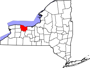 | |
| Towns | ||
| Villages | ||
| CDPs | ||
| Other hamlets | ||
| Footnotes | ‡This populated place also has portions in an adjacent county or counties | |