Clarkson, New York
| Clarkson | |
| Town | |
| Country | United States |
|---|---|
| State | New York |
| County | Monroe |
| Elevation | 368 ft (112.2 m) |
| Coordinates | 43°15′07″N 77°55′19″W / 43.25194°N 77.92194°WCoordinates: 43°15′07″N 77°55′19″W / 43.25194°N 77.92194°W |
| Area | 33.2 sq mi (86.0 km2) |
| - land | 33.2 sq mi (86 km2) |
| - water | 0.1 sq mi (0 km2), 0.3% |
| Population | 6,736 (2010) |
| Density | 203/sq mi (78/km2) |
| Established | 1819 |
| Town Supervisor | Paul M. Kimball (R) First election 1983
|
| Timezone | EST (UTC-5) |
| - summer (DST) | EDT (UTC-4) |
| ZIP code | 14430 |
| Area code | 585 |
 Location in Monroe County and the state of New York.
| |
 Location of New York in the United States
| |
| Website: http://www.clarksonny.org/ | |
Clarkson is a town in Monroe County, New York, USA. The population was 6,736 at the 2010 census. The town is named after General Matthew Clarkson.
The Town of Clarkson is on the west border of the county and is west of the City of Rochester.
History
General Matthew Clarkson was an extensive landowner in this locality, who gave 100 acres (405,000 m²) to the town. Clarkson was formed from the Town of Murray, on 2 April 1819. Clarkson was reduced to form the Towns of Union (the present town of Hamlin) in 1852.
It has been claimed that Moddy Freeman was the first settler in Clarkson. James Sayres purchased at Clarkson Corners in 1804 and was the first settler on the Ridge Road. Eli Blodgett also settled here in 1804, and there were many others prior to 1809. In 1819 and a year or two thereafter, settlement and development progressed rapidly. It was the home of Henry R. Seldon, judge of the Court of Appeals, and later lieutenant governor of the State of New York. The first male child born was a son to Mrs. Clarkson; the first female birth was that of Betsey Palmer, in 1812. Charlotte Cummings taught the first school, in 1812. Henry McCall kept the first store, about 1810. Isaac Williams built the first frame house, and was the first blacksmith. Dr. Noah Owen was the physician and Dr. Rowe the second. John Bowman was the first lawyer. The first and about the only newspaper published in Clarkson was the Jeffersonian, in 1835, which continued for only a year. The first sawmill was erected previous to 1811, by James Sayres, and stood a half-mile east of the corners. Several distilleries were among the early industries along the Ridge Road. A post-office was established in 1816, Dr. Baldwin being the first postmaster..
The Ridge Road was an important thoroughfare during the war times of 1812-15, and Clarkson was the general rendezvous for troops and the temporary depository for supplies and munitions of war. Clarkson village, then known as "Murray Corners," was a hamlet of considerable note, the Ridge Road being the main route between Canandaigua and Lewiston. The Corners was a stopping-place where horses were changed and travelers allowed a brief respite, but since the completion of the Erie Canal, and the still later construction of the New York Central railroad, the town of Sweden; has gained an ascendency and profited, while Clarkson; has correspondingly lost in commercial importance.
Geography
According to the United States Census Bureau, the town has a total area of 33.2 square miles (86 km2), of which, 33.2 square miles (86 km2) of it is land and 0.03% is water.
The west town line is the border of Orleans County, marked by New York State Route 272. New York State Route 104, Ridge Road, is an east-west highway.
Demographics
| Historical population | |||
|---|---|---|---|
| Census | Pop. | %± | |
| 1820 | 1,612 | — | |
| 1830 | 3,251 | 101.7% | |
| 1840 | 3,486 | 7.2% | |
| 1850 | 4,555 | 30.7% | |
| 1860 | 2,093 | −54.1% | |
| 1870 | 1,884 | −10.0% | |
| 1880 | 2,160 | 14.6% | |
| 1890 | 1,741 | −19.4% | |
| 1900 | 1,581 | −9.2% | |
| 1910 | 1,549 | −2.0% | |
| 1920 | 1,403 | −9.4% | |
| 1930 | 1,456 | 3.8% | |
| 1940 | 1,449 | −0.5% | |
| 1950 | 1,912 | 32.0% | |
| 1960 | 2,339 | 22.3% | |
| 1970 | 3,642 | 55.7% | |
| 1980 | 4,016 | 10.3% | |
| 1990 | 4,517 | 12.5% | |
| 2000 | 6,072 | 34.4% | |
| 2010 | 6,736 | 10.9% | |
| Est. 2014 | 6,813 | [1] | 1.1% |
As of the census[3] of 2000, there were 6,072 people, 2,034 households, and 1,582 families residing in the town. The population density was 182.8 people per square mile (70.6/km²). There were 2,090 housing units at an average density of 62.9 per square mile (24.3/km²). The racial makeup of the town was 93.92% White, 2.03% African American, 0.25% Native American, 0.64% Asian, 0.05% Pacific Islander, 1.40% from other races, and 1.71% from two or more races. Hispanic or Latino of any race were 2.72% of the population.
There were 2,034 households out of which 41.3% had children under the age of 18 living with them, 64.7% were married couples living together, 9.8% had a female householder with no husband present, and 22.2% were non-families. 18.1% of all households were made up of individuals and 8.4% had someone living alone who was 65 years of age or older. The average household size was 2.86 and the average family size was 3.26.
In the town the population was spread out with 29.4% under the age of 18, 6.0% from 18 to 24, 30.7% from 25 to 44, 21.9% from 45 to 64, and 11.9% who were 65 years of age or older. The median age was 36 years. For every 100 females there were 94.8 males. For every 100 females age 18 and over, there were 89.9 males.
The median income for a household in the town was $53,438, and the median income for a family was $58,212. Males had a median income of $41,397 versus $25,795 for females. The per capita income for the town was $20,555. About 3.1% of families and 4.9% of the population were below the poverty line, including 4.0% of those under age 18 and 7.6% of those age 65 or over.
Government

The town is governed by a town board consisting of a supervisor and four board members, all elected by registered town voters.
Communities and locations in Clarkson
- Brockport – Part of the Village of Brockport is in the town.
- Clarkson Corners – A hamlet in the census-designated place of Clarkson, formerly known as "Murray Corners" and "Clarkson" (until 2009) that was an important community on Ridge Road until the opening of the Erie Canal and railroads. The Clarkson Corners Historic District was listed on the National Register of Historic Places in 1994.[4]
- Garland – A hamlet in the southeast part of town on Ridge Road (NY-104), also in part of Clarkson CDP.
- Morton – A hamlet at the west town line on NY-272.
- Otis – A location in the northeast part of the town.
- Redman Corners – A hamlet on Ridge Road on the west side of the town.
- Ridge Road – NYS-104, once the major highway between Rochester and Niagara Falls.
- Seymour Library - A public library serving Brockport, Clarkson, & Sweden NY
References
- ↑ "Annual Estimates of the Resident Population for Incorporated Places: April 1, 2010 to July 1, 2014". Retrieved June 4, 2015.
- ↑ "Census of Population and Housing". Census.gov. Archived from the original on May 11, 2015. Retrieved June 4, 2015.
- ↑ "American FactFinder". United States Census Bureau. Archived from the original on 2013-09-11. Retrieved 2008-01-31.
- ↑ National Park Service (2010-07-09). "National Register Information System". National Register of Historic Places. National Park Service.
External links
- Town of Clarkson, NY webpage
- History of Rochester and Monroe County, NY Volume I, William F. Peck, Published 1908, Transcribed by Margaret Steen
Municipalities and communities of Monroe County, New York, United States | ||
|---|---|---|
| City | 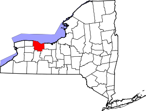 | |
| Towns | ||
| Villages | ||
| CDPs | ||
| Other hamlets | ||
| Footnotes | ‡This populated place also has portions in an adjacent county or counties | |