Hurricane Deck, Missouri

Hurricane Deck is an unincorporated community in Camden County, Missouri, United States, on the Lake of the Ozarks. It is part of the lake's resort area, and according to one source is named for a tornado which struck the area, tornadoes once being called "hurricanes" locally.[1]
According to lakehistory.info it derives its name from the nautical name for the top deck of a river steam ship which is called a "Hurricane Deck" because the wind always blew up there. There is a high ridge at the location on the lake.[2]
One of the most distinctive bridges in the Lake of the Ozarks is the Hurricane Deck Bridge which carries Route 5 across the Osage Arm of the lake.[3] The bridge which was completed in 1936 is one of three "upside down" bridges where its truss support is below the road deck enabling passengers in cars to see the lake. The bridge's design is similar to the I-35W Mississippi River bridge bridge that collapsed in Minneapolis, Minnesota in 2007 (although the Hurricane Deck Bridge's main span is actually longer—462 feet vs. 458 feet—and the Hurricane Deck has piers in the water while the Minnesota bridge spanned both sides of the Mississippi). The other two bridges—the Grand Glaize Bridge over the Grand Glaize Arm and the Niangua Bridge over the Niangua Arm have since been torn down and replaced by girder bridges.
References
- ↑ McMillen, Margot Ford. A to Z Missouri: The Dictionary of Missouri Place Names. Columbia, Missouri: Pebble Publishing. 1996. ISBN 0-9646625-4-X
- ↑ Hurricane Deck
- ↑ Historic Bridges of the U.S. | Hurricane Deck Bridge
Municipalities and communities of Camden County, Missouri, United States | ||
|---|---|---|
| Cities | 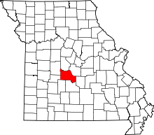 | |
| Villages | ||
| Townships | ||
| CDPs | ||
| Other unincorporated communities | ||
| Footnotes | ‡This populated place also has portions in an adjacent county or counties | |
Coordinates: 38°07′54″N 92°47′38″W / 38.13167°N 92.79389°W