Osceola Township, Camden County, Missouri
| Osceola Township | |
|---|---|
| Township | |
 Location in Camden County | |
| Coordinates: 38°03′09″N 92°45′40″W / 38.05250°N 92.76111°WCoordinates: 38°03′09″N 92°45′40″W / 38.05250°N 92.76111°W | |
| Country |
|
| State |
|
| County | Camden |
| Area | |
| • Total | 32.13 sq mi (83.23 km2) |
| • Land | 25.71 sq mi (66.6 km2) |
| • Water | 6.42 sq mi (16.63 km2) 19.98% |
| Elevation | 883 ft (269 m) |
| Population (2000) | |
| • Total | 3,457 |
| • Density | 134.5/sq mi (51.9/km2) |
| Time zone | CST (UTC-6) |
| • Summer (DST) | CDT (UTC-5) |
| ZIP codes | 65020, 65052 |
| GNIS feature ID | 2397850 |
Osceola Township is one of eleven townships in Camden County, Missouri, USA. As of the 2000 census, its population was 3,457.[1]
Geography
According to the United States Census Bureau, Osceola Township covers an area of 32.13 square miles (83.23 square kilometers); of this, 25.71 square miles (66.6 square kilometers, 80.02 percent) is land and 6.42 square miles (16.63 square kilometers, 19.98 percent) is water.
Cities, towns, villages
- Camdenton (partial)
Adjacent townships
- Jasper Township (north)
- Osage Township (northeast)
- Kiheka Township (east)
- Niangua Township (southwest)
- Adair Township (northwest)
Cemeteries
The township contains Memorial Cemetery.
Major highways
School districts
- Camdenton R-Iii School District
Political districts
- Missouri's 4th congressional district
- State House District 155
- State Senate District 33
References
- United States Census Bureau 2008 TIGER/Line Shapefiles
- United States Board on Geographic Names (GNIS)
- United States National Atlas
External links
 |
Adair Township | Jasper Township | Osage Township | |
| |
Kiheka Township | |||
| ||||
| | ||||
| Niangua Township | |
Municipalities and communities of Camden County, Missouri, United States | ||
|---|---|---|
| Cities | 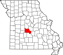 | |
| Villages | ||
| Townships | ||
| CDPs | ||
| Other unincorporated communities | ||
| Footnotes | ‡This populated place also has portions in an adjacent county or counties | |
This article is issued from Wikipedia - version of the 11/16/2013. The text is available under the Creative Commons Attribution/Share Alike but additional terms may apply for the media files.