Hubbard, Ohio
| Hubbard, Ohio | ||
|---|---|---|
| City | ||
| ||
 Location within the state of Ohio | ||
 Location of Hubbard in Trumbull County | ||
| Coordinates: 41°9′26″N 80°34′9″W / 41.15722°N 80.56917°WCoordinates: 41°9′26″N 80°34′9″W / 41.15722°N 80.56917°W | ||
| Country | United States | |
| State | Ohio | |
| County | Trumbull | |
| Incorporated | 1868 | |
| Government | ||
| • Mayor | John Darko (D) | |
| Area[1] | ||
| • Total | 3.91 sq mi (10.13 km2) | |
| • Land | 3.90 sq mi (10.10 km2) | |
| • Water | 0.01 sq mi (0.03 km2) | |
| Elevation[2] | 984 ft (300 m) | |
| Population (2010)[3] | ||
| • Total | 7,874 | |
| • Estimate (2012[4]) | 7,783 | |
| • Density | 2,019.0/sq mi (779.5/km2) | |
| Time zone | Eastern (EST) (UTC-5) | |
| • Summer (DST) | EDT (UTC-4) | |
| ZIP code | 44425 | |
| Area code(s) | 330 | |
| FIPS code | 39-36582[5] | |
| GNIS feature ID | 1048855[2] | |
| Website | http://www.cityofhubbard.com/ | |
.svg.png)
Hubbard is a city in Trumbull County, Ohio, United States. It is formed from part of Hubbard Township, which was formed from the Connecticut Western Reserve. The population was 7,874 at the 2010 census. It is part of the Youngstown-Warren-Boardman, OH-PA Metropolitan Statistical Area.
History
A post office called Hubbard has been in operation since 1826.[6] The village has the name of Nehemiah Huubard, Jr., a Connecticut Land Company agent.[7]
Geography
Hubbard is located at 41°09′26″N 80°34′09″W / 41.157361°N 80.569243°W (41.157361, −80.569243).[8] It is completely surrounded by Hubbard Township.
According to the United States Census Bureau, the city has a total area of 3.91 square miles (10.13 km2), of which 3.90 square miles (10.10 km2) is land and 0.01 square miles (0.03 km2) is water.[1]
Demographics
| Historical population | |||
|---|---|---|---|
| Census | Pop. | %± | |
| 1870 | 1,126 | — | |
| 1880 | 1,511 | 34.2% | |
| 1890 | 1,498 | −0.9% | |
| 1900 | 1,230 | −17.9% | |
| 1910 | 1,699 | 38.1% | |
| 1920 | 3,320 | 95.4% | |
| 1930 | 4,080 | 22.9% | |
| 1940 | 4,189 | 2.7% | |
| 1950 | 4,560 | 8.9% | |
| 1960 | 7,137 | 56.5% | |
| 1970 | 8,583 | 20.3% | |
| 1980 | 9,245 | 7.7% | |
| 1990 | 8,248 | −10.8% | |
| 2000 | 8,284 | 0.4% | |
| 2010 | 7,874 | −4.9% | |
| Est. 2015 | 7,650 | [9] | −2.8% |
| Sources:[10][11][12][13][5][14] | |||
2010 census
As of the census[3] of 2010, there were 7,874 people, 3,442 households, and 2,185 families residing in the city. The population density was 2,019.0 inhabitants per square mile (779.5/km2). There were 3,701 housing units at an average density of 949.0 per square mile (366.4/km2). The racial makeup of the city was 96.5% White, 1.5% African American, 0.1% Native American, 0.3% Asian, 0.1% Pacific Islander, 0.3% from other races, and 1.2% from two or more races. Hispanic or Latino of any race were 1.3% of the population.
There were 3,442 households of which 26.7% had children under the age of 18 living with them, 46.7% were married couples living together, 12.1% had a female householder with no husband present, 4.7% had a male householder with no wife present, and 36.5% were non-families. 32.6% of all households were made up of individuals and 15.2% had someone living alone who was 65 years of age or older. The average household size was 2.29 and the average family size was 2.90.
The median age in the city was 43.9 years. 20.3% of residents were under the age of 18; 8.7% were between the ages of 18 and 24; 22.3% were from 25 to 44; 29.6% were from 45 to 64; and 19.1% were 65 years of age or older. The gender makeup of the city was 47.6% male and 52.4% female.
2000 census
As of the census[5] of 2000, there were 8,284 people, 3,456 households, and 2,322 families residing in the city. The population density was 2,402.3 people per square mile (927.1/km2). There were 3,666 housing units at an average density of 1,063.1 per square mile (410.3/km2). The racial makeup of the city was 98.08% White, 0.92% African American, 0.11% Native American, 0.14% Asian, 0.01% Pacific Islander, 0.14% from other races, and 0.59% from two or more races. Hispanic or Latino of any race were 0.46% of the population.
There were 3,457 households out of which 28.0% had children under the age of 18 living with them, 53.7% were married couples living together, 10.2% had a female householder with no husband present, and 32.8% were non-families. 30.0% of all households were made up of individuals and 15.1% had someone living alone who was 65 years of age or older. The average household size was 2.40 and the average family size was 2.99.
In the city the population was spread out with 23.2% under the age of 18, 7.6% from 18 to 24, 26.2% from 25 to 44, 24.7% from 45 to 64, and 18.3% who were 65 years of age or older. The median age was 40 years. For every 100 females there were 89.7 males. For every 100 females age 18 and over, there were 85.1 males.
The median income for a household in the city was $34,657, and the median income for a family was $42,077. Males had a median income of $34,572 versus $25,052 for females. The per capita income for the city was $19,838. About 5.3% of families and 8.6% of the population were below the poverty line, including 15.4% of those under age 18 and 4.8% of those age 65 or over.
Notable people
- Anthony Smith, professional football player for the Green Bay Packers.
- Rudy Hubbard, head football coach of Florida A&M University from 1974 to 1985.
- Phil Keaggy, musician, guitarist, CCM artist
References
- 1 2 "US Gazetteer files 2010". United States Census Bureau. Retrieved 2013-01-06.
- 1 2 "US Board on Geographic Names". United States Geological Survey. 2007-10-25. Retrieved 2008-01-31.
- 1 2 "American FactFinder". United States Census Bureau. Retrieved 2013-01-06.
- ↑ "Population Estimates". United States Census Bureau. Retrieved 2013-06-17.
- 1 2 3 "American FactFinder". United States Census Bureau. Retrieved 2008-01-31.
- ↑ "Post offices". Jim Forte Postal History. Retrieved 13 June 2016.
- ↑ Overman, William Daniel (1958). Ohio Town Names. Akron, OH: Atlantic Press. p. 62.
- ↑ "US Gazetteer files: 2010, 2000, and 1990". United States Census Bureau. 2011-02-12. Retrieved 2011-04-23.
- ↑ "Annual Estimates of the Resident Population for Incorporated Places: April 1, 2010 to July 1, 2015". Retrieved July 2, 2016.
- ↑ "Population: Ohio" (PDF). 1910 U.S. Census. U.S. Census Bureau. Retrieved 28 November 2013.
- ↑ "Population: Ohio" (PDF). 1930 US Census. U.S. Census Bureau. Retrieved 28 November 2013.
- ↑ "Number of Inhabitants: Ohio" (PDF). 18th Census of the United States. U.S. Census Bureau. Retrieved 22 November 2013.
- ↑ "Ohio: Population and Housing Unit Counts" (PDF). U.S. Census Bureau. Retrieved 22 November 2013.
- ↑ "Incorporated Places and Minor Civil Divisions Datasets: Subcounty Population Estimates: April 1, 2010 to July 1, 2012". U.S. Census Bureau. Retrieved 25 November 2013.
External links
Municipalities and communities of Trumbull County, Ohio, United States | ||
|---|---|---|
| Cities | 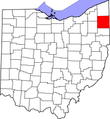 | |
| Villages | ||
| Townships | ||
| CDPs |
| |
| Unincorporated communities | ||
| Footnotes | ‡This populated place also has portions in an adjacent county or counties | |