Champion Heights, Ohio
| Champion Heights, Ohio | |
|---|---|
| CDP | |
 Location of Champion Heights, Ohio | |
| Coordinates: 41°17′26″N 80°51′5″W / 41.29056°N 80.85139°WCoordinates: 41°17′26″N 80°51′5″W / 41.29056°N 80.85139°W | |
| Country | United States |
| State | Ohio |
| County | Trumbull |
| Area | |
| • Total | 3.4 sq mi (8.8 km2) |
| • Land | 3.4 sq mi (8.8 km2) |
| • Water | 0.0 sq mi (0.0 km2) |
| Population (2000) | |
| • Total | 4,727 |
| • Density | 1,390.0/sq mi (536.7/km2) |
| Time zone | Eastern (EST) (UTC-5) |
| • Summer (DST) | EDT (UTC-4) |
| FIPS code | 39-13484[1] |
Champion Heights is a census-designated place (CDP) in Trumbull County, Ohio, United States. The population was 4,727 at the 2000 census. It is part of the Youngstown–Warren–Boardman, OH-PA Metropolitan Statistical Area.
History
A variant name was Champion.[2] A post office was in operation under the name Champion in 1850 until 1858, and again from 1873 until it was discontinued in 1902.[3] The community takes its name from Champion Township.[4]
Geography
Champion Heights is located at 41°17′26″N 80°51′5″W / 41.29056°N 80.85139°W (41.290453, -80.851287).[5]
According to the United States Census Bureau, the CDP has a total area of 3.4 square miles (8.8 km2), all land.
Demographics
| Historical population | |||
|---|---|---|---|
| Census | Pop. | %± | |
| 1990 | 4,665 | — | |
| 2000 | 4,727 | 1.3% | |
| source:[6] | |||
As of the census[1] of 2000, there were 4,727 people, 1,850 households, and 1,376 families residing in the CDP. The population density was 1,390.0 people per square mile (536.8/km²). There were 1,897 housing units at an average density of 557.8/sq mi (215.4/km²). The racial makeup of the CDP was 98.43% White, 0.66% African American, 0.32% Native American, 0.11% Asian, 0.08% from other races, and 0.40% from two or more races. Hispanic or Latino of any race were 0.63% of the population.
There were 1,850 households out of which 31.6% had children under the age of 18 living with them, 61.2% were married couples living together, 10.3% had a female householder with no husband present, and 25.6% were non-families. 22.2% of all households were made up of individuals and 11.8% had someone living alone who was 65 years of age or older. The average household size was 2.52 and the average family size was 2.94.
In the CDP the population was spread out with 23.8% under the age of 18, 6.0% from 18 to 24, 28.6% from 25 to 44, 23.5% from 45 to 64, and 18.0% who were 65 years of age or older. The median age was 40 years. For every 100 females there were 89.5 males. For every 100 females age 18 and over, there were 84.7 males.
The median income for a household in the CDP was $42,472, and the median income for a family was $49,309. Males had a median income of $38,839 versus $24,801 for females. The per capita income for the CDP was $19,919. About 3.2% of families and 5.3% of the population were below the poverty line, including 8.3% of those under age 18 and 8.6% of those age 65 or over.
References
- 1 2 "American FactFinder". United States Census Bureau. Archived from the original on 2013-09-11. Retrieved 2008-01-31.
- ↑ U.S. Geological Survey Geographic Names Information System: Champion
- ↑ U.S. Geological Survey Geographic Names Information System: Champion Post Office (historical)
- ↑ Overman, William Daniel (1958). Ohio Town Names. Akron, OH: Atlantic Press. p. 26.
- ↑ "US Gazetteer files: 2010, 2000, and 1990". United States Census Bureau. 2011-02-12. Retrieved 2011-04-23.
- ↑ "CENSUS OF POPULATION AND HOUSING (1790-2000)". U.S. Census Bureau. Retrieved 2010-07-17.
Municipalities and communities of Trumbull County, Ohio, United States | ||
|---|---|---|
| Cities | 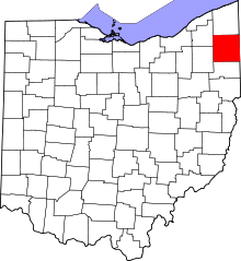 | |
| Villages | ||
| Townships | ||
| CDPs |
| |
| Unincorporated communities | ||
| Footnotes | ‡This populated place also has portions in an adjacent county or counties | |