Horningtoft
| Horningtoft | |
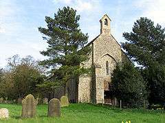 St Edmund, Horningtoft |
|
 Horningtoft |
|
| Area | 5.73 km2 (2.21 sq mi) |
|---|---|
| Population | 127 (2011)[1] |
| – density | 22/km2 (57/sq mi) |
| OS grid reference | TF935231 |
| Civil parish | Horningtoft |
| District | Breckland |
| Shire county | Norfolk |
| Region | East |
| Country | England |
| Sovereign state | United Kingdom |
| Post town | DEREHAM |
| Postcode district | NR20 |
| Police | Norfolk |
| Fire | Norfolk |
| Ambulance | East of England |
| EU Parliament | East of England |
| Website | http://horningtoft.org.uk/parishcouncil.html |
Coordinates: 52°46′16″N 0°52′05″E / 52.771°N 0.868°E
Horningtoft is a village and civil parish in the English county of Norfolk. It covers an area of 5.73 km2 (2.21 sq mi) and had a population of 135 in 54 households at the 2001 census,[2] reducing to a population of 127 in 53 households at the 2011 Census. For the purposes of local government, it falls within the district of Breckland.
The village approximately 5 miles north of East Dereham. It is close to the villages of Whissonsett and Brisley. The village has a Danish Camp to its eastern end.
Notable residents
- Legendary English cricketer Fuller Pilch (1804–1870) was born in the village.
Notes
![]() Media related to Horningtoft at Wikimedia Commons
Media related to Horningtoft at Wikimedia Commons
- ↑ "Civil Parish population 2011". Neighbourhood Statistics. Office for Nattional Statistics. Retrieved 6 August 2016.
- ↑ Census population and household counts for unparished urban areas and all parishes. Office for National Statistics & Norfolk County Council (2001). Retrieved 20 June 2009.
This article is issued from Wikipedia - version of the 10/26/2016. The text is available under the Creative Commons Attribution/Share Alike but additional terms may apply for the media files.