Garboldisham

| Garboldisham | |
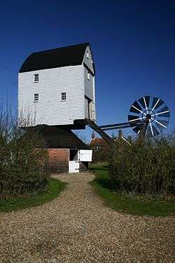 Garboldisham Windmill |
|
 Garboldisham |
|
| Area | 11.17 km2 (4.31 sq mi) |
|---|---|
| Population | 721 (2001 census[1]) 969 2011 [2] |
| – density | 65/km2 (170/sq mi) |
| OS grid reference | TM005815 |
| Civil parish | Garboldisham |
| District | Breckland |
| Shire county | Norfolk |
| Region | East |
| Country | England |
| Sovereign state | United Kingdom |
| Post town | DISS |
| Postcode district | IP22 |
| Dialling code | 01953 |
| Police | Norfolk |
| Fire | Norfolk |
| Ambulance | East of England |
| EU Parliament | East of England |
| UK Parliament | South West Norfolk |
Coordinates: 52°23′42″N 0°56′53″E / 52.395°N 0.948°E
Garboldisham is a village and civil parish, part of Guiltcross (hundred) in the Breckland district, in Norfolk, England, near the boundary with Suffolk. In the 2001 census the parish had a population of 721[3] increasing to 969 at the 2011 Census.
Origin of name
A D Mills (2003) says it was a 'homestead or village of a man called Gǣrbald'.[4] It appeared in the Domesday Book (1086) as Gerboldesham. The traditional view of Gaerbold is that it is an Old English name, i.e. homestead of Garbold. Others argue it has a Viking origin with Garbold being a famous Viking.[5] As described above, the boundary between Anglian, Viking and possibly even Iceni is blurred in the light of recent genetic and linguistic research.
To the south of the village sit the small affiliated hamlet of Smallworth and Broomscot Common, the name of the latter according to some recalling the village's ancient pagan past but more likely, so Carole Hough thinks, an affiliation to a Scandinavian with the surname Brun.[6] This name might reflect the Viking invasions or Scandinavian connections of the Wuffingas, founders of the kingdom of East Anglia. It might even go further back in time if you believe theories that the pre-Roman Iceni inhabiting this area were Old English speakers rather than Cymric/Welsh.[7]
Notable buildings

The village contains a Post Office with shop, selling a range of groceries as well as East Anglian regional "gourmet". On Church Road is Garboldisham Church of England School, a Primary School about 90 pupils strong serving Garboldisham, surrounding villages and also Thetford. It feeds into Diss High School and Old Buckenham High School. The school sits next to Garboldisham St John the Baptist Church and opposite the village hall. About 200 yards north is the ruined Garboldisham All Saints Church, where the 14th century western face collapsed into the nave in 1734. There is also a small Methodist Chapel, situated south of the A1066. The Fox Public House, on the crossroad of the A1066 and Hopton/Harling Road, closed in 2007.
Village life
There are active cricket and football teams. Village rumour has it that the Australian Cricket team played at the cricket ground at some point in the 19th Century.
There are few famous notables from Garboldisham, despite the active Amateur Dramatic Society. However, the "Garboldisham Road" was mentioned in the infamous Fry and Laurie sketch "Strawberries and Cream".[8] Queen Boudicca was also reputed to be buried in Soldier's Grave, a 10-foot 10,000-year-old burial mound. The Garboldisham Hoard, discovered by Basil Brown in the mound during excavations circa 1956, can be found in the British Museum. John Winston Spencer-Churchill, 7th Duke of Marlborough and grandfather of Sir Winston Churchill, was born in Garboldisham Hall in 1822. Of more contemporary note, the mother of pianist of folk rock band Moishe's Bagel Phil Alexander lives in the village. Alexander has also played for Salsa Celtica and the Eliza Carthy Band.
References
| Wikimedia Commons has media related to Garboldisham. |
- ↑ Census population and household counts for unparished urban areas and all parishes. Office for National Statistics & Norfolk County Council (2001). Retrieved 20 June 2009.
- ↑ "Civil Parish population 2011". Neighbourhood Statistics. Office for National Statistics. Retrieved 4 August 2016.
- ↑ "Neighbourhood Statistics: 2001 Census: Key Statistics: Parish Headcounts: Area: Garboldisham CP (Parish)". Office for National Statistics. Retrieved 2008-06-03.
- ↑ "A. D. MILLS. "Garboldisham." A Dictionary of British Place-Names. Oxford University Press. 2003. Encyclopedia.com. 6 Jun. 2009".
- ↑ "Y - DNA: Paternal - FAUX".
- ↑ "Hough, C. (1998). OE Brūn in Place-Names. English Studies 79: 512-521.".
- ↑ "The Origins of the British: A Genetic Detective Story by Stephen Oppenheimer, 2006". Carroll & Graf Publishing. Retrieved 2009-06-04.
- ↑ "A Bit of Fry and Laurie English Strawberries on the Garboldisham Road".