Broadland
| Broadland District | |
|---|---|
| Non-metropolitan district | |
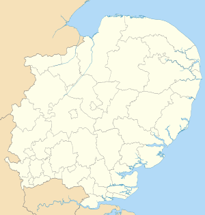
 Broadland shown within Norfolk | |
| Sovereign state | United Kingdom |
| Constituent country | England |
| Region | East of England |
| Non-metropolitan county | Norfolk |
| Status | Non-metropolitan district |
| Admin HQ | Thorpe St Andrew |
| Incorporated | 1 April 1974 |
| Government | |
| • Type | Non-metropolitan district council |
| • Body | Broadland District Council |
| • Leadership | Leader & Cabinet (Conservative) |
| • MPs |
Keith Simpson Chloe Smith |
| Area | |
| • Total | 213.3 sq mi (552.4 km2) |
| Area rank | 83rd (of 326) |
| Population (mid-2014 est.) | |
| • Total | 125,961 |
| • Rank | 171st (of 326) |
| • Density | 590/sq mi (230/km2) |
| • Ethnicity | 98.8% White |
| Time zone | GMT (UTC0) |
| • Summer (DST) | BST (UTC+1) |
| ONS code |
33UC (ONS) E07000144 (GSS) |
| OS grid reference | TG2682109307 |
| Website |
www |
Broadland is a local government district in Norfolk, England, named after the Norfolk Broads. The population of the Local Authority District taken at the 2011 Census was 124,646.[1] Its council is based in Thorpe St Andrew, which is a suburb of the City of Norwich.
In 2013, Broadland was announced as the most peaceful locality within the United Kingdom, having the lowest level of violent crime than anywhere else within the country.[2]
History
The district was formed on 1 April 1974 by the merger of St. Faiths and Aylsham Rural District and part of Blofield and Flegg Rural District.
Politics
The council is currently under Conservative control, as it has been for the majority of its existence, with the exception of two periods of No overall control. The council consists of 47 councillors, elected from 27 wards. After the most recent full council elections held on 7 May 2015, the composition of the council is as follows:
| Broadland District Council Composition as of 7 May 2015 | |||||||||
|---|---|---|---|---|---|---|---|---|---|
| Party | Seats | Swing | |||||||
| Conservatives | 43 | +9 | |||||||
| Liberal Democrats | 4 | -8 | |||||||
Composition
The district is entirely parished, and is made up of 65 civil parishes. At the time of the 2001 census, the district had an area of 546 square kilometres (211 sq mi), with a population of 118,513 in 50,009 households.[3]
The district contains the following civil parishes:
- Acle, Alderford, Attlebridge, Aylsham
- Beeston St. Andrew, Beighton, Belaugh, Blickling, Blofield, Booton, Brampton, Brandiston, Brundall, Burgh and Tuttington, Buxton Lammas, Buxton
- Cantley, Cawston, Coltishall, Crostwick
- Drayton
- Felthorpe, Foulsham, Freethorpe, Frettenham
- Great Plumstead, Great Witchingham, Guestwick
- Hainford, Halvergate, Haveringland, Hellesdon, Hemblington, Hevingham, Heydon, Honingham, Horsford, Horsham St Faith, Horsham St Faith and Newton St Faith, Horstead with Stanninghall
- Lingwood and Burlingham, Little Plumstead, Little Witchingham
- Marsham, Morton on the Hill
- Old Catton, Oulton
- Postwick with Witton
- Rackheath, Reedham, Reepham, Ringland
- Salhouse, Salle, South Walsham, Spixworth, Sprowston, Stratton Strawless, Strumpshaw, Swannington
- Taverham, Themelthorpe, Thorpe St. Andrew
- Upton with Fishley
- Weston Longville, Woodbastwick, Wood Dalling, Wroxham
Climate
Climate in this area has mild differences between highs and lows, and there is adequate rainfall year round. The Köppen Climate Classification subtype for this climate is "Cfb". (Marine West Coast Climate/Oceanic climate).[4]
| Climate data for Broadland, UK | |||||||||||||
|---|---|---|---|---|---|---|---|---|---|---|---|---|---|
| Month | Jan | Feb | Mar | Apr | May | Jun | Jul | Aug | Sep | Oct | Nov | Dec | Year |
| Average high °C (°F) | 7 (45) |
8 (46) |
10 (50) |
13 (55) |
16 (61) |
19 (66) |
21 (70) |
22 (72) |
19 (66) |
15 (59) |
10 (50) |
7 (44) |
14 (57) |
| Average low °C (°F) | 1 (34) |
1 (34) |
2 (36) |
3 (37) |
6 (43) |
9 (48) |
11 (52) |
11 (52) |
9 (48) |
5 (41) |
2 (36) |
1 (34) |
5 (41) |
| Average precipitation mm (inches) | 48 (1.9) |
43 (1.7) |
43 (1.7) |
43 (1.7) |
41 (1.6) |
61 (2.4) |
53 (2.1) |
61 (2.4) |
64 (2.5) |
69 (2.7) |
74 (2.9) |
66 (2.6) |
665 (26.2) |
| Source: Weatherbase [5] | |||||||||||||
References
- ↑ "Local Authority District population 2011". Neighbourhood Statistics. Office for National Statisticxs. Retrieved 26 July 2016.
- ↑ http://uk.news.yahoo.com/photos/screen-shot-2013-04-24-at-10-49-34-am-png-photo-1002787826.html
- ↑ Office for National Statistics & Norfolk County Council (2001). Census population and household counts for unparished urban areas and all parishes. Retrieved 2 December 2005.
- ↑ Climate Summary
- ↑ "Weatherbase.com". Weatherbase. 2013. Retrieved 5 June 2013.
| Boroughs or districts | |
|---|---|
| Major settlements |
|
| Topics | |
Coordinates: 52°38′1.25″N 1°21′8.46″E / 52.6336806°N 1.3523500°E