Hoopeston, Illinois
| Hoopeston, Illinois | |
|---|---|
| City | |
|
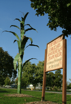
Art in McFerren Park, 2007 | |
| Nickname(s): Sweetcorn Capital of the World | |
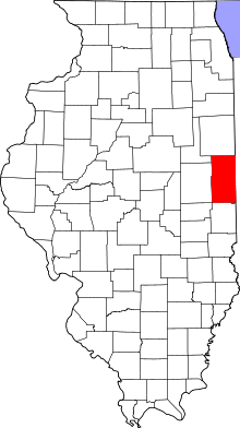 Vermilion County's location in Illinois | |
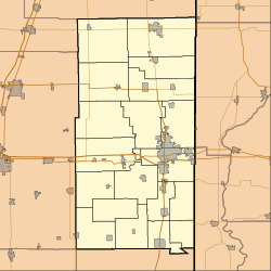 Hoopeston, Illinois Hoopeston's location in Vermilion County | |
| Coordinates: 40°28′02″N 87°40′06″W / 40.46722°N 87.66833°WCoordinates: 40°28′02″N 87°40′06″W / 40.46722°N 87.66833°W | |
| Country | United States |
| State | Illinois |
| County | Vermilion |
| Township | Grant |
| Founded | 1871 |
| Organized | 1874 |
| Incorporated | 1877 |
| Government | |
| • Mayor | Bill Crusinberry [1] |
| Area | |
| • Total | 3.69 sq mi (9.6 km2) |
| • Land | 3.69 sq mi (9.6 km2) |
| • Water | 0.00 sq mi (0.0 km2) |
| Elevation | 725 ft (221 m) |
| Population (2010)[2] | |
| • Total | 5,251 |
| • Estimate (2014)[3] | 5,258 |
| • Density | 1,400/sq mi (550/km2) |
| Time zone | CST (UTC-6) |
| • Summer (DST) | CDT (UTC-5) |
| ZIP code | 60942 |
| Area code | 217 |
| GNIS ID | 410494 [4] |
| Website | cityofhoopeston.com |
Hoopeston (/ˈhʊpstən/) is a city in Grant Township, Vermilion County, Illinois, United States. As of the 2010 census, the city population was 5,351.[2]
History
Hoopeston was laid out in 1871. It was named for Thomas Hoopes, one of the men who offered land for the crossing of two railroads: the Lafayette, Bloomington and Western Railroad and the Chicago, Danville and Vincennes Railroad.[5][6] The two railroads separated the town into four sections. The latter railroad still exists and is now operated jointly by CSX Transportation and Union Pacific Railroad.[7]
In 1890, Greer College was established in Hoopeston, funded by a gift of $40,000 and 500 acres (2.0 km2) of land from John Greer.[6]
Business and manufacturing in Hoopeston have historically been related to agriculture. In 1875, S. S. McCall established the Illinois Canning Company to can locally-grown vegetables; and this was so successful that in 1878 the Hoopeston Canning Company was established, which later became part of Stokely-Van Camp, Inc.[6] In addition, Silgan Can (formerly American Can) had a factory which manufactured the tin cans themselves, and an FMC plant manufactured agricultural machinery.
In honor of its agricultural roots, Hoopeston holds a Sweet Corn Festival each September, starting the Thursday before Labor Day and ending on Labor Day.
In association with the Sweet Corn Festival, the Miss National Sweetheart Pageant is also held during the week. Runners-up from the Miss America state pageants are eligible to compete for the title of Miss National Sweetheart.
It was also the location of one of several prisoner of war camps housing German soldiers during World War II (see German Prisoner of War Camp, Hoopeston, Illinois).
Geography
Hoopeston is located at the intersection of Illinois Route 1 and Illinois Route 9, about one mile from the north edge of Vermilion County. According to the 2010 census, Hoopeston has a total area of 3.69 square miles (9.56 km2), all land.[8]
Demographics
| Historical population | |||
|---|---|---|---|
| Census | Pop. | %± | |
| 1880 | 1,272 | — | |
| 1890 | 1,911 | 50.2% | |
| 1900 | 3,823 | 100.1% | |
| 1910 | 4,698 | 22.9% | |
| 1920 | 5,451 | 16.0% | |
| 1930 | 5,613 | 3.0% | |
| 1940 | 5,381 | −4.1% | |
| 1950 | 5,992 | 11.4% | |
| 1960 | 6,606 | 10.2% | |
| 1970 | 6,461 | −2.2% | |
| 1980 | 6,411 | −0.8% | |
| 1990 | 5,871 | −8.4% | |
| 2000 | 5,965 | 1.6% | |
| 2010 | 5,351 | −10.3% | |
| Est. 2015 | 5,220 | [9] | −2.4% |
| U.S. Decennial Census | |||
Hoopeston is part of the Danville, Illinois, Metropolitan Statistical Area.
As of the census[10] of 2000, there were 5,965 people, 2,297 households, and 1,499 families residing in the city. The population density was 1,913.8 people per square mile (738.2/km²). There were 2,520 housing units at an average density of 808.5/sq mi (311.9/km²). The racial makeup of the city was 91.79% White, 0.82% African American, 0.28% Native American, 0.13% Asian, 5.60% from other races, and 1.37% from two or more races. Hispanic or Latino of any race were 8.38% of the population.
There were 2,297 households out of which 30.7% had children under the age of 18 living with them, 50.5% were married couples living together, 11.4% had a female householder with no husband present, and 34.7% were non-families. 31.2% of all households were made up of individuals and 16.6% had someone living alone who was 65 years of age or older. The average household size was 2.44 and the average family size was 3.04.
In the city the population was spread out with 24.8% under the age of 18, 8.3% from 18 to 24, 24.1% from 25 to 44, 22.4% from 45 to 64, and 20.4% who were 65 years of age or older. The median age was 40 years. For every 100 females there were 99.2 males. For every 100 females age 18 and over, there were 97.6 males.
The median income for a household in the city was $31,947, and the median income for a family was $39,368. Males had a median income of $31,656 versus $20,474 for females. The per capita income for the city was $15,055. About 12.3% of families and 13.8% of the population were below the poverty line, including 16.6% of those under age 18 and 11.7% of those age 65 or over.
Education
Primary and secondary education
- Hoopeston Area High School
- Hoopeston Area Middle School
- John Greer Grade School (originally known as John Greer College) serves 5th and 6th grade students.
- Honeywell School serves 3rd and 4th grade students.
- Maple Grade School serves kindergarten through 2nd grade students.
The school district has faced increasingly declining enrollment over the past 10 years. The district has also struggled financially in recent years. The school teams are named the "Cornjerkers", a term describing farm workers who picked corn prior to the use of mechanized corn picker implements.
Hoopeston Area High School is the alma mater of current Ohio State University head men's basketball coach Thad Matta.
Library
Hoopeston is served by the Hoopeston Carnegie Public Library.[11]
Notable people
- Frankie Gustine, infielder for the Pittsburgh Pirates, Chicago Cubs and St. Louis Browns
- Thad Matta, Ohio State University head men's basketball coach
References
- ↑ "Elected Officials". City of Hoopeston, Illinois. Retrieved 2012-10-02.
- 1 2 "2010 City Population and Housing Occupancy Status". U.S. Census Bureau. Retrieved May 14, 2012.
- ↑ "Annual Estimates of the Resident Population for Incorporated Places: April 1, 2010 to July 1, 2014". Retrieved June 4, 2015.
- ↑ "Hoopeston". Geographic Names Information System. United States Geological Survey. Retrieved 2010-08-21.
- ↑ Jones, Lottie E. (1911). History of Vermilion County, Illinois (volume 1). Chicago, Illinois: Pioneer Publishing Company. p. 224.
- 1 2 3 Stapp, Katherine; W. I. Bowman (1968). History Under Our Feet: The Story of Vermilion County, Illinois. Danville, Illinois: Interstate Printers and Publishers, Inc. pp. 42–44.
- ↑ "Illinois Railroad Map" (PDF). Illinois Department of Transportation. January 2006. Retrieved 2007-09-23.
- ↑ "G001 - Geographic Identifiers - 2010 Census Summary File 1". United States Census Bureau. Retrieved 2015-12-27.
- ↑ "Annual Estimates of the Resident Population for Incorporated Places: April 1, 2010 to July 1, 2015". Retrieved July 2, 2016.
- ↑ "American FactFinder". United States Census Bureau. Retrieved 2008-01-31.
- ↑ "Homepage". Hoopeston Public Library District. Retrieved 24 June 2014.
External links
| Wikimedia Commons has media related to Hoopeston, Illinois. |
- City of Hoopeston
- hoopeston.org, Hoopeston related web sites and businesses
- Hoopeston school district
Municipalities and communities of Vermilion County, Illinois, United States | ||
|---|---|---|
| Cities | ||
| Villages | ||
| Townships | ||
| CDP | ||
| Other unincorporated communities | ||
| Footnotes | ‡This populated place also has portions in an adjacent county or counties | |