Armstrong, Illinois
| Armstrong | |
|---|---|
| Unincorporated community | |
|
The Armstrong post office | |
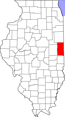 Vermilion County's location in Illinois | |
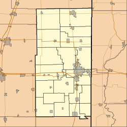 Armstrong Armstrong's location in Vermilion County | |
| Coordinates: 40°18′23″N 87°52′40″W / 40.30639°N 87.87778°WCoordinates: 40°18′23″N 87°52′40″W / 40.30639°N 87.87778°W | |
| Country |
|
| State |
|
| County | Vermilion County |
| Township | Middlefork Township |
| Established | 1876 |
| Elevation | 212 m (696 ft) |
| ZIP code | 61812 |
| Area code(s) | 217 |
| GNIS feature ID | 0403620[1] |

Armstrong is an unincorporated community in Middlefork Township, Vermilion County, Illinois.
History
Armstrong was laid out in 1876 on land owned by Thomas and Henry Armstrong; it was on the route of the Havana, Rantoul, and Eastern narrow-gauge railroad (which later became the Illinois Central Railroad).
On October 2, 1908, a fire destroyed many important buildings in Armstrong, including the general store, the harness shop, the blacksmith shop, the lumber yard, the opera house, the post office, and the grain elevator. Water was pumped by hand by residents to try to fight the fire, and water was also brought by rail from over a mile away; the town had no fire equipment.[2]
Geography
Armstrong is located in the northwestern part of the county, just northeast of the intersection of U.S. Route 136 and Illinois State Route 49. It is about four miles west of Potomac.

References
- ↑ "Armstrong". Geographic Names Information System. United States Geological Survey. Retrieved 2010-08-22.
- ↑ Stapp, Katherine; W. I. Bowman (1968). History Under Our Feet: The Story of Vermilion County, Illinois. Danville, Illinois: Interstate Printers and Publishers, Inc. p. 39.
External links
Municipalities and communities of Vermilion County, Illinois, United States | ||
|---|---|---|
| Cities | ||
| Villages | ||
| Townships | ||
| CDP | ||
| Other unincorporated communities | ||
| Footnotes | ‡This populated place also has portions in an adjacent county or counties | |