Rankin, Illinois
| Rankin | |
|---|---|
| Village (United States) | |
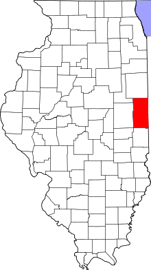 Vermilion County's location in Illinois | |
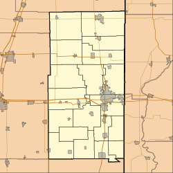 Rankin Rankin's location in Vermilion County | |
| Coordinates: 40°27′54″N 87°53′47″W / 40.46500°N 87.89639°WCoordinates: 40°27′54″N 87°53′47″W / 40.46500°N 87.89639°W | |
| Country |
|
| State |
|
| County | Vermilion |
| Township | Butler |
| Area | |
| • Total | 1.5 km2 (0.58 sq mi) |
| • Land | 1.5 km2 (0.58 sq mi) |
| • Water | 0.0 km2 (0.00 sq mi) |
| Elevation | 220 m (722 ft) |
| Population (2000) | |
| • Total | 617 |
| • Density | 416.9/km2 (1,082.5/sq mi) |
| ZIP code | 60960 |
| Area code(s) | 217 |
| GNIS feature ID | 0416385[1] |
Rankin is a village in Butler Township, Vermilion County, Illinois, United States. It is part of the Danville, Illinois Metropolitan Statistical Area. The population was 617 at the 2000 census.
History
This town was named after W. A. Rankin, a wealthy landowner in the area. In 1872, a dispute between him and W. H. Pells (who was on the board of directors of the[2] Lake Erie and Western Railroad) over the location of a railroad station. Ultimately, over the course of several years, Rankin won out over Pellsville, which was located a mile and a half to the west. There were railroad maintenance shops in Rankin until 1932 when they were moved to Frankfort, Indiana, and some of the residents of Rankin followed.[3]
In 1972 the town celebrated its centennial, and a small commemorative volume was issued with brief articles on many of the town's families.
The Veterans Memorial
Located on the Main street in Rankin, it was built in 1996. Local people joined together and put in motion to build this memorial. Due credit goes to RTHS graduate Margaret "Maggie" Olson Diskin, who spearheaded this project.
Names of more than 700 men and women from the Rankin area who served our nation in war and peace are embedded on this monument.
The wars are Civil War, Spanish–American War, WW I, WW II, Korean War, Lebanon Conflict, Vietnam War, Korean War, Operation Enduring Freedom and Operation Iraqi Freedom.
Its website is "http://www.rankinveteransmemorial.com"
Geography
Rankin is located at 40°27′50″N 87°53′46″W / 40.46389°N 87.89611°W (40.463836, -87.896055).[4]
According to the 2010 census, Rankin has a total area of 0.58 square miles (1.50 km2), all land.[5]
Demographics
| Historical population | |||
|---|---|---|---|
| Census | Pop. | %± | |
| 1880 | 258 | — | |
| 1890 | 314 | 21.7% | |
| 1900 | 754 | 140.1% | |
| 1910 | 858 | 13.8% | |
| 1920 | 944 | 10.0% | |
| 1930 | 840 | −11.0% | |
| 1940 | 781 | −7.0% | |
| 1950 | 737 | −5.6% | |
| 1960 | 761 | 3.3% | |
| 1970 | 727 | −4.5% | |
| 1980 | 727 | 0.0% | |
| 1990 | 619 | −14.9% | |
| 2000 | 617 | −0.3% | |
| 2010 | 561 | −9.1% | |
| Est. 2015 | 539 | [6] | −3.9% |
As of the census[8] of 2000, there were 617 people, 247 households, and 162 families residing in the village. The population density was 1,078.3 people per square mile (417.9/km²). There were 282 housing units at an average density of 492.8 per square mile (191.0/km²). The racial makeup of the village was 93.52% White, 0.16% African American, 0.49% Native American, 0.49% Asian, 4.86% from other races, and 0.49% from two or more races. Hispanic or Latino of any race were 6.16% of the population.
There were 247 households out of which 27.9% had children under the age of 18 living with them, 51.8% were married couples living together, 8.9% had a female householder with no husband present, and 34.4% were non-families. 30.0% of all households were made up of individuals and 15.8% had someone living alone who was 65 years of age or older. The average household size was 2.50 and the average family size was 3.09.
In the village the population was spread out with 27.9% under the age of 18, 6.0% from 18 to 24, 27.1% from 25 to 44, 21.1% from 45 to 64, and 18.0% who were 65 years of age or older. The median age was 37 years. For every 100 females there were 102.3 males. For every 100 females age 18 and over, there were 96.0 males.
The median income for a household in the village was $29,063, and the median income for a family was $35,234. Males had a median income of $30,446 versus $22,188 for females. The per capita income for the village was $14,005. About 9.2% of families and 13.6% of the population were below the poverty line, including 11.5% of those under age 18 and 11.2% of those age 65 or over.
There are relatively few famous people who have come from Rankin. However, Dr. Daniel Howard, who graduated from Rankin Township High School in 1978, is a prominent physician in Baltimore, Maryland, where he serves as Chief of Staff at the University of Maryland Medical Center Midtown Campus.
References
- ↑ "Rankin". Geographic Names Information System. United States Geological Survey. Retrieved 2010-08-21.
- ↑ : Rankin Centennial History Committee. "Stories of a prairie town : history of Rankin, Ill.". Rankin Centennial History Committee.
- ↑ Stapp, Katherine; W. I. Bowman (1968). History Under Our Feet: The Story of Vermilion County, Illinois. Danville, Illinois: Interstate Printers and Publishers, Inc. p. 41.
- ↑ "US Gazetteer files: 2010, 2000, and 1990". United States Census Bureau. 2011-02-12. Retrieved 2011-04-23.
- ↑ "G001 - Geographic Identifiers - 2010 Census Summary File 1". United States Census Bureau. Retrieved 2015-12-25.
- ↑ "Annual Estimates of the Resident Population for Incorporated Places: April 1, 2010 to July 1, 2015". Retrieved July 2, 2016.
- ↑ "Census of Population and Housing". Census.gov. Retrieved June 4, 2015.
- ↑ "American FactFinder". United States Census Bureau. Retrieved 2008-01-31.
Municipalities and communities of Vermilion County, Illinois, United States | ||
|---|---|---|
| Cities | ||
| Villages | ||
| Townships | ||
| CDP | ||
| Other unincorporated communities | ||
| Footnotes | ‡This populated place also has portions in an adjacent county or counties | |
