Holdingford, Minnesota
| Holdingford, Minnesota | |
|---|---|
| City | |
|
One of many references to Lake Wobegon in Holdingford | |
| Nickname(s): Gateway to Lake Wobegon | |
| Motto: "Most Scenic Part Of The Lake Wobegon Trail"[1] | |
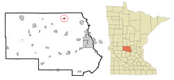 Location of Holdingford within Stearns County, Minnesota | |
| Coordinates: 45°44′N 94°28′W / 45.733°N 94.467°W | |
| Country | United States |
| State | Minnesota |
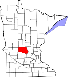
| County | Stearns |
| Area[2] | |
| • Total | 0.85 sq mi (2.20 km2) |
| • Land | 0.85 sq mi (2.20 km2) |
| • Water | 0 sq mi (0 km2) |
| Elevation | 1,181 ft (360 m) |
| Population (2010)[3] | |
| • Total | 708 |
| • Estimate (2012[4]) | 705 |
| • Density | 832.9/sq mi (321.6/km2) |
| Time zone | Central (CST) (UTC-6) |
| • Summer (DST) | CDT (UTC-5) |
| ZIP code | 56340 |
| Area code(s) | 320 |
| FIPS code | 27-29582[5] |
| GNIS feature ID | 0645075[6] |
| Website | www.holdingfordmn.us |

Holdingford is a city in Stearns County, Minnesota, United States. The population was 708 at the 2010 census.[7] It claims to be "The Gateway to Lake Wobegon", the fictional central Minnesota town created by author Garrison Keillor.
Holdingford is part of the St. Cloud Metropolitan Statistical Area.
History
Holdingford was platted in the 1870s by Randolph Holding on a site near a ford.[8] A post office has been in operation at Holdingford since 1872.[9]
During Prohibition, Holdingford earned the title of "moonshine capital of Minnesota" due to its production of Minnesota 13 whiskey.[10]
Geography
According to the United States Census Bureau, the city has a total area of 0.85 square miles (2.20 km2), all of it land.[2]

Holdingford is located nine miles north of the city of Avon at Interstate 94 in central Minnesota. The city of Albany is also nearby.
Demographics
| Historical population | |||
|---|---|---|---|
| Census | Pop. | %± | |
| 1900 | 191 | — | |
| 1910 | 276 | 44.5% | |
| 1920 | 507 | 83.7% | |
| 1930 | 477 | −5.9% | |
| 1940 | 527 | 10.5% | |
| 1950 | 458 | −13.1% | |
| 1960 | 526 | 14.8% | |
| 1970 | 551 | 4.8% | |
| 1980 | 635 | 15.2% | |
| 1990 | 561 | −11.7% | |
| 2000 | 736 | 31.2% | |
| 2010 | 708 | −3.8% | |
| Est. 2015 | 713 | [11] | 0.7% |
.JPG)
2010 census
As of the census[3] of 2010, there were 708 people, 306 households, and 190 families residing in the city. The population density was 832.9 inhabitants per square mile (321.6/km2). There were 330 housing units at an average density of 388.2 per square mile (149.9/km2). The racial makeup of the city was 98.6% White, 0.1% Asian, 0.4% Pacific Islander, and 0.8% from two or more races. Hispanic or Latino of any race were 0.7% of the population.
There were 306 households of which 29.7% had children under the age of 18 living with them, 44.8% were married couples living together, 9.8% had a female householder with no husband present, 7.5% had a male householder with no wife present, and 37.9% were non-families. 32.4% of all households were made up of individuals and 14% had someone living alone who was 65 years of age or older. The average household size was 2.31 and the average family size was 2.92.
The median age in the city was 37.3 years. 25.8% of residents were under the age of 18; 7.5% were between the ages of 18 and 24; 25.1% were from 25 to 44; 25.2% were from 45 to 64; and 16.2% were 65 years of age or older. The gender makeup of the city was 50.7% male and 49.3% female.
2000 census
As of the census[5] of 2000, there were 736 people, 286 households, and 197 families residing in the city. The population density was 1,182.1 people per square mile (458.3/km²). There were 297 housing units at an average density of 477.0 per square mile (185.0/km²). The racial makeup of the city was 99.18% White, 0.54% Asian, and 0.27% from two or more races. Hispanic or Latino of any race were 0.14% of the population.
There were 286 households out of which 32.2% had children under the age of 18 living with them, 51.4% were married couples living together, 12.9% had a female householder with no husband present, and 31.1% were non-families. 27.3% of all households were made up of individuals and 16.8% had someone living alone who was 65 years of age or older. The average household size was 2.55 and the average family size was 3.13.
In the city the population was spread out with 27.6% under the age of 18, 9.8% from 18 to 24, 23.5% from 25 to 44, 20.2% from 45 to 64, and 18.9% who were 65 years of age or older. The median age was 38 years. For every 100 females there were 95.7 males. For every 100 females age 18 and over, there were 91.7 males.
The median income for a household in the city was $34,000, and the median income for a family was $42,788. Males had a median income of $31,053 versus $21,141 for females. The per capita income for the city was $15,410. About 6.2% of families and 11.2% of the population were below the poverty line, including 13.9% of those under age 18 and 9.2% of those age 65 or over.
Education
Holdingford Public Schools are part of the Holdingford Public School District. Schools in the district include Holdingford Elementary School and Holdingford High School.[13][14] Holdingford Elementary serves Preschool to 6th grade, and Holdingford High School serves Grades 7–12. The Holdingford Huskers are expanding in the sports area. They have baseball/softball, volleyball, football, tennis, swimming, track, wrestling, and cheerleading.
Infrastructure
Transportation
Stearns County Road 9 (4th Street), Stearns County Road 17 (River Street), and Main Street are three of the main routes in the community.
Holdingford is home to the longest covered bridge in Minnesota.[15] The bridge is located along the Lake Wobegon Trail extension that runs from Albany past Holdingford. It is 186 feet (57 m) long and was built in 2008 by the Holdingford Lions club.[16]
Notable people
- Kenny Benkowski, better known as "Sodbuster" Kenny Jay, was born March 27, 1937, in Holdingford, Minnesota. He was a professional wrestler who competed primarily in the American Wrestling Association.[17]
- Joseph Brinkman, born April 9, 1944, in Little Falls, Minnesota, was raised in Holdingford, and graduated from Holdingford High School. He is a former umpire in Major League Baseball Umpire who worked in the American League from 1973 to 1999 and throughout both major leagues from 2000 until his retirement during the 2006 season.[18]
References
- ↑ "City of Holdingford Minnesota". City of Holdingford Minnesota. Retrieved October 8, 2012.
- 1 2 "US Gazetteer files 2010". United States Census Bureau. Retrieved 2012-11-13.
- 1 2 "American FactFinder". United States Census Bureau. Retrieved 2012-11-13.
- ↑ "Population Estimates". United States Census Bureau. Retrieved 2013-05-28.
- 1 2 "American FactFinder". United States Census Bureau. Retrieved 2008-01-31.
- ↑ "US Board on Geographic Names". United States Geological Survey. 2007-10-25. Retrieved 2008-01-31.
- ↑ "2010 Census Redistricting Data (Public Law 94-171) Summary File". American FactFinder. U.S. Census Bureau, 2010 Census. Retrieved 23 April 2011.
- ↑ Upham, Warren (1920). Minnesota Geographic Names: Their Origin and Historic Significance. Minnesota Historical Society. p. 524.
- ↑ "Stearns County". Jim Forte Postal History. Retrieved 8 August 2015.
- ↑ "Minnesota 13 author to be at Herald booth during LNO". Sauk Centre Herald. 22 April 2014. Retrieved 9 August 2015.
- ↑ "Annual Estimates of the Resident Population for Incorporated Places: April 1, 2010 to July 1, 2015". Retrieved July 2, 2016.
- ↑ "Census of Population and Housing". Census.gov. Retrieved June 4, 2015.
- ↑ "Holdingford Public Schools". Holdingford Public Schools. Retrieved October 8, 2012.
- ↑ "Holdingford Public School District". Great Schools, Inc. Retrieved October 8, 2012.
- ↑ "Holdingford covered bridge - Minnesota Trails Magazine".
- ↑ "Minnesota Covered Bridges List".
- ↑ "KENNY JAY". Cauliflower Alley Club. Archived from the original on April 18, 2007. Retrieved October 8, 2012.
- ↑ "Joe Brinkman". Society for American Baseball Research. Retrieved October 8, 2012.
External links
| Wikimedia Commons has media related to Holdingford, Minnesota. |
- Official City of Holdingford Website
- Holdingford Historical Holdingford Area Historical Society
- Exit153 News of what's Happening in Holdingford Today
- Holdingford Public Schools
- City-Data.com
- ePodunk: Profile for Holdingford, Minnesota
Coordinates: 45°44′N 94°28′W / 45.733°N 94.467°W
Municipalities and communities of Stearns County, Minnesota, United States | ||
|---|---|---|
| Cities |
|  |
| Townships |
| |
| CDP | ||
| Unincorporated communities | ||
| Footnotes | ‡This populated place also has portions in an adjacent county or counties | |
| Core City |  | ||||||
|---|---|---|---|---|---|---|---|
| Surrounding communities |
| ||||||
| Counties | |||||||
‡ indicates that it is partially in the metropolitan area. § indicates a CDP | |||||||