Hazeldean, Queensland
| Hazeldean Queensland | |||||||||||||
|---|---|---|---|---|---|---|---|---|---|---|---|---|---|
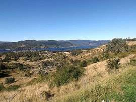 D'Aguilar Range and Somerset Dam along Esk Kilcoy Road, 2015 | |||||||||||||
 Hazeldean | |||||||||||||
| Coordinates | 27°2′S 152°33′E / 27.033°S 152.550°ECoordinates: 27°2′S 152°33′E / 27.033°S 152.550°E | ||||||||||||
| Population | 267 (2011 census)[1] | ||||||||||||
| Postcode(s) | 4515 | ||||||||||||
| LGA(s) | Somerset Region | ||||||||||||
| State electorate(s) | Nanango | ||||||||||||
| Federal Division(s) | Blair | ||||||||||||
| |||||||||||||
Hazeldean is a large locality in the Somerset Region, Queensland, Australia. At the 2011 Australian Census the population of Hazeldean was 267.[1]
Somerset Dam occupies the east of Hazeldean. Western parts are elevated and remain mostly vegetated. In the south is Deer Reserve National Park and towards the north is Deer Reserve State Forest. A strip between the dam and the mountains is mostly rural-residential.
Lake Somerset Holiday Park is a large park on the edge of Somerset Dam which offers a range of accommodation including cabins and camping.
References
- 1 2 Australian Bureau of Statistics (31 October 2012). "Hazeldean (State Suburb)". 2011 Census QuickStats. Retrieved 21 August 2015.
External links
![]() Media related to Hazeldean, Queensland at Wikimedia Commons
Media related to Hazeldean, Queensland at Wikimedia Commons
This article is issued from Wikipedia - version of the 7/19/2016. The text is available under the Creative Commons Attribution/Share Alike but additional terms may apply for the media files.