Harris, Minnesota
| Harris, Minnesota | |
|---|---|
| City | |
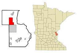 Location of the city of Harris within Chisago County, Minnesota | |
| Coordinates: 45°35′37″N 92°58′49″W / 45.59361°N 92.98028°W | |
| Country | United States |
| State | Minnesota |
| County | Chisago |
| Government | |
| • Mayor | Diane Miller |
| Area[1] | |
| • Total | 20.06 sq mi (51.96 km2) |
| • Land | 19.94 sq mi (51.64 km2) |
| • Water | 0.12 sq mi (0.31 km2) |
| Elevation | 906 ft (276 m) |
| Population (2010)[2] | |
| • Total | 1,132 |
| • Estimate (2012[3]) | 1,125 |
| • Density | 56.8/sq mi (21.9/km2) |
| Time zone | Central (CST) (UTC-6) |
| • Summer (DST) | CDT (UTC-5) |
| ZIP code | 55032 |
| Area code(s) | 651 |
| FIPS code | 27-27278[4] |
| GNIS feature ID | 0644685[5] |
| Website | www.harrismn.com |
Harris is a city in Chisago County, Minnesota, United States. The population was 1,132 at the 2010 census.[6] There is a restaurant named Kafe Stuga, a post office, a bar and grill, and tattoo shop, among other businesses. Interstate 35 serves as a main route for the community.
Geography
According to the United States Census Bureau, the city has a total area of 20.06 square miles (51.96 km2), of which, 19.94 square miles (51.64 km2) is land and 0.12 square miles (0.31 km2) is water.[1]
History
Harris was platted in 1873, and incorporated as a city in 1882.[7] It was named after Philip S. Harris, an officer of the St. Paul and Duluth Railroad Company.[7] A post office has been in operation in Harris since 1874.[8]
Demographics
| Historical population | |||
|---|---|---|---|
| Census | Pop. | %± | |
| 1890 | 504 | — | |
| 1900 | 710 | 40.9% | |
| 1910 | 673 | −5.2% | |
| 1920 | 672 | −0.1% | |
| 1930 | 584 | −13.1% | |
| 1940 | 609 | 4.3% | |
| 1950 | 569 | −6.6% | |
| 1960 | 552 | −3.0% | |
| 1970 | 559 | 1.3% | |
| 1980 | 678 | 21.3% | |
| 1990 | 843 | 24.3% | |
| 2000 | 1,121 | 33.0% | |
| 2010 | 1,132 | 1.0% | |
| Est. 2015 | 1,125 | [9] | −0.6% |
2010 census
As of the census[2] of 2010, there were 1,132 people, 423 households, and 315 families residing in the city. The population density was 56.8 inhabitants per square mile (21.9/km2). There were 449 housing units at an average density of 22.5 per square mile (8.7/km2). The racial makeup of the city was 97.3% White, 0.9% African American, 0.9% Native American, 0.1% Asian, 0.3% from other races, and 0.6% from two or more races. Hispanic or Latino of any race were 1.6% of the population.
There were 423 households of which 32.6% had children under the age of 18 living with them, 60.8% were married couples living together, 6.6% had a female householder with no husband present, 7.1% had a male householder with no wife present, and 25.5% were non-families. 20.1% of all households were made up of individuals and 7.1% had someone living alone who was 65 years of age or older. The average household size was 2.66 and the average family size was 3.02.
The median age in the city was 41.8 years. 22.7% of residents were under the age of 18; 7.7% were between the ages of 18 and 24; 25.9% were from 25 to 44; 32% were from 45 to 64; and 11.7% were 65 years of age or older. The gender makeup of the city was 53.1% male and 46.9% female.
2000 census
As of the census[4] of 2000, there were 1,121 people, 377 households, and 286 families residing in the city. The population density was 56.7 people per square mile (21.9/km²). There were 393 housing units at an average density of 19.9 per square mile (7.7/km²). The racial makeup of the city was 97.77% White, 0.36% African American, 0.45% Native American, 0.27% Asian, 0.54% from other races, and 0.62% from two or more races. Hispanic or Latino of any race were 1.52% of the population.
There were 377 households out of which 42.7% had children under the age of 18 living with them, 63.4% were married couples living together, 6.4% had a female householder with no husband present, and 23.9% were non-families. 19.6% of all households were made up of individuals and 8.5% had someone living alone who was 65 years of age or older. The average household size was 2.97 and the average family size was 3.37.
In the city the population was spread out with 32.7% under the age of 18, 6.7% from 18 to 24, 33.0% from 25 to 44, 19.5% from 45 to 64, and 8.0% who were 65 years of age or older. The median age was 34 years. For every 100 females there were 114.3 males. For every 100 females age 18 and over, there were 111.2 males.
The median income for a household in the city was $49,545, and the median income for a family was $51,719. Males had a median income of $37,917 versus $25,703 for females. The per capita income for the city was $18,258. About 1.8% of families and 4.9% of the population were below the poverty line, including 3.5% of those under age 18 and 15.6% of those age 65 or over.
Notable people
- Charles A. Peterson, Wisconsin State Assemblyman, was born in Harris.[11]
Notes
- 1 2 "US Gazetteer files 2010". United States Census Bureau. Retrieved 2012-11-13.
- 1 2 "American FactFinder". United States Census Bureau. Retrieved 2012-11-13.
- ↑ "Population Estimates". United States Census Bureau. Retrieved 2013-05-28.
- 1 2 "American FactFinder". United States Census Bureau. Retrieved 2008-01-31.
- ↑ "US Board on Geographic Names". United States Geological Survey. 2007-10-25. Retrieved 2008-01-31.
- ↑ "2010 Census Redistricting Data (Public Law 94-171) Summary File". American FactFinder. U.S. Census Bureau, 2010 Census. Retrieved 23 April 2011.
- 1 2 Upham, Warren (1920). Minnesota Geographic Names: Their Origin and Historic Significance. Minnesota Historical Society. p. 108.
- ↑ "Chisago County". Jim Forte Postal History. Retrieved 19 April 2015.
- ↑ "Annual Estimates of the Resident Population for Incorporated Places: April 1, 2010 to July 1, 2015". Retrieved July 2, 2016.
- ↑ "Census of Population and Housing". Census.gov. Retrieved June 4, 2015.
- ↑ Database
References
- Chisago County Bicentennial Committee (1976). “An early look at Chisago County”, Review Corporation, North Branch, Minnesota.
- Edwards, Elijah Evan and Folsom, William Hanery Carman (1888). "Fifty Years in the Northwest: With and Introduction and Appendix Containing Reminiscenses, Incidents and Notes", Pioneer Press Co.
- Harris Centennial Committee (1984). “Harris Centennial: 1884-1984”, Coordinated by: Irene Martinson and Inez Hanson, Review Corporation, North Branch, Minnesota.
Municipalities and communities of Chisago County, Minnesota, United States | ||
|---|---|---|
| Cities | 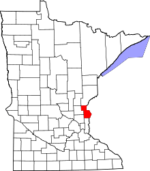 | |
| Townships | ||
| Unincorporated communities | ||
Coordinates: 45°35′11″N 92°58′29″W / 45.58639°N 92.97472°W