Lindstrom, Minnesota
| Lindstrom, Minnesota | |
|---|---|
| City | |
|
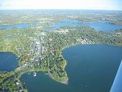
Aerial view of the town of Lindström | |
| Motto: America's Little Sweden | |
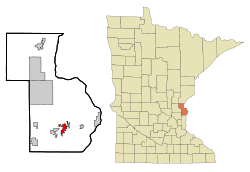 Location of the city of Lindström within Chisago County, Minnesota | |
| Coordinates: 45°23′16″N 92°50′38″W / 45.38778°N 92.84389°W | |
| Country | United States |
| State | Minnesota |
| County | Chisago |
| Area[1] | |
| • Total | 3.69 sq mi (9.56 km2) |
| • Land | 3.60 sq mi (9.32 km2) |
| • Water | 0.09 sq mi (0.23 km2) |
| Elevation | 925 ft (282 m) |
| Population (2010)[2] | |
| • Total | 4,442 |
| • Estimate (2012[3]) | 4,408 |
| • Density | 1,233.9/sq mi (476.4/km2) |
| Time zone | Central (CST) (UTC-6) |
| • Summer (DST) | CDT (UTC-5) |
| ZIP code | 55045 |
| Area code(s) | 651 |
| FIPS code | 27-37304[4] |
| GNIS feature ID | 0646720[5] |
| Website | www.lindstrom.mn.org |
Lindstrom, officially spelled Lindström,[6] is a city in Chisago County, Minnesota, United States, located 35 miles northeast of the Twin Cities. The population was 4,442 at the 2010 census.[7] Lindström's motto is America's Little Sweden. U.S. Highway 8 serves as a main route for the community. The ö in the city's name is derived from the Swedish language.
Geography
According to the United States Census Bureau, the city has a total area of 3.69 square miles (9.56 km2), of which, 3.60 square miles (9.32 km2) is land and 0.09 square miles (0.23 km2) is water.[1]
Lindström is located 10 miles from the Wisconsin state line, and less than two hours from cities including Duluth, St. Cloud, and the Twin Cities area. When looking at the town from above, it looks like it could be an island due to the surrounding lakes.
History
In 1853, Daniel Lindström left Sweden in search of a nice piece of land to settle in America. Lindström was platted in 1880.[8] The town of Lindström was incorporated in 1894. Many other Swedish emigrants traveled with Daniel Lindström. Joris Per Anderson, half brother to Daniel Lindström, came in 1850 leading a party from Hassela, Sweden. In the party was Erik Norelius, whose personal journals in part formed the basis of Vilhelm Moberg’s novels of the Swedish emigration to the United States, The Emigrants. Moberg's novels have two main characters, Karl Oskar and Kristina Nilsson. The novels depict the hardships Swedish emigrants endured en route to America. A bronze statue of the author, holding his bicycle as if ready to ride away, stands on a stepped platform in Chisago City’s town park. An image of Karl Oskar and Kristina remains Lindström’s logo today. Since 1990, anyone who has taken U.S. Highway 8 from north of Forest Lake to Lindstrom has driven on the Moberg Trail.[9]
Lindström celebrates Karl Oskar and Kristina annually with Karl Oskar Days. This event takes place mid-July and includes such activities as the coronation of a "Karl Oskar Princess", parades, a street dance, and fireworks. There are still statues of Karl Oskar and Kristina in Lindström, as a tribute to the early Swedish immigrants whose descendants continue to populate the area. These statues are the main attraction for tourists from all over the world who come to Lindström because of its Swedish heritage.[10]
Lindström was settled predominantly by Swedish immigrants and their families.
In April 2015, Minnesota Governor Mark Dayton signed an executive order to restore the "umlauts" (ö) over the "o" on the Lindström city limits sign. The sign will now match the spelling on the sign that officially welcomes visitors to the town.[11]
Education
Lindström is part of the Chisago Lakes School District #2144. There are five schools in the area, which accommodate around 3,600 students in grades K–12. The five schools in the district include Primary School (Grades K–2), Lakeside School (Grades 3–5), Taylors Falls Elementary (Grades K–5), Chisago Lakes Middle School (Grades 6–8), and Chisago Lakes High School (Grades 9–12).
Demographics
| Historical population | |||
|---|---|---|---|
| Census | Pop. | %± | |
| 1900 | 395 | — | |
| 1910 | 522 | 32.2% | |
| 1920 | 523 | 0.2% | |
| 1930 | 561 | 7.3% | |
| 1940 | 637 | 13.5% | |
| 1950 | 729 | 14.4% | |
| 1960 | 835 | 14.5% | |
| 1970 | 1,260 | 50.9% | |
| 1980 | 1,972 | 56.5% | |
| 1990 | 2,461 | 24.8% | |
| 2000 | 3,015 | 22.5% | |
| 2010 | 4,442 | 47.3% | |
| Est. 2015 | 4,401 | [12] | −0.9% |
| U.S. Decennial Census | |||
2010 census
As of the census[2] of 2010, there were 4,442 people, 1,774 households, and 1,265 families residing in the city. The population density was 1,233.9 inhabitants per square mile (476.4/km2). There were 1,943 housing units at an average density of 539.7 per square mile (208.4/km2). The racial makeup of the city was 97.0% White, 0.4% African American, 0.2% Native American, 0.6% Asian, 0.3% from other races, and 1.4% from two or more races. Hispanic or Latino of any race were 1.2% of the population.
There were 1,774 households of which 34.2% had children under the age of 18 living with them, 56.9% were married couples living together, 9.9% had a female householder with no husband present, 4.6% had a male householder with no wife present, and 28.7% were non-families. 23.5% of all households were made up of individuals and 11.5% had someone living alone who was 65 years of age or older. The average household size was 2.50 and the average family size was 2.96.
The median age in the city was 39.1 years. 25.8% of residents were under the age of 18; 5.6% were between the ages of 18 and 24; 26.7% were from 25 to 44; 25.5% were from 45 to 64; and 16.2% were 65 years of age or older. The gender makeup of the city was 49.9% male and 50.1% female.
2000 census
As of the census[4] of 2000, there were 3,015 people, 1,225 households, and 855 families residing in the city. The population density was 1,332.1 people per square mile (515.1/km²). There were 1,322 housing units at an average density of 584.1 per square mile (225.9/km²). The racial makeup of the city was 97.61% White, 0.20% African American, 0.36% Native American, 0.50% Asian, 0.56% from other races, and 0.76% from two or more races. Hispanic or Latino of any race were 1.13% of the population. 25.1% were of German, 22.8% Swedish, 12.8% Norwegian, 7.9% French and 6.3% Irish ancestry according to Census 2000. 100.0% spoke English as their first language.
There were 1,225 households out of which 31.1% had children under the age of 18 living with them, 58.4% were married couples living together, 8.2% had a female householder with no husband present, and 30.2% were non-families. 25.7% of all households were made up of individuals and 13.6% had someone living alone who was 65 years of age or older. The average household size was 2.46 and the average family size was 2.95.
In the city the population was spread out with 26.0% under the age of 18, 6.8% from 18 to 24, 26.5% from 25 to 44, 22.5% from 45 to 64, and 18.1% who were 65 years of age or older. The median age was 39 years. For every 100 females there were 95.8 males. For every 100 females age 18 and over, there were 90.7 males.
The median income for a household in the city was $44,980, and the median income for a family was $50,519. Males had a median income of $42,604 versus $28,163 for females. The per capita income for the city was $21,195. About 5.7% of families and 8.0% of the population were below the poverty line, including 8.6% of those under age 18 and 13.9% of those age 65 or over.
Sister cities
See also
References
- 1 2 "US Gazetteer files 2010". United States Census Bureau. Archived from the original on 2012-01-24. Retrieved 2012-11-13.
- 1 2 "American FactFinder". United States Census Bureau. Retrieved 2012-11-13.
- ↑ "Population Estimates". United States Census Bureau. Archived from the original on 2013-06-17. Retrieved 2013-05-28.
- 1 2 "American FactFinder". United States Census Bureau. Archived from the original on 2013-09-11. Retrieved 2008-01-31.
- ↑ "US Board on Geographic Names". United States Geological Survey. 2007-10-25. Retrieved 2008-01-31.
- ↑ Julie Bosman (2015-04-16). "Lindström Loses Umlauts on Road Signs, and the Town is Dotted With Displeasure". The New York Times. Retrieved 2015-07-14.
- ↑ "2010 Census Redistricting Data (Public Law 94-171) Summary File". American FactFinder. U.S. Census Bureau, 2010 Census. Archived from the original on 21 July 2011. Retrieved 23 April 2011.
- ↑ Upham, Warren (1920). Minnesota Geographic Names: Their Origin and Historic Significance. Minnesota Historical Society. p. 108.
- ↑ Lindström's Larger than Life Couple (by Moira F. Harris.Monumental Minnesota: A Guide to Outdoor Sculpture (Pogo Press, 1992)
- ↑ Events/all.htmlCultural Events in the Community
- ↑ http://www.startribune.com/politics/national/299890591.html
- ↑ "Annual Estimates of the Resident Population for Incorporated Places: April 1, 2010 to July 1, 2015". Retrieved July 2, 2016.
External links
- City of Lindstrom
- Lindstrom Community Profile
- Vilhelm Moberg
- Lindstrom, Minnesota at the Minnesota Historical Society.
- Karl Oskar Days 2012
Municipalities and communities of Chisago County, Minnesota, United States | ||
|---|---|---|
| Cities | 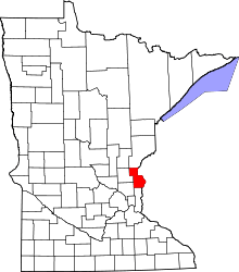 | |
| Townships | ||
| Unincorporated communities | ||
Coordinates: 45°23′22″N 92°50′53″W / 45.38944°N 92.84806°W