Hardenville, Missouri
| Hardenville, Missouri | |
|---|---|
| Community | |
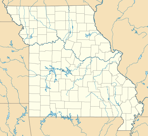 Hardenville, Missouri Location of Hardenville, Missouri | |
| Coordinates: 36°35′20″N 92°22′15″W / 36.58889°N 92.37083°WCoordinates: 36°35′20″N 92°22′15″W / 36.58889°N 92.37083°W[1] | |
| Country | U. S. A. |
| State | Missouri |
| County | Ozark County |
| Elevation[1] | 294 m (965 ft) |
| Time zone | CST (UTC-6) |
| • Summer (DST) | CDT (UTC-5) |
Hardenville is an unincorporated community in eastern Ozark County in southern Missouri.[2] It is located on U.S. Highway 160 about five miles east of Gainesville and five miles west of Tecumseh which is at the north end of Norfork Lake. The community is located on an Ozark ridge at an elevation of 963 feet (294 m).[1]
The Hardenville post office (zip code 65666) was established in 1921.[3] George S. Harden, an early postmaster, gave the community his last name.[4]
References
- 1 2 3 Udall Quadrangle, Missouri–Ozark County, 7.5 Minute Series, USGS, 1968
- ↑ U.S. Geological Survey Geographic Names Information System: Hardenville
- ↑ Post Offices in Ozark County, MO
- ↑ "Ozark County Place Names, 1928–1945". The State Historical Society of Missouri. Archived from the original on June 24, 2016. Retrieved November 27, 2016.
External links
Municipalities and communities of Ozark County, Missouri, United States | ||
|---|---|---|
| Cities | 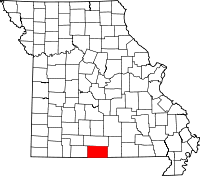 | |
| Villages | ||
| Townships |
| |
| CDPs | ||
| Other unincorporated communities | ||
| Ghost towns | ||
This article is issued from Wikipedia - version of the 11/28/2016. The text is available under the Creative Commons Attribution/Share Alike but additional terms may apply for the media files.