Harbour Heights, Florida
| Harbour Heights, Florida | |
|---|---|
| Census-designated place | |
 Location in Charlotte County and the state of Florida | |
| Coordinates: 26°59′25″N 82°0′19″W / 26.99028°N 82.00528°WCoordinates: 26°59′25″N 82°0′19″W / 26.99028°N 82.00528°W | |
| Country |
|
| State |
|
| County | Charlotte |
| Area | |
| • Total | 2.4 sq mi (6.3 km2) |
| • Land | 2.2 sq mi (5.6 km2) |
| • Water | 0.3 sq mi (0.7 km2) |
| Elevation | 10 ft (3 m) |
| Population (2010) | |
| • Total | 2,987 |
| • Density | 1,378/sq mi (532.2/km2) |
| Time zone | Eastern (EST) (UTC-5) |
| • Summer (DST) | EDT (UTC-4) |
| FIPS code | 12-28800[1] |
| GNIS feature ID | 0283722[2] |
Harbour Heights is a census-designated place (CDP) in Charlotte County, Florida, United States. The population was 2,987 at the 2010 census.[3] It is part of the Punta Gorda Metropolitan Statistical Area.
Geography
Harbour Heights is located in northern Charlotte County at 26°59′25″N 82°0′19″W / 26.99028°N 82.00528°W (26.990210, -82.005325),[4] on the northwest side of the Peace River. Harbor View Road connects the community to Interstate 75, 1 mile (1.6 km) to the southwest. Punta Gorda, the Charlotte County seat, is 6 miles (10 km) to the southwest on the south side of the Peace River.
According to the United States Census Bureau, the Harbour Heights CDP has a total area of 2.4 square miles (6.3 km2), of which 2.2 square miles (5.6 km2) is land and 0.27 square miles (0.7 km2), or 11.19%, is water.[3]
Demographics
As of the census[1] of 2000, there were 2,873 people, 1,243 households, and 919 families residing in the CDP. The population density was 1,308.2 people per square mile (504.2/km²). There were 1,383 housing units at an average density of 629.8/sq mi (242.7/km²). The racial makeup of the CDP was 93.70% White, 2.85% African American, 0.03% Native American, 0.77% Asian, 0.07% Pacific Islander, 0.73% from other races, and 1.84% from two or more races. Hispanic or Latino of any race were 3.83% of the population.
There were 1,243 households out of which 21.0% had children under the age of 18 living with them, 62.8% were married couples living together, 8.2% had a female householder with no husband present, and 26.0% were non-families. 20.8% of all households were made up of individuals and 12.8% had someone living alone who was 65 years of age or older. The average household size was 2.31 and the average family size was 2.64.
In the CDP the population was spread out with 18.2% under the age of 18, 4.7% from 18 to 24, 19.2% from 25 to 44, 27.0% from 45 to 64, and 30.9% who were 65 years of age or older. The median age was 51 years. For every 100 females there were 87.7 males. For every 100 females age 18 and over, there were 86.0 males.
The median income for a household in the CDP was $44,394, and the median income for a family was $47,025. Males had a median income of $31,825 versus $21,173 for females. The per capita income for the CDP was $22,547. About 1.8% of families and 2.7% of the population were below the poverty line, including none of those under age 18 and 3.7% of those age 65 or over.
References
- 1 2 "American FactFinder". United States Census Bureau. Retrieved 2008-01-31.
- ↑ "US Board on Geographic Names". United States Geological Survey. 2007-10-25. Retrieved 2008-01-31.
- 1 2 "Geographic Identifiers: 2010 Demographic Profile Data (G001): Harbour Heights CDP, Florida". U.S. Census Bureau, American Factfinder. Retrieved June 25, 2014.
- ↑ "US Gazetteer files: 2010, 2000, and 1990". United States Census Bureau. 2011-02-12. Retrieved 2011-04-23.
Municipalities and communities of Charlotte County, Florida, United States | ||
|---|---|---|
| City | 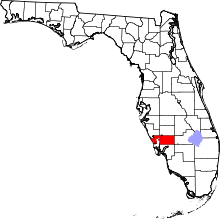 | |
| CDPs | ||
| Unincorporated communities | ||
| Footnotes | ‡This populated place also has portions in an adjacent county or counties | |