Rotonda West, Florida
| Rotonda West, Florida Rotonda | |
|---|---|
| Census-designated place & Unincorporated community | |
 | |
 Location in Charlotte County and the state of Florida | |
| Country |
|
| State |
|
| County | Charlotte |
| Area | |
| • Total | 11.5 sq mi (29.9 km2) |
| • Land | 10.7 sq mi (27.6 km2) |
| • Water | 0.9 sq mi (2.3 km2) |
| Population (2010) | |
| • Total | 8,759 |
| • Density | 823/sq mi (317.8/km2) |
| Time zone | Eastern Time |
| Area code(s) | 941 |
Rotonda West is an unincorporated, deed-restricted community situated in west Charlotte County, Florida, United States. The U.S. Census Bureau lists it as the Rotonda census-designated place, with a population of 8,759 at the 2010 census.[1] It is part of the Punta Gorda Metropolitan Statistical Area. It was developed and named Rotonda West by Cavanagh Communities Corporation, the developers of a projected but now defunct community named Rotonda in southern Martin County and northern Palm Beach County.[2]
Geography
Rotonda West is located at 26°53′16″N 82°16′17″W / 26.887875°N 82.271262°WCoordinates: 26°53′16″N 82°16′17″W / 26.887875°N 82.271262°W.[3]
According to the United States Census Bureau, the Rotonda CDP has a total area of 11.5 square miles (29.9 km2), of which 10.7 square miles (27.6 km2) is land and 0.89 square miles (2.3 km2), or 7.74%, is water.[1]
Public schools
Rotonda West falls within the Charlotte County Public School district. Two schools are found inside the Rotonda West area: L.A. Ainger Middle School[4] and Vineland Elementary School.[5] Both schools have received an A from the state more than five years in a row.[6]
Center of Rotonda
There is a large park inside the center of Rotonda West with a playground, tennis courts, and a walking path. There is also a designated area where people can pay to park boats, trailers, and RVs. There is also a massive wastewater treatment plant next to the RV & Boat Parking.
Climate
Located in southwest Florida on the Gulf Coast, the weather usually stays relatively mild. In the summer, it is common for temperatures to reach the mid-90s, but this is tempered by sea breezes from the Gulf. At night in the summer, temperatures quickly drop to the low to mid 70s. However, due to the high humidity levels and lack of breeze, it tends to feel much hotter. In the winter, hard freezes are rare. It is more common to have frost on the ground briefly in pre-dawn hours, but it melts shortly after sunrise. Temperatures average 50 - 70 degrees during the winter.
Summer thunderstorms are not uncommon. The dry season is in the spring.
Demographics
As of the census[7] of 2000, there were 6,574 people, 3,181 households, and 2,287 families residing in the CDP. The population density was 597.4 people per square mile (230.7/km²). There were 3,961 housing units at an average density of 359.9/sq mi (139.0/km²). The racial makeup of the CDP was 98.16% White, 0.44% African American, 0.23% Native American, 0.35% Asian, 0.32% from other races, and 0.50% from two or more races. Hispanic or Latino of any race were 1.34% of the population.
There were 3,181 households out of which 11.4% had children under the age of 18 living with them, 66.3% were married couples living together, 4.0% had a female householder with no husband present, and 28.1% were non-families. 24.5% of all households were made up of individuals and 18.0% had someone living alone who was 65 years of age or older. The average household size was 2.05 and the average family size was 2.39.
In the CDP the population was spread out with 11.0% under the age of 18, 2.9% from 18 to 24, 12.3% from 25 to 44, 29.1% from 45 to 64, and 44.7% who were 65 years of age or older. The median age was 63 years. For every 100 females there were 89.7 males. For every 100 females age 18 and over, there were 88.8 males.
The median income for a household in the CDP was $38,636, and the median income for a family was $43,844. Males had a median income of $28,046 versus $18,616 for females. The per capita income for the CDP was $21,437. About 1.7% of families and 4.0% of the population were below the poverty line, including 6.5% of those under age 18 and 2.7% of those age 65 or over.
Notable person
- Luke Halpin, actor
References
- 1 2 "Geographic Identifiers: 2010 Demographic Profile Data (G001): Rotonda CDP, Florida". U.S. Census Bureau, American Factfinder. Retrieved November 8, 2012.
- ↑ |Early Facts About Rotonda West by Jack Alexander
- ↑ "US Gazetteer files: 2010, 2000, and 1990". United States Census Bureau. 2011-02-12. Retrieved 2011-04-23.
- ↑ "L.A. Ainger Middle School". Charlotte County Public Schools. Archived from the original on 2008-06-11. Retrieved 2008-09-01.
- ↑ "Vineland Elementary". Charlotte County Public Schools. Archived from the original on 2008-05-17. Retrieved 2008-09-01.
- ↑ "School Accountability Reports". Florida Department of Education. Retrieved 2008-09-02.
- ↑ "American FactFinder". United States Census Bureau. Retrieved 2008-01-31.
External links
Municipalities and communities of Charlotte County, Florida, United States | ||
|---|---|---|
| City | 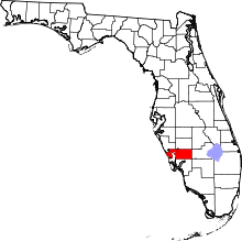 | |
| CDPs | ||
| Unincorporated communities | ||
| Footnotes | ‡This populated place also has portions in an adjacent county or counties | |