Haraz River
| Haraz | |
|---|---|
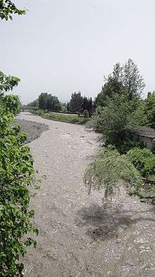 Haraz River in Amol County in Spring. | |
| Country | Iran |
| Basin | |
| Main source |
Central Alborz ≈ 3,500 m (11,500 ft) |
| River mouth |
Caspian Sea ≈ −25 m (−82 ft) |
| Physical characteristics | |
| Length | ≈ 150 km (93 mi) |
The Haraz River (Persian: هراز) is a notable river flowing through the Mazandaran Province of northern Iran. It flows northwards, from the Alborz mountain range into the Caspian Sea.
Geography
Course
The Haraz River originates at the foot of Mount Damavand in Larijan District, the highest peak of the Alborz Range. From its mountain source, it flows down into the Haraz River Valley, into the city of Amol, and onto its river mouth in the southern Caspian Sea between the towns of Fereydoon Kenar in Fereydunkenar County and Mahmood Abad in Mahmudabad County.
Haraz River Valley
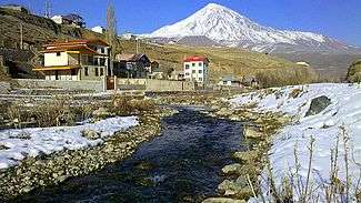
Road 77 (Haraz Road) follows the river over the Hashem Pass and through the valley, and is the most important road from Tehran to the Caspian coast. It also provides access to Lar National Park, and is the nearest road to Mount Damavand, which at 5,610 metres (18,410 ft) is the highest peak in Iran and the Middle East region.
Central Alborz mountain range map
| Map of central Alborz | Peaks: | 1 `Alam Kūh |
|---|---|---|
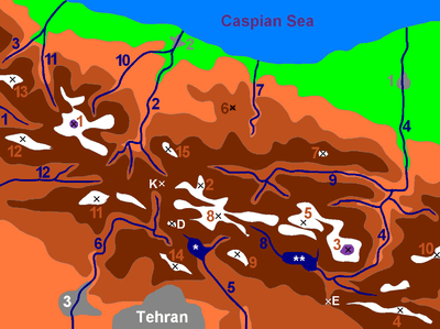 -25 to 500 m 500 to 1500 m 1500 to 2500 m 2500 to 3500 m 3500 to 4500 m 4500 to 5671 m |
2 Āzād Kūh | 3 Damāvand |
| 4 Do Berar | 5 Do Khaharan | |
| 6 Ghal`eh Gardan | 7 Gorg | |
| 8 Kholeno | 9 Mehr Chal | |
| 10 Mīšīneh Marg | 11 Naz | |
| 12 Shah Alborz | 13 Sīālān | |
| 14 Tochal | 15 Varavašt | |
| Rivers: | 0 | |
| 1 Alamūt | 2 Chālūs | |
| 3 Do Hezār | 4 Harāz | |
| 5 Jājrūd | 6 Karaj | |
| 7 Kojūr | 8 Lār | |
| 9 Nūr | 10 Sardāb | |
| 11 Seh Hazār | 12 Shāh Rūd | |
| Cities: | 1 Āmol | |
| 2 Chālūs | 3 Karaj | |
| Other: | D Dīzīn | |
| E Emāmzādeh Hāšem | K Kandovān Tunnel | |
| * Latīān Dam | ** Lār Dam |
See also
- Alborz (Elburz) mountain range topics
- Tributaries of the Caspian Sea
References
External links
-
 Media related to category:Haraz River at Wikimedia Commons
| Lake Urmia basin |
|
|---|---|
| Persian Gulf basin | |
| Oman sea basin | |
| Caspian basin | |
| Gavkhouni basin | |
| Namak Lake basin | |
| Hamun-e Jaz Murian basin | |