Shah Alborz
| Shah Alborz | |
|---|---|
 | |
| Highest point | |
| Elevation | 4,200 m (13,800 ft) |
| Coordinates | 36°19′N 50°45′E / 36.317°N 50.750°ECoordinates: 36°19′N 50°45′E / 36.317°N 50.750°E |
| Geography | |
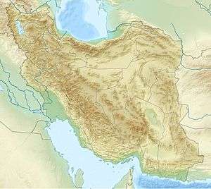 Shah Alborz Border of Tehran and Qazvīn Province, Iran | |
| Parent range | Alborz |
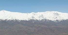
Shah Alborz is a mountain peak in Alborz range in Iran. At an elevation of 4,200 metres (13,800 ft)[1] it is the highest peak in the range. Its north face rises from the Alamout valley, to the south lies the Taleghan Valley and to the west, the plains of east-Ghazvin. Parts of the north face are covered by the Shah Alborz glacier at elevations of 3,400 to 3,600 metres (11,200 to 11,800 ft).[2]
| Map of central Alborz | Peaks: | 1 `Alam Kūh |
|---|---|---|
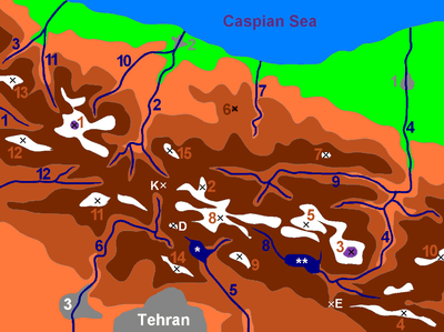 -25 to 500 m 500 to 1500 m 1500 to 2500 m 2500 to 3500 m 3500 to 4500 m 4500 to 5671 m |
2 Āzād Kūh | 3 Damāvand |
| 4 Do Berar | 5 Do Khaharan | |
| 6 Ghal`eh Gardan | 7 Gorg | |
| 8 Kholeno | 9 Mehr Chal | |
| 10 Mīšīneh Marg | 11 Naz | |
| 12 Shah Alborz | 13 Sīālān | |
| 14 Tochal | 15 Varavašt | |
| Rivers: | 0 | |
| 1 Alamūt | 2 Chālūs | |
| 3 Do Hezār | 4 Harāz | |
| 5 Jājrūd | 6 Karaj | |
| 7 Kojūr | 8 Lār | |
| 9 Nūr | 10 Sardāb | |
| 11 Seh Hazār | 12 Shāh Rūd | |
| Cities: | 1 Āmol | |
| 2 Chālūs | 3 Karaj | |
| Other: | D Dīzīn | |
| E Emāmzādeh Hāšem | K Kandovān Tunnel | |
| * Latīān Dam | ** Lār Dam |
Climbing
The level of difficulty is "walk-up" and the nearest center is Taleghan. The best months to climb the mountain are from March to September.[1] The most often-used route to the peak passes through the Hasanjoon valley.[3]
References
- 1 2 "Shah Alborz". Peakware World Mountain Encyclopedia. Interactive Outdoors, Inc. Retrieved 2007-07-31.
- ↑ "Shah Alborz (King Alborz)". SummitPost.org. Retrieved 2007-07-31.
|first1=missing|last1=in Authors list (help) - ↑ "Mount Shah Alborz". MountainZone.ir. Retrieved 2007-07-31.
This article is issued from Wikipedia - version of the 8/8/2015. The text is available under the Creative Commons Attribution/Share Alike but additional terms may apply for the media files.