Hallsville, Missouri
| Hallsville, Missouri | |
|---|---|
| City | |
 Location of Hallsville, Missouri | |
| Coordinates: 39°7′1″N 92°13′14″W / 39.11694°N 92.22056°WCoordinates: 39°7′1″N 92°13′14″W / 39.11694°N 92.22056°W | |
| Country | United States |
| State | Missouri |
| County | Boone |
| Government | |
| • Mayor | Cheri Reisch [1] |
| Area[2] | |
| • Total | 1.33 sq mi (3.44 km2) |
| • Land | 1.33 sq mi (3.44 km2) |
| • Water | 0 sq mi (0 km2) |
| Elevation | 902 ft (275 m) |
| Population (2010)[3] | |
| • Total | 1,491 |
| • Estimate (2012[4]) | 1,532 |
| • Density | 1,121.1/sq mi (432.9/km2) |
| Time zone | Central (CST) (UTC-6) |
| • Summer (DST) | CDT (UTC-5) |
| ZIP code | 65255 |
| Area code(s) | 573 |
| FIPS code | 29-29998[5] |
| GNIS feature ID | 0750202[6] |
| Website | City of Hallsville |
Hallsville is a city in Boone County, Missouri, United States. It is part of the Columbia, Missouri Metropolitan Statistical Area. The population was 1,491 at the 2010 census.
History
Hallsville was laid out in 1866. It was named for its first postmaster, Judge John W. Hall.[7] The town was not platted originally, having grown naturally at a crossroads around a store and blacksmith. The railroad platted the town of Hickman and installed a depot a half mile south, but Hallsville grew and Hickman did not.[8] Colonel William F. Switzler reported that in 1882, Hallsville contained five stores, one harness shop and one blacksmith shop, but no church or school house yet. The population was 65.[8]
During the Civil War, on 22 September 1863, the Mount Zion Church east of Hallsville was burned by northern troops. According to one claim by Colonel William Switzler, this was because Iowa Lieutenant Hartman found the church to be a "bushwhacker's nest." The church was rebuilt in 1861, torn down and rebuilt in 1903, and still stands.[8][9]
Geography
Hallsville is located at 39°7′1″N 92°13′14″W / 39.11694°N 92.22056°W (39.116956, -92.220571).[10] According to the United States Census Bureau, the city has a total area of 1.33 square miles (3.44 km2), all of it land.[2]
Demographics
| Historical population | |||
|---|---|---|---|
| Census | Pop. | %± | |
| 1880 | 60 | — | |
| 1890 | 92 | 53.3% | |
| 1900 | 157 | 70.7% | |
| 1910 | 195 | 24.2% | |
| 1920 | 225 | 15.4% | |
| 1930 | 212 | −5.8% | |
| 1940 | 224 | 5.7% | |
| 1950 | 225 | 0.4% | |
| 1960 | 363 | 61.3% | |
| 1970 | 790 | 117.6% | |
| 1980 | 850 | 7.6% | |
| 1990 | 917 | 7.9% | |
| 2000 | 978 | 6.7% | |
| 2010 | 1,491 | 52.5% | |
| Est. 2015 | 1,551 | [11] | 4.0% |
2010 census
As of the census[3] of 2010, there were 1,491 people, 586 households, and 397 families residing in the city. The population density was 1,121.1 inhabitants per square mile (432.9/km2). There were 615 housing units at an average density of 462.4 per square mile (178.5/km2). The racial makeup of the city was 96.8% White, 0.9% African American, 0.1% Native American, 0.1% Pacific Islander, 0.4% from other races, and 1.7% from two or more races. Hispanic or Latino of any race were 1.6% of the population.
There were 586 households of which 41.8% had children under the age of 18 living with them, 48.6% were married couples living together, 14.0% had a female householder with no husband present, 5.1% had a male householder with no wife present, and 32.3% were non-families. 27.0% of all households were made up of individuals and 12% had someone living alone who was 65 years of age or older. The average household size was 2.53 and the average family size was 3.06.
The median age in the city was 34.7 years. 30.8% of residents were under the age of 18; 5.5% were between the ages of 18 and 24; 28.5% were from 25 to 44; 22.2% were from 45 to 64; and 12.9% were 65 years of age or older. The gender makeup of the city was 47.8% male and 52.2% female.
2000 census
As of the census[5] of 2000, there were 978 people, 404 households, and 275 families residing in the city. The population density was 1,334.2 people per square mile (517.3/km²). There were 439 housing units at an average density of 598.9 per square mile (232.2/km²). The racial makeup of the city was 96.42% White, 1.53% African American, 0.61% Native American, 0.31% from other races, and 1.12% from two or more races. Hispanic or Latino of any race were 0.72% of the population.
There were 404 households out of which 37.6% had children under the age of 18 living with them, 52.7% were married couples living together, 12.4% had a female householder with no husband present, and 31.9% were non-families. 28.0% of all households were made up of individuals and 12.4% had someone living alone who was 65 years of age or older. The average household size was 2.42 and the average family size was 2.98.
In the city the population was spread out with 29.7% under the age of 18, 5.9% from 18 to 24, 30.8% from 25 to 44, 22.9% from 45 to 64, and 10.7% who were 65 years of age or older. The median age was 34 years. For every 100 females there were 85.6 males. For every 100 females age 18 and over, there were 77.8 males.
The median income for a household in the city was $35,536, and the median income for a family was $49,531. Males had a median income of $30,417 versus $25,227 for females. The per capita income for the city was $18,282. About 2.6% of families and 6.6% of the population were below the poverty line, including 8.2% of those under age 18 and 11.3% of those age 65 or over.
Notable sites
Southeast of the town is Mount Zion Church and Cemetery the site of the Battle of Mount Zion Church during the American Civil War.[13]
References
- ↑ "City of Hallsville". 2015. Retrieved 2015-07-06.
- 1 2 "US Gazetteer files 2010". United States Census Bureau. Retrieved 2012-07-08.
- 1 2 "American FactFinder". United States Census Bureau. Retrieved 2012-07-08.
- ↑ "Population Estimates". United States Census Bureau. Retrieved 2013-05-30.
- 1 2 "American FactFinder". United States Census Bureau. Retrieved 2008-01-31.
- ↑ "US Board on Geographic Names". United States Geological Survey. 2007-10-25. Retrieved 2008-01-31.
- ↑ Eaton, David Wolfe (1916). How Missouri Counties, Towns and Streams Were Named. The State Historical Society of Missouri. p. 212.
- 1 2 3 Switzler, Col. William F. (1882). History of Boone County, Missouri. Western Historical Company. pp. 1115–1117.
- ↑ "Mt. Zion Church and Cemetery History". 2013. Retrieved 2015-07-06.
- ↑ "US Gazetteer files: 2010, 2000, and 1990". United States Census Bureau. 2011-02-12. Retrieved 2011-04-23.
- ↑ "Annual Estimates of the Resident Population for Incorporated Places: April 1, 2010 to July 1, 2015". Retrieved July 2, 2016.
- ↑ "Census of Population and Housing". Census.gov. Retrieved June 4, 2015.
- ↑ http://www.mcwm.org/history_battle-of-mount-zion-church.html
External links
Municipalities and communities of Boone County, Missouri, United States | ||
|---|---|---|
| Cities | 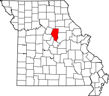 | |
| Villages | ||
| Townships | ||
| Unincorporated communities | ||
| Ghost towns | ||
| Footnotes | ‡This populated place also has portions in an adjacent county or counties | |