Cedar Township, Boone County, Missouri
| Cedar Township | |
|---|---|
| Township | |
| Coordinates: 38°43′00″N 92°16′40″W / 38.71667°N 92.27778°WCoordinates: 38°43′00″N 92°16′40″W / 38.71667°N 92.27778°W[1] | |
| Country | United States |
| State | Missouri |
| County | Boone |
| Area | |
| • Total | 196.0 sq mi (508 km2) |
| • Land | 192.6 sq mi (499 km2) |
| • Water | 3.4 sq mi (9 km2) |
| Population (2012) | |
| • Total | 4,190 |
| • Density | 21/sq mi (8.3/km2) |
| Area code(s) | 573 |
| GNIS Feature ID | 766330 |
Cedar Township is the southernmost of ten townships in Boone County, Missouri, USA. As of the 2012, its population was 4,190.[2] The township's major cities include the river town of Hartsburg and part of the prairie town Ashland.
History
Cedar Township was established in 1821.[3] The township was named after Cedar Creek.[4]
Geography
Cedar Township covers an area of 196 square miles (510 km2) and is located in the extreme south of Boone County between the Missouri River and Cedar Creek. The township contains two incorporated settlements: all of Hartsburg and part of Ashland. The unincorporated communities of Claysville and Wilton are also within the bounds. There are at least three major cemeteries located within its bounds: Friendens, Goshen, and Mount Pleasant. The Missouri River, Hart Creek, Jermison Creek, and Cedar Creek all flow through the township. The Hart Creek Conservation Area and part of the Mark Twain National Forest are also located there.
References
- ↑ "Township of Cedar". Geographic Names Information System. United States Geological Survey. Retrieved 2014-01-16.
- ↑ "Cedar township, Boone County, Missouri". U.S. Census Bureau, American FactFinder 2. Archived from the original on September 11, 2013. Retrieved August 24, 2013.
- ↑ History of Boone County, Missouri. Western Historical Company. 1882. p. 615.
- ↑ "Boone County Place Names, 1928–1945 (archived)". The State Historical Society of Missouri. Archived from the original on 24 June 2016. Retrieved 4 September 2016.
External links
Municipalities and communities of Boone County, Missouri, United States | ||
|---|---|---|
| Cities | 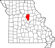 | |
| Villages | ||
| Townships | ||
| Unincorporated communities | ||
| Ghost towns | ||
| Footnotes | ‡This populated place also has portions in an adjacent county or counties | |