Grade II* listed buildings in Great Yarmouth

There are over 20,000 Grade II* listed buildings in England. This page is a list of these buildings in the district of Great Yarmouth in Norfolk.

Great Yarmouth

Name Location Type Completed [note 1]Date designated Grid ref.[note 2]
Geo-coordinates
Entry number [note 3]Image
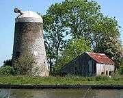
Wiseman's Mill Ashby with Oby, Great Yarmouth Drainage Mill Built 1753 4 December 1987 TG4092613793
52°40′06″N 1°33′43″E / 52.668258°N 1.561814°E / 52.668258; 1.561814 (Wiseman's Mill)
1051014
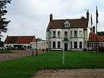
Belton Old Hall Belton with Browston House Early 18th century 27 November 1954 TG4828802623
52°33′53″N 1°39′43″E / 52.564729°N 1.662075°E / 52.564729; 1.662075 (Belton Old Hall)
1372933
Browston Hall Hotel Browston Green, Belton with Browston House Late 17th century 27 November 1954 TG4997401772
52°33′23″N 1°41′11″E / 52.556323°N 1.686256°E / 52.556323; 1.686256 (Browston Hall Hotel)
1051001
Church of All Saints Belton with Browston Parish Church 1866 27 November 1954 TG4855502949
52°34′03″N 1°39′59″E / 52.567532°N 1.66625°E / 52.567532; 1.66625 (Church of All Saints)
1372932
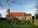
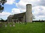
Church of St Nicholas Bradwell Parish Church 12th century 27 November 1954 TG5031503855
52°34′29″N 1°41′34″E / 52.574854°N 1.692846°E / 52.574854; 1.692846 (Church of St Nicholas)
1051006
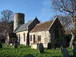
Church of St Peter and St Paul Burgh Castle Parish Church Late 11th century 27 November 1954 TG4764004973
52°35′10″N 1°39′15″E / 52.586107°N 1.65429°E / 52.586107; 1.65429 (Church of St Peter and St Paul)
1051008
Church of Holy Trinity Caister-on-Sea Parish Church 13th century 4 March 1947 TG5199612278
52°38′59″N 1°43′26″E / 52.649639°N 1.724012°E / 52.649639; 1.724012 (Church of Holy Trinity)
1287563
Church of All Saints Filby Parish Church 14th century 25 September 1962 TG4690113224
52°39′38″N 1°38′58″E / 52.660467°N 1.649564°E / 52.660467; 1.649564 (Church of All Saints)
1287564
Church of St Margaret Burgh St Margaret, Fleggburgh Parish Church 12th century 25 September 1962 TG4449414010
52°40′07″N 1°36′53″E / 52.668609°N 1.614631°E / 52.668609; 1.614631 (Church of St Margaret)
1372907
Church of St Peter Clippesby, Fleggburgh Parish Church c.1200 25 September 1962 TG4284614588
52°40′28″N 1°35′27″E / 52.674535°N 1.590735°E / 52.674535; 1.590735 (Church of St Peter)
1051017
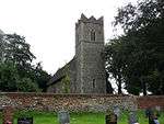
Church of St Edmund Fritton and St. Olaves Parish Church 12th century 27 November 1954 TG4732700143
52°32′35″N 1°38′46″E / 52.542917°N 1.64608°E / 52.542917; 1.64608 (Church of St Edmund)
1372918
Drainage Pump St Olave's Marsh, Fritton and St. Olaves Drainage Mill 1910 27 November 1954 TM4568499713
52°32′23″N 1°37′18″E / 52.539802°N 1.621584°E / 52.539802; 1.621584 (Drainage Pump)
1372904
Fritton Old Hall Fritton and St. Olaves House/Restaurant c.1540 27 November 1954 TG4760300145
52°32′34″N 1°39′01″E / 52.542809°N 1.650143°E / 52.542809; 1.650143 (Fritton Old Hall)
1305105
Barn at Home Farm Hemsby Aisled Barn Early 17th century 4 March 1947 TG4915917271
52°41′45″N 1°41′09″E / 52.695741°N 1.685938°E / 52.695741; 1.685938 (Barn at Home Farm)
1287567
Church of St Margaret Hopton-on-Sea Parish Church 1866-67 27 November 1954 TG5241500040
52°32′23″N 1°43′15″E / 52.53966°N 1.720868°E / 52.53966; 1.720868 (Church of St Margaret)
1050972
Old St Margaret's Church Hopton-on-Sea Parish Church (ruined) Late 13th century 27 November 1954 TM5301799972
52°32′20″N 1°43′47″E / 52.538771°N 1.729673°E / 52.538771; 1.729673 (Old St Margaret's Church)
1050970
Church of St Mary Thrigby, Mautby Parish Church First half 14th century 25 September 1962 TG4605312393
52°39′12″N 1°38′11″E / 52.653397°N 1.636433°E / 52.653397; 1.636433 (Church of St Mary)
1152375
Church of St Peter and St Paul Runham, Mautby Church Mid 14th century 25 September 1962 TG4597410827
52°38′22″N 1°38′03″E / 52.639383°N 1.634101°E / 52.639383; 1.634101 (Church of St Peter and St Paul)
1050977
Church of St Peter and St Paul Mautby Parish Church Late 12th century 25 September 1962 TG4807012377
52°39′08″N 1°39′58″E / 52.652335°N 1.666176°E / 52.652335; 1.666176 (Church of St Peter and St Paul)
1152350
Church of St Margaret Ormesby St. Margaret with Scratby Parish Church 14th century 25 September 1962 TG4988714532
52°40′15″N 1°41′41″E / 52.670835°N 1.694611°E / 52.670835; 1.694611 (Church of St Margaret)
1227867
Ormesby Old Hall Ormesby St. Margaret with Scratby House Mid 17th century 20 February 1952 TG5003814501
52°40′14″N 1°41′49″E / 52.670487°N 1.696815°E / 52.670487; 1.696815 (Ormesby Old Hall)
1287569
Church of St Michael Ormesby St. Michael Parish Church 13th century 25 September 1962 TG4807514883
52°40′29″N 1°40′05″E / 52.674815°N 1.668134°E / 52.674815; 1.668134 (Church of St Michael)
1287570
Church of St Peter and St Paul Repps with Bastwick Parish Church 12th century 25 September 1962 TG4219016927
52°41′45″N 1°34′58″E / 52.695813°N 1.582771°E / 52.695813; 1.582771 (Church of St Peter and St Paul)
1051024
Potter Heigham Bridge Repps with Bastwick Road Bridge 14th century 16 April 1955 TG4199818473
52°42′35″N 1°34′52″E / 52.70977°N 1.581073°E / 52.70977; 1.581073 (Potter Heigham Bridge)
1305009
Church of St George Rollesby Parish Church 12th century 25 September 1962 TG4461915759
52°41′03″N 1°37′04″E / 52.684244°N 1.617774°E / 52.684244; 1.617774 (Church of St George)
1152526
Burnley Hall East Somerton, Somerton House Early 18th century 20 February 1952 TG4787819756
52°43′07″N 1°40′08″E / 52.718622°N 1.668894°E / 52.718622; 1.668894 (Burnley Hall)
1216607
Church of St Mary West Somerton, Somerton Parish Church c.1200 25 September 1962 TG4754919547
52°43′01″N 1°39′50″E / 52.716897°N 1.663876°E / 52.716897; 1.663876 (Church of St Mary)
1216608
Church of St Andrew Stokesby with Herringby Parish Church 13th century 25 September 1962 TG4359210568
52°38′17″N 1°35′56″E / 52.638133°N 1.59878°E / 52.638133; 1.59878 (Church of St Andrew)
1152707
Church of St Edmund Thurne Parish Church Late 13th century 25 September 1962 TG4051015613
52°41′05″N 1°33′25″E / 52.684772°N 1.557002°E / 52.684772; 1.557002 (Church of St Edmund)
1304567
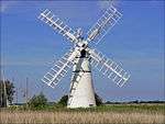
Thurne Dyke Windpump Thurne Drainage Mill 1820 7 December 1962 TG4005315918
52°41′16″N 1°33′02″E / 52.687711°N 1.550477°E / 52.687711; 1.550477 (Thurne Dyke Windpump)
1050999
Caister Hall West Caister Castle 19th century 4 December 1987 TG5042012218
52°38′59″N 1°42′03″E / 52.64983°N 1.70072°E / 52.64983; 1.70072 (Caister Hall)
1228031
Church of St Andrew Southtown and Gorleston Parish Church 13th century 27 June 1953 TG5244704408
52°34′44″N 1°43′29″E / 52.57883°N 1.72466°E / 52.57883; 1.72466 (Church of St Andrew)
1096807
Church of St Mary including Church Rooms and Surrounding Wall Regent Rd, Great Yarmouth Roman Catholic Church 1848-1850 9 December 1976 TG5289607634
52°36′27″N 1°44′01″E / 52.607561°N 1.733735°E / 52.607561; 1.733735 (Church of St Mary including Church Rooms and Surrounding Wall)
1245910
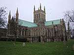
Church of St Nicholas Great Yarmouth Parish Church 1101-1119 27 June 1953 TG5243508036
52°36′41″N 1°43′38″E / 52.611382°N 1.727248°E / 52.611382; 1.727248 (Church of St Nicholas)
1096813
Church of St Peter Southtown and Gorleston Catholic Church 1938-1939 5 August 1974 TG5262904123
52°34′34″N 1°43′38″E / 52.576189°N 1.727123°E / 52.576189; 1.727123 (Church of St Peter)
1246581
Custom House Great Yarmouth Merchants House 1720 5 August 1974 TG5240607236
52°36′15″N 1°43′34″E / 52.604218°N 1.726211°E / 52.604218; 1.726211 (Custom House)
1245800
Great Yarmouth Potteries Great Yarmouth Fish curing works 19th century 9 December 1976 TG5272706909
52°36′04″N 1°43′50″E / 52.601136°N 1.730691°E / 52.601136; 1.730691 (Great Yarmouth Potteries)
1245561
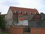
Old Merchants House Great Yarmouth Merchants House Early 17th century 27 June 1953 TG5246207142
52°36′12″N 1°43′37″E / 52.603349°N 1.726964°E / 52.603349; 1.726964 (Old Merchants House)
1245917
Old White Lion Public House Great Yarmouth Public House Early 17th century 27 June 1953 TG5263507081
52°36′10″N 1°43′46″E / 52.602722°N 1.729467°E / 52.602722; 1.729467 (Old White Lion Public House)
1271278
St Nicholas Hospital Main Block Great Yarmouth Hospital 1818 5 August 1974 TG5289006400
52°35′47″N 1°43′58″E / 52.596494°N 1.732704°E / 52.596494; 1.732704 (St Nicholas Hospital Main Block)
1245983
St Nicholas Hospital Main Entrance Range Great Yarmouth Entrance 1811 5 August 1974 TG5284006464
52°35′50″N 1°43′55″E / 52.597091°N 1.732016°E / 52.597091; 1.732016 (St Nicholas Hospital Main Entrance Range)
1245984
The Hippodrome Great Yarmouth Circus (recreational) 1903 8 December 1978 TG5304807119
52°36′10″N 1°44′08″E / 52.602871°N 1.735581°E / 52.602871; 1.735581 (The Hippodrome)
1245922
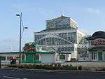
The Winter Gardens Great Yarmouth Glasshouse 1878-1881 5 August 1974 TG5314806762
52°35′59″N 1°44′12″E / 52.599621°N 1.736781°E / 52.599621; 1.736781 (The Winter Gardens)
1271608
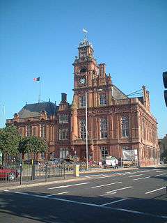
Town Hall Great Yarmouth Magistrates Court Until 1990 5 August 1974 TG5231307426
52°36′21″N 1°43′30″E / 52.605966°N 1.724985°E / 52.605966; 1.724985 (Town Hall)
1246969
Vicarage Great Yarmouth Vicarage Early 17th century 27 June 1953 TG5243907977
52°36′39″N 1°43′38″E / 52.61085°N 1.727262°E / 52.61085; 1.727262 (Vicarage)
1096809
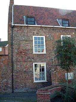
25 South Quay Great Yarmouth House 1644 27 June 1953 TG5243807190
52°36′14″N 1°43′36″E / 52.603791°N 1.726647°E / 52.603791; 1.726647 (25 South Quay)
1245803

Notes

  1. The date given is the date used by Historic England as significant for the initial building or that of an important part in the structure's description.
  2. Sometimes known as OSGB36, the grid reference is based on the British national grid reference system used by the Ordnance Survey.
  3. The "List Entry Number" is a unique number assigned to each listed building and scheduled monument by Historic England.

Media related to Grade II* listed buildings in Norfolk, England at Wikimedia Commons

This article is issued from Wikipedia - version of the 11/3/2016. The text is available under the Creative Commons Attribution/Share Alike but additional terms may apply for the media files.