Grade II* listed buildings in Charnwood (borough)

There are over 20,000 Grade II* listed buildings in England. This page is a list of these buildings in Charnwood.

Charnwood

Name Location Type Completed [note 1]Date designated Grid ref.[note 2]
Geo-coordinates
Entry number [note 3]Image
Pack Horse Bridge The Leys, Anstey, Charnwood Packhorse Bridge C16/C17 1 June 1966 SK5518508448
52°40′15″N 1°11′07″W / 52.67094°N 1.185342°W / 52.67094; -1.185342 (Pack Horse Bridge)
1177116
Barkby Grange Farmhouse Barkby, Charnwood Farmhouse 1855 30 November 1977 SK6467909275
52°40′38″N 1°02′41″W / 52.677326°N 1.044799°W / 52.677326; -1.044799 (Barkby Grange Farmhouse)
1074495
Church of the Holy Trinity Barrow upon Soar, Charnwood Parish Church Medieval 1 June 1966 SK5764617577
52°45′10″N 1°08′50″W / 52.752741°N 1.147354°W / 52.752741; -1.147354 (Church of the Holy Trinity)
1074589
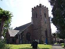
Church of All Saints Beeby, Charnwood Parish Church Late 13th century 1 June 1966 SK6640708321
52°40′07″N 1°01′10″W / 52.668542°N 1.019437°W / 52.668542; -1.019437 (Church of All Saints)
1177337
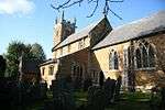
Church of All Saints Cossington, Charnwood Church 13th century 1 June 1966 SK6036413664
52°43′02″N 1°06′28″W / 52.717273°N 1.107808°W / 52.717273; -1.107808 (Church of All Saints)
1228032
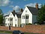
The Old Rectory Cossington, Charnwood House 16th century 2 July 1951 SK6034413621
52°43′01″N 1°06′29″W / 52.716889°N 1.108112°W / 52.716889; -1.108112 (The Old Rectory)
1228038
Church of St Peter and St Paul Hathern, Charnwood Church 14th century 15 March 1965 SK5027022428
52°47′49″N 1°15′21″W / 52.797081°N 1.255884°W / 52.797081; -1.255884 (Church of St Peter and St Paul)
1320287
The Village Cross Hathern, Charnwood Village Cross Medieval 15 March 1965 SK5028822343
52°47′47″N 1°15′20″W / 52.796315°N 1.25563°W / 52.796315; -1.25563 (The Village Cross)
1361141
Church of St Peter Mountsorrel, Charnwood Church 14th century 1 June 1966 SK5811615106
52°43′50″N 1°08′27″W / 52.73048°N 1.140828°W / 52.73048; -1.140828 (Church of St Peter)
1228111
The Market Cross Mountsorrel, Charnwood Market Cross 1793 1 June 1966 SK5817915051
52°43′48″N 1°08′24″W / 52.729979°N 1.139905°W / 52.729979; -1.139905 (The Market Cross)
1287313
2, Loughborough Road Mountsorrel, Charnwood House 1788 12 October 1984 SK5813015131
52°43′51″N 1°08′26″W / 52.730703°N 1.140617°W / 52.730703; -1.140617 (2, Loughborough Road)
1228109
Bradgate House and chapel Bradgate Park, Newtown Linford, Charnwood Country House Begun c1490 1 June 1966 SK5342610174
52°41′12″N 1°12′40″W / 52.68663°N 1.211072°W / 52.68663; -1.211072 (Bradgate House and chapel)
1074677
Church of All Saints Newtown Linford, Charnwood Church C14/15 1 June 1966 SK5220709782
52°41′00″N 1°13′45″W / 52.683225°N 1.229166°W / 52.683225; -1.229166 (Church of All Saints)
1074679
Garden Wall Bradgate Park, Newtown Linford, Charnwood Garden Wall Early 16th century 1 June 1966 SK5349210161
52°41′11″N 1°12′36″W / 52.686507°N 1.210098°W / 52.686507; -1.210098 (Garden Wall)
1361080
Church of St Andrew Prestwold Hall, Prestwold, Charnwood Parish Church Late 14th century 1 June 1966 SK5778221444
52°47′15″N 1°08′41″W / 52.787485°N 1.144659°W / 52.787485; -1.144659 (Church of St Andrew)
1074561
The Old Hall Queniborough, Charnwood House 1675-6 1 June 1966 SK6474612395
52°42′19″N 1°02′36″W / 52.705361°N 1.043196°W / 52.705361; -1.043196 (The Old Hall)
1074513
Church of St Botolph Ratcliffe on the Wreake, Charnwood Church 14th century 1 June 1966 SK6304614534
52°43′29″N 1°04′05″W / 52.724788°N 1.067942°W / 52.724788; -1.067942 (Church of St Botolph)
1278781
Church of St Michael and All Saints Rearsby, Charnwood Parish Church Late 13th century to early 14th century 1 June 1966 SK6511114638
52°43′32″N 1°02′14″W / 52.725478°N 1.037351°W / 52.725478; -1.037351 (Church of St Michael and All Saints)
1307375
Old Hall Rearsby, Charnwood House Late 19th century 1 June 1966 SK6500814299
52°43′21″N 1°02′20″W / 52.722444°N 1.038943°W / 52.722444; -1.038943 (Old Hall)
1361185
Church of St Mary the Virgin and St John the Baptist Rothley, Charnwood Church 13th century 1 June 1966 SK5859512654
52°42′30″N 1°08′03″W / 52.708389°N 1.134172°W / 52.708389; -1.134172 (Church of St Mary the Virgin and St John the Baptist)
1230285
Church of All Saints Seagrave, Charnwood Church 13th century 1 June 1966 SK6199217586
52°45′08″N 1°04′59″W / 52.752342°N 1.082971°W / 52.752342; -1.082971 (Church of All Saints)
1230528
Church of St Mary Sileby, Charnwood Church 13th century 1 June 1966 SK6005115174
52°43′51″N 1°06′44″W / 52.730881°N 1.112165°W / 52.730881; -1.112165 (Church of St Mary)
1230687
Church of St John the Baptist South Croxton, Charnwood Parish Church 14th century 1 June 1966 SK6917710328
52°41′10″N 0°58′41″W / 52.686236°N 0.978062°W / 52.686236; -0.978062 (Church of St John the Baptist)
1361188
Church of St Leonard Swithland, Charnwood Church 13th century and Later 1 June 1966 SK5549412826
52°42′37″N 1°10′48″W / 52.710261°N 1.180036°W / 52.710261; -1.180036 (Church of St Leonard)
1177875
Danvers Tomb at Church of St Leonard Swithland, Charnwood Table Tomb 1745 1 June 1966 SK5552312834
52°42′37″N 1°10′47″W / 52.71033°N 1.179606°W / 52.71033; -1.179606 (Danvers Tomb at Church of St Leonard)
1361113
Church of Holy Trinity Thrussington, Charnwood Church 13th century 1 June 1966 SK6503615779
52°44′09″N 1°02′18″W / 52.735743°N 1.038235°W / 52.735743; -1.038235 (Church of Holy Trinity)
1230701
Church of All Saints Thurcaston and Cropston, Charnwood Church 12th century 1 June 1966 SK5653610680
52°41′27″N 1°09′54″W / 52.690864°N 1.164983°W / 52.690864; -1.164983 (Church of All Saints)
1074627
Latimer's House Thurcaston and Cropston, Charnwood House C15/C16 9 July 1951 SK5666510851
52°41′33″N 1°09′47″W / 52.692387°N 1.163045°W / 52.692387; -1.163045 (Latimer's House)
1074625
Church of St Michael Thurmaston, Charnwood Parish Church c.1300 1 June 1966 SK6103109359
52°40′43″N 1°05′55″W / 52.678503°N 1.098732°W / 52.678503; -1.098732 (Church of St Michael)
1307276
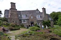
Stoneywell Cottage Ulverscroft, Charnwood House 1899 1 June 1966 SK4978711788
52°42′05″N 1°15′53″W / 52.701484°N 1.264658°W / 52.701484; -1.264658 (Stoneywell Cottage)
1361102
Beaumanor Hall Woodhouse, Charnwood House 13th century 21 March 1972 SK5377915685
52°44′10″N 1°12′18″W / 52.736132°N 1.204951°W / 52.736132; -1.204951 (Beaumanor Hall)
1361103
Church of St Mary in the Elms Woodhouse, Charnwood Church 15th century 1 June 1966 SK5385015150
52°43′53″N 1°12′14″W / 52.731316°N 1.203987°W / 52.731316; -1.203987 (Church of St Mary in the Elms)
1074611
Church of St Paul Woodhouse Eaves, Charnwood Church 1837 15 March 1984 SK5316714080
52°43′18″N 1°12′51″W / 52.721766°N 1.214273°W / 52.721766; -1.214273 (Church of St Paul)
1074609
Stables, Clock Tower and Outhouses at Beaumanor Hall Beaumanor Park, Woodhouse, Charnwood Wall 1842-1854 15 March 1984 SK5378215798
52°44′14″N 1°12′18″W / 52.737148°N 1.204888°W / 52.737148; -1.204888 (Stables, Clock Tower and Outhouses at Beaumanor Hall)
1074641
Terrace Walls, Urns, Fountain and Seat at Beaumanor Hall Beaumanor Park, Woodhouse, Charnwood Garden Wall Mid 19th century 15 March 1984 SK5377115583
52°44′07″N 1°12′18″W / 52.735216°N 1.205086°W / 52.735216; -1.205086 (Terrace Walls, Urns, Fountain and Seat at Beaumanor Hall)
1180207
Garendon Park, the Temple of Venus Loughborough, Charnwood Statue 1730's 15 March 1965 SK4979019057
52°46′01″N 1°15′49″W / 52.766824°N 1.263513°W / 52.766824; -1.263513 (Garendon Park, the Temple of Venus)
1116109
Taylor's Bell Foundry (that Part on East Side of Cobden Street) Loughborough, Charnwood Bell Foundry c.1874 24 December 1985 SK5414519810
52°46′23″N 1°11′56″W / 52.773174°N 1.198851°W / 52.773174; -1.198851 (Taylor's Bell Foundry (that Part on East Side of Cobden Street))
1236293
Taylor's Bell Foundry (that Part on West Side of Cobden Street) Loughborough, Charnwood Carpenters Workshop 1859 24 December 1985 SK5414019825
52°46′24″N 1°11′56″W / 52.77331°N 1.198923°W / 52.77331; -1.198923 (Taylor's Bell Foundry (that Part on West Side of Cobden Street))
1264685
The Old Rectory Loughborough, Charnwood Cross Passage House 16th century 15 March 1965 SK5375819984
52°46′29″N 1°12′16″W / 52.774777°N 1.204559°W / 52.774777; -1.204559 (The Old Rectory)
1320404

Notes

  1. The date given is the date used by Historic England as significant for the initial building or that of an important part in the structure's description.
  2. Sometimes known as OSGB36, the grid reference is based on the British national grid reference system used by the Ordnance Survey.
  3. The "List Entry Number" is a unique number assigned to each listed building and scheduled monument by Historic England.

Media related to Grade II* listed buildings in Leicestershire at Wikimedia Commons

This article is issued from Wikipedia - version of the 8/25/2016. The text is available under the Creative Commons Attribution/Share Alike but additional terms may apply for the media files.